Brezovica, Šmarješke Toplice
| Brezovica | |
|---|---|
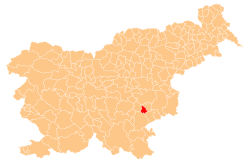
 Brezovica Location in Slovenia | |
| Coordinates: 45°52′41.77″N 15°14′25.36″E / 45.8782694°N 15.2403778°ECoordinates: 45°52′41.77″N 15°14′25.36″E / 45.8782694°N 15.2403778°E | |
| Country |
|
| Traditional region | Lower Carniola |
| Statistical region | Southeast Slovenia |
| Municipality | Šmarješke Toplice |
| Area | |
| • Total | 3.17 km2 (1.22 sq mi) |
| Elevation | 183.1 m (600.7 ft) |
| Population (2002) | |
| • Total | 186 |
| [1] | |
Brezovica (pronounced [ˈbɾeːzɔʋitsa]) is a village in the Municipality of Šmarješke Toplice in southeastern Slovenia. It lies between Šmarješke Toplice and Šmarjeta in the historical region of Lower Carniola. The municipality is now included in the Southeast Slovenia Statistical Region.[2]
Unmarked grave
Brezovica is the site of an unmarked grave associated with the Second World War. The Sela Grave (Slovene: Grobišče Sela) is located in the woods northwest of the village. It contains the remains of a Hungarian doctor and partisan that was killed by the Partisans in 1943.[3]
References
External links
| Settlements | Administrative centre: Šmarješke Toplice
|  | ||||
|---|---|---|---|---|---|---|
| Landmarks |
| |||||
This article is issued from
Wikipedia.
The text is licensed under Creative Commons - Attribution - Sharealike.
Additional terms may apply for the media files.