Čelevec, Šmarješke Toplice
| Čelevec | |
|---|---|
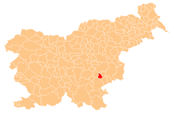
 Čelevec Location in Slovenia | |
| Coordinates: 45°55′15.42″N 15°13′28.94″E / 45.9209500°N 15.2247056°ECoordinates: 45°55′15.42″N 15°13′28.94″E / 45.9209500°N 15.2247056°E | |
| Country |
|
| Traditional region | Lower Carniola |
| Statistical region | Southeast Slovenia |
| Municipality | Šmarješke Toplice |
| Area | |
| • Total | 1.21 km2 (0.47 sq mi) |
| Elevation | 251.7 m (825.8 ft) |
| Population (2002) | |
| • Total | 52 |
| [1] | |
Čelevec (pronounced [tʃɛˈleːʋəts], German: Tscheleutsch[2]) is a small settlement in the Municipality of Šmarješke Toplice in the historical region of Lower Carniola in southeastern Slovenia. The municipality is now included in the Southeast Slovenia Statistical Region.[3]
References
- ↑ Statistical Office of the Republic of Slovenia
- ↑ Intelligenzblatt zur Laibacher Zeitung, no. 141. 24 November 1849, p. 37.
- ↑ Šmarješke Toplice municipal site
External links
| Settlements | Administrative centre: Šmarješke Toplice
|  | ||||
|---|---|---|---|---|---|---|
| Landmarks |
| |||||
This article is issued from
Wikipedia.
The text is licensed under Creative Commons - Attribution - Sharealike.
Additional terms may apply for the media files.