Brahmavar
| Brahmavara Brahmavara | |
|---|---|
| Town | |
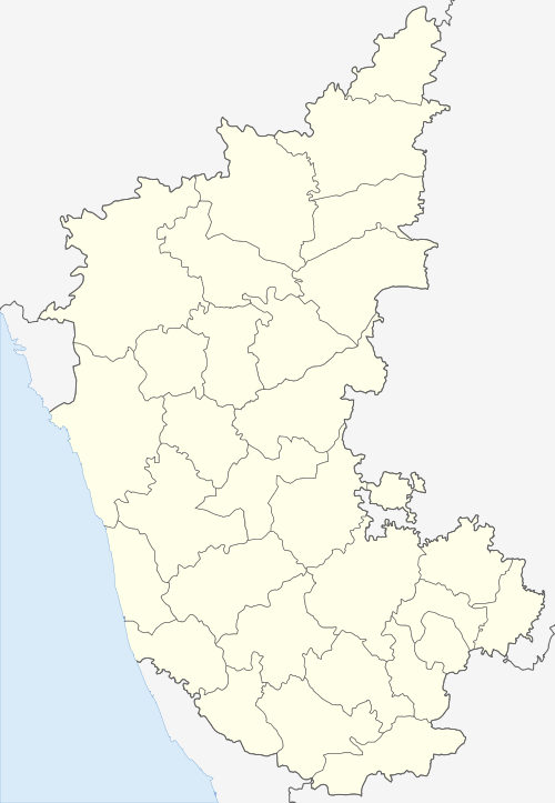
 Brahmavara Location in India | |
| Coordinates: 13°24′14″N 74°42′25″E / 13.404°N 74.707°ECoordinates: 13°24′14″N 74°42′25″E / 13.404°N 74.707°E | |
| Country |
|
| State | Karnataka |
| District | Udupi District |
| Population | |
| • Total | 131,203[1] |
| Languages | |
| • Official | Kannada |
| • Regional | Kundagannada, Tulu, Konkani. |
| Time zone | UTC+5:30 (IST) |
| PIN | 576213[2] |
| Telephone code | 0820[3] |
| Vehicle registration | KA-20[4] |
Brahmavara is a main road town on NH 66 (formerly NH 17), located 13 kilometres (8.1 mi) north of the Udupi in Karnataka, India. It has been mentioned "Lord Brahma's Vara or Ajapura". It is an ancient cultural centre of the Coastal Karnataka being adjacent to Barkur.
Location
Brahmavara lies about 68 kilometres (40 mi) north of Mangalore. Brahmavara is situated about 13 kilometres (10 mi) north of Udupi on the National highway NH 66 (formerly NH 17). River Suvarna and Sita flow around Brahmavara. These rivers originate from Western Ghats and form backwaters around Brahmavara before joining Arabian Sea near Hangarkatte.
Brahmavara is surrounded by several villages such as Handadi, Baikady, Matpadi, Kunjal, Kumragod, Salikeri, Haradi and Matapadi. Barkur lies north to Brahmavara and Temple city Udupi lies to the south.
History
It is believed that the Mahalinga temple was constructed in the 9th century AD. The wall of the temple is built on the laterite stones. There is an image of Gaja-Gowri, which has been kept in Navaranga, which perhaps belongs to the Hoysala period. It is holding Ankusha and Pasha in the upper hand and Padma (lotus) in right lower, and the left lower hand in the abhaya pose. Handadi near Brahmavar was the settlement of the Hande family, a family of Brahmins from Northern India. Gopinatha temple is mentioned in an inscription that it is the third temple. The image of the presiding deity is of Hoysala workmanship.
Population
Population of Brahmavara is about 131,203. The majority of the population of Brahmavara is Hindu. Christians and Muslim community make up rest of the population.
Transportation
Brahmavara situated on NH 66 (formerly NH 17) is directly connected by bus service from Udupi on the Mangalore-Udupi-Kundapura line. Bus service is also available to most places within Udupi district and to Bengaluru, Mumbai, Mangaluru, Goa and other nearby districts. Lots of buses are plying from Kundapura to Udupi and Kundapura to Mangaluru. And Brahmavara to Hebri state Hwy one of the most importent road in Udupi this road conected on Agumbe, Thirthalli, Shimoga, Koppa, Sringeri and state capital Bangalore. Kunda Kannada, Tulu, Konkani & Byari are the local languages spoken among the different communities.
The nearest railway station for local trains is in Barkur and for long distance trains is in Udupi.
Rivers
The town of Brahmavara is sandwiched between the Seeta and Suvarna rivers which originate from the Western Ghats. They join the Arabian Sea a few kilometers from Brahmavara. The rivers form beautiful backwaters around Brahmavara. Tourists can cruise the backwaters on local country boats.
Places of worship


- Aanjaneya/Shanaishwara Temple
- Gopinatha Temple
- Santhana Gopala Temple
- Holy Family Church, established 1 April 1934[5][6] It is one of the few churches by the National Highway.
- Janardhana shrine in the Agrahara
- Mahalingeshwara Temple
- Mudduganapathi Temple Mabukala
- St. Mary's Syrian Cathedral
- Salikeri Vaidyanatheshwara Temple
- Sree Mahalingeshwara Temple and Nagaradi, Bandimutt, Hanehalli
- Sri Lakshmi Venkataramana Temple, Car-street, Brahmavara
- Shankara Narayana Temple, Chanthar, Brahmavara
- Sri Kashivishwanataha temple, Sri Venkataramana temple Chantaru, Agrahara
- Shri Babbu Swami Temple, Behind Nirmala High School
- Jamia Masjid,Uppinakote
Educational institutions
- Board School (Udupi Zilla Parishat Higher Primary School)
- Cosmopolitan Higher Primary School, Brahmavara (CHP)
- Govt Pre-University College, Brahmavara
- Little Rock Indian School – in Chantar, about 4 km (2.5 mi) from Brahmavar
- Nirmala English Medium School
- Nirmala Higher Primary School
- Nirmala High School
- G.M Vidhyaniketan Public School Brahmavara
- SMS College
- St. Mary's English Medium School
- St. Mary's Syrian Pre-University College
- Rural Development and Self Employment Training (RUDSET) Institute.
- St. Mary's Syrian English Medium School, Brahmavar
Other places of interest
- All India Radio station
- Agriculture Research Institute
- Barkur town
- Handadi Tenkumane
- Brahma Stahana
- Garadi mane in Varambally village
- Handadi, the settlement of the Hande family, one of many Brahmin families who settled in the region following their migration from North India
- Hangyo Ice Cream factory in Srikrishna Dairy Campus
- Mahishamardini temple in Neelavara
- Nadoor
- Srikrishna Dairy – 4 km from Brahmavara towards Udupi
- Sugar factory
- Prabhat Saw Mill - 1 km from Brahmavar Bus stand towards Hebri
Distance from Brahmavar
References
- ↑ "4 gram panchayats pass resolution to merge with Brahmawar". The Times of India. 16 July 2014. Retrieved 24 August 2018.
- ↑ "Central Excise and Service Tax Location Code (Areas Under the Range West of Mangalore-II DVN (610201)". Central Excise and Service Tax. Retrieved 2008-07-14.
- ↑ "STD Codes for cities in Karnataka". Bharat Sanchar Nigam Limited (BSNL). Archived from the original on 2008-04-17. Retrieved 2008-07-06.
- ↑ "List of RTOs". AICDA (All India Car Dealers Association). Archived from the original on 2008-08-28. Retrieved 2008-07-14.
- ↑ Holy Family Church, Brahmavar
- ↑
External links
| Wikimedia Commons has media related to Brahmavara. |
- Rotary Brahmavar International
- Saint Mary's Syrian PU College
- St. Bartholomew's Barkur-Kalyanpur Claims
- Jesuvera. "Holy Family Church, Brahmavar". Jmjbvr.blogspot.com. Retrieved 2013-01-03.