Bradford, Franklin County, Iowa
| Bradford, Iowa | |
|---|---|
| Census-designated place | |
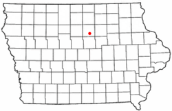 Location of Bradford, Iowa | |
| Coordinates: 42°37′59″N 93°14′42″W / 42.63306°N 93.24500°WCoordinates: 42°37′59″N 93°14′42″W / 42.63306°N 93.24500°W | |
| Country | United States |
| State | Iowa |
| County | Franklin |
| Area[1] | |
| • Total | 0.582 sq mi (1.51 km2) |
| • Land | 0.582 sq mi (1.51 km2) |
| • Water | 0 sq mi (0 km2) |
| Elevation | 1,257 ft (383 m) |
| Population (2010)[2] | |
| • Total | 99 |
| • Density | 170/sq mi (66/km2) |
| Time zone | UTC-6 (Central (CST)) |
| • Summer (DST) | UTC-5 (CDT) |
| Area code(s) | 641 |
| GNIS feature ID | 454797[3] |
Bradford is an unincorporated community and census-designated place in Franklin County, Iowa, United States.[3] Its population was 99 as of the 2010 census.[2]
Notes
- ↑ "US Gazetteer files: 2010, 2000, and 1990". United States Census Bureau. 2011-02-12. Retrieved 2011-04-23.
- 1 2 "American FactFinder". United States Census Bureau. Archived from the original on 2013-09-11. Retrieved 2011-05-14.
- 1 2 "Bradford". Geographic Names Information System. United States Geological Survey.
- ↑ Stuart, I. L. (1914). History of Franklin County, Iowa: A Record of Settlement, Organization, Progress and Achievement, Volume 1. S. J. Clarke Publishing Company. p. 315.
Municipalities and communities of Franklin County, Iowa, United States | ||
|---|---|---|
| Cities | ||
| Townships | ||
| CDPs | ||
| Unincorporated communities | ||
| Footnotes | ‡This populated place also has portions in an adjacent county or counties | |
This article is issued from
Wikipedia.
The text is licensed under Creative Commons - Attribution - Sharealike.
Additional terms may apply for the media files.