Bowlesville Township, Gallatin County, Illinois
| Bowlesville Township | |
|---|---|
| Township | |
 Location in Gallatin County | |
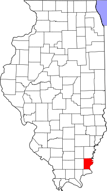 Gallatin County's location in Illinois | |
| Coordinates: 37°38′42″N 88°12′49″W / 37.64500°N 88.21361°WCoordinates: 37°38′42″N 88°12′49″W / 37.64500°N 88.21361°W | |
| Country | United States |
| State | Illinois |
| County | Gallatin |
| Established | November 5, 1890 |
| Area | |
| • Total | 39.86 sq mi (103.2 km2) |
| • Land | 38.66 sq mi (100.1 km2) |
| • Water | 1.2 sq mi (3 km2) 3.01% |
| Elevation | 390 ft (119 m) |
| Population (2010) | |
| • Estimate (2016)[1] | 177 |
| • Density | 4.9/sq mi (1.9/km2) |
| Time zone | UTC-6 (CST) |
| • Summer (DST) | UTC-5 (CDT) |
| ZIP codes | 62931, 62954, 62984 |
| FIPS code | 17-059-07536 |
Bowlesville Township is one of ten townships in Gallatin County, Illinois, USA. As of the 2010 census, its population was 188 and it contained 87 housing units.[2]
Geography
According to the 2010 census, the township has a total area of 39.86 square miles (103.2 km2), of which 38.66 square miles (100.1 km2) (or 96.99%) is land and 1.2 square miles (3.1 km2) (or 3.01%) is water.[2]
Unincorporated towns
(This list is based on USGS data and may include former settlements.)
Extinct towns
- Bowlesville at 37°40′27″N 88°12′45″W / 37.674214°N 88.212536°W
(These towns are listed as "historical" by the USGS.)
Cemeteries
The township contains these three cemeteries: Earnshaw, Hogan and Stanley.
Major highways
Airports and landing strips
- Dortch Private Strip
Rivers
Lakes
- Mud Lake
Demographics
| Historical population | |||
|---|---|---|---|
| Census | Pop. | %± | |
| Est. 2016 | 177 | [1] | |
| U.S. Decennial Census[3] | |||
School districts
- Gallatin Community Unit School District 7
- Hardin County Community Unit School District 1
Political districts
- Illinois' 19th congressional district
- State House District 118
- State Senate District 59
References
- "Bowlesville Township, Gallatin County, Illinois". Geographic Names Information System. United States Geological Survey. Retrieved 2010-01-17.
- United States Census Bureau 2007 TIGER/Line Shapefiles
- United States National Atlas
- 1 2 "Population and Housing Unit Estimates". Retrieved June 9, 2017.
- 1 2 "Population, Housing Units, Area, and Density: 2010 - County -- County Subdivision and Place -- 2010 Census Summary File 1". United States Census. Retrieved 2013-05-28.
- ↑ "Census of Population and Housing". Census.gov. Retrieved June 4, 2016.
External links
Places adjacent to Bowlesville Township, Gallatin County, Illinois | ||||||||||
|---|---|---|---|---|---|---|---|---|---|---|
| ||||||||||
Municipalities and communities of Gallatin County, Illinois, United States | ||
|---|---|---|
| City | ||
| Villages | ||
| Townships | ||
| Unincorporated communities | ||
This article is issued from
Wikipedia.
The text is licensed under Creative Commons - Attribution - Sharealike.
Additional terms may apply for the media files.