Boulder City Municipal Airport
| Boulder City Municipal Airport | |||||||||||||||||||
|---|---|---|---|---|---|---|---|---|---|---|---|---|---|---|---|---|---|---|---|
_AN1977832.jpg) | |||||||||||||||||||
| Summary | |||||||||||||||||||
| Airport type | Public | ||||||||||||||||||
| Owner | Boulder City Municipality | ||||||||||||||||||
| Serves | Boulder City, Nevada | ||||||||||||||||||
| Elevation AMSL | 2,203 ft / 671 m | ||||||||||||||||||
| Coordinates | 35°56′50″N 114°51′37″W / 35.94722°N 114.86028°WCoordinates: 35°56′50″N 114°51′37″W / 35.94722°N 114.86028°W | ||||||||||||||||||
| Website |
flybouldercity | ||||||||||||||||||
| Map | |||||||||||||||||||
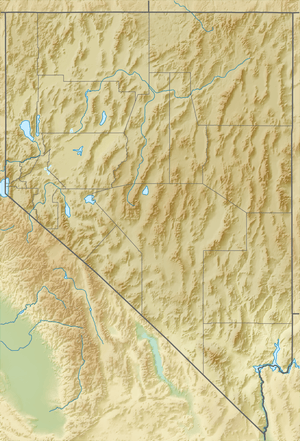
 BVU Location of airport in Nevada / United States  BVU BVU (the US) | |||||||||||||||||||
| Runways | |||||||||||||||||||
| |||||||||||||||||||
| Statistics (2011) | |||||||||||||||||||
| |||||||||||||||||||
Boulder City Municipal Airport (IATA: BLD[2], ICAO: KBVU, FAA LID: BVU, formerly 61B[3]) is a public use airport located one nautical mile (2 km) southwest of the central business district of Boulder City, in Clark County, Nevada, United States. It is owned by Boulder City Municipality.[1]
As per the Federal Aviation Administration, this airport had 300,553 passenger boardings (enplanements) in calendar year 2008,[4] 194,838 in 2009, and 169,923 in 2010.[5] The National Plan of Integrated Airport Systems for 2011–2015 categorized it as a primary commercial service airport.[6]
Although many U.S. airports use the same three-letter location identifier for the FAA and IATA, Boulder City Municipal Airport is assigned BVU by the FAA[1] and BLD by the IATA[2] (which assigned BVU to Beluga Airport in Beluga, Alaska).[7]
History
Boulder City Municipal Airport replaced Boulder City Airport that started out as Bullock Airport.
On March 19, 2009 the Boulder City Aerocenter, a new 30,000 sq ft (2,800 m2) terminal, opened to service Papillon Grand Canyon Helicopters, Grand Canyon Airlines and Scenic Airlines.[8]
Facilities and aircraft
Boulder City Municipal Airport covers an area of 530 acres (214 ha) at an elevation of 2,203 feet (671 m) above mean sea level. It has three runways with asphalt surfaces: 9L/27R is 2,166 by 60 feet (660 x 18 m); 9R/27L is 4,803 by 75 feet (1,464 x 23 m); 15/33 is 3,852 by 75 feet (1,174 x 23 m).[1]
For the 12-month period ending February 1, 2011, the airport had 100,025 aircraft operations, an average of 274 per day: 70% air taxi, 30% general aviation, and <1% military. At that time there were 234 aircraft based at this airport: 77% single-engine, 13% helicopter, 9% multi-engine, 1% ultralight, and <1% jet.[1]
Airlines and destinations
| Airlines | Destinations |
|---|---|
| Papillon Grand Canyon Helicopters | Grand Canyon |
| Las Vegas Helicopters | Grand Canyon |
| Scenic Airlines operated by Grand Canyon Airlines | Grand Canyon |
| Grand Canyon Airlines | Grand Canyon |
| 5 Star Helicopter Tours | Grand Canyon |
Statistics
| Carrier | Passengers (arriving and departing) |
|---|---|
| Scenic | 65,990(100%) |
| Rank | Destination | Passengers |
|---|---|---|
| 1 | Peach Springs Airport (DQR) | 18,360 |
| 2 | Grand Canyon National Park Airport (GCN) | 11,380 |
References
- 1 2 3 4 5 FAA Airport Master Record for BVU (Form 5010 PDF). Federal Aviation Administration. Effective November 15, 2012.
- 1 2 "IATA Airport Code Search (BLD: Boulder City Municipal)". International Air Transport Association. Retrieved June 13, 2014.
- ↑ "Boulder City Municipal Airport (61B)". FAA data republished by AirNav. January 15, 2009. Archived from the original on March 9, 2009.
- ↑ "Enplanements for CY 2008" (PDF, 1.0 MB). CY 2008 Passenger Boarding and All-Cargo Data. Federal Aviation Administration. December 18, 2009.
- ↑ "Enplanements for CY 2010" (PDF, 189 KB). CY 2010 Passenger Boarding and All-Cargo Data. Federal Aviation Administration. October 4, 2011.
- ↑ "2011–2015 NPIAS Report, Appendix A" (PDF). National Plan of Integrated Airport Systems. Federal Aviation Administration. October 4, 2010. Archived from the original (PDF, 2.03 MB) on 2012-09-27.
- ↑ "Beluga, Alaska (ICAO: PABG, IATA: BVU, FAA: BLG)". Great Circle Mapper. Retrieved June 13, 2014.
- ↑ Spillman, Benjamin (March 20, 2009). "Happy landings in Boulder City". Retrieved April 28, 2009.
- 1 2 "Boulder City, NV: Boulder City Municipal (BLD)". Bureau of Transportation Statistics (BTS), Research and Innovative Technology Administration (RITA), U.S. Department of Transportation. December 2008. Retrieved June 13, 2014.
External links
- Official website

- Boulder City Automated Weather Observation Station
- "Diagram of Boulder City Airport (61B)" (PDF). Archived from the original (PDF) on 2016-03-03. from Nevada DOT
- Aerial image as of May 1994 from USGS The National Map
- FAA Terminal Procedures for BVU, effective October 11, 2018
- Resources for this airport:
- FAA airport information for BVU
- AirNav airport information for KBVU
- ASN accident history for BLD
- FlightAware airport information and live flight tracker
- SkyVector aeronautical chart for KBVU