Bonnie Lake (Alberta)
| Bonnie Lake | |
|---|---|
 | |
| Location | Smoky Lake County, Alberta |
| Coordinates | 54°09′03″N 111°51′50″W / 54.15083°N 111.86389°WCoordinates: 54°09′03″N 111°51′50″W / 54.15083°N 111.86389°W |
| Lake type | Hyper-Eutrophic |
| Primary outflows | Stony Creek |
| Catchment area | 49.6 km2 (19.2 sq mi) |
| Basin countries | Canada |
| Max. length | 5 km (3.1 mi) |
| Max. width | 1.2 km (0.75 mi) |
| Surface area | 3.77 km2 (1.46 sq mi)[1] |
| Average depth | 3.1 m (10 ft) |
| Max. depth | 6.1 m (20 ft) |
| Surface elevation | 648 m (2,126 ft) |
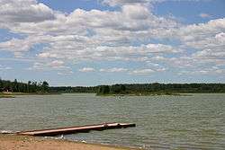
Bonnie Lake is a small lake in Alberta, Canada. It is located 6 km (3.7 mi) outside of Vilna, Alberta, north of Highway 28, and is part of the North Saskatchewan River basin.
The lake has a surface of 3.77 km2 (1.46 sq mi) and reaches a maximum depth of 6.1 m (20 ft), while the average depth is 3.1 m (10 ft). Bonnie Lake drains a total area of 49.6 km2 (19.2 sq mi).[1] The lake drains through its south shore into Stony Creek which empties into the North Saskatchewan River.
There is a small camp ground with 25 sites, power, and a beach, managed as the Bonnie Lake Provincial Recreation Area. There are very few fish in the lake, but there is a large number of birds on the lake. There is also a small golf course very close to the lake.
References
- 1 2 University of Alberta. "Atlas of Alberta Lakes: Bonnie Lake". Retrieved 2007-08-30.

This article is issued from
Wikipedia.
The text is licensed under Creative Commons - Attribution - Sharealike.
Additional terms may apply for the media files.