Bogard Township, Daviess County, Indiana
| Bogard Township | |
|---|---|
| Township | |
 Methodist church in Cornettsville | |
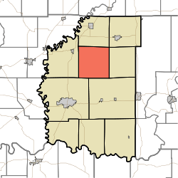 Location of Bogard Township in Daviess County | |
| Coordinates: 38°46′09″N 87°04′26″W / 38.76917°N 87.07389°WCoordinates: 38°46′09″N 87°04′26″W / 38.76917°N 87.07389°W | |
| Country | United States |
| State | Indiana |
| County | Daviess |
| Government | |
| • Type | Indiana township |
| Area | |
| • Total | 36.75 sq mi (95.2 km2) |
| • Land | 36.44 sq mi (94.4 km2) |
| • Water | 0.31 sq mi (0.8 km2) |
| Elevation[1] | 486 ft (148 m) |
| Population (2010) | |
| • Total | 1,473 |
| • Density | 40.4/sq mi (15.6/km2) |
| FIPS code | 18-06274[2] |
| GNIS feature ID | 453121 |
Bogard Township is one of ten townships in Daviess County, Indiana. As of the 2010 census, its population was 1,473 and it contained 395 housing units.[3]
History
Bogard Township was organized on 9 May 1820. Among its earliest settlers was North Carolina native Elias Myers, who arrived in 1816 and purchased 320 acres (130 ha) of land in the following year. Its namesake was a W. Bogard, who was a victim of an attack by Indians.[4]
The McCall Family Farmstead was added to the National Register of Historic Places in 2013.[5]
Geography
According to the 2010 census, the township has a total area of 36.75 square miles (95.2 km2), of which 36.44 square miles (94.4 km2) (or 99.16%) is land and 0.31 square miles (0.80 km2) (or 0.84%) is water.[3]
Unincorporated towns
(This list is based on USGS data and may include former settlements.)
Adjacent townships
- Elmore Township (north)
- Madison Township (northeast)
- Van Buren Township (east)
- Barr Township (southeast)
- Washington Township (southwest)
- Steele Township (west)
Cemeteries
The township contains five cemeteries: Concord, Cornettsville, Humphries, Tolberts Chapel and Wells.
References
- "Bogard Township, Daviess County, Indiana". Geographic Names Information System. United States Geological Survey. Retrieved 2009-09-24.
- United States Census Bureau cartographic boundary files
- ↑ "US Board on Geographic Names". United States Geological Survey. 2007-10-25. Retrieved 2008-01-31.
- ↑ "American FactFinder". United States Census Bureau. Archived from the original on 2013-09-11. Retrieved 2008-01-31.
- 1 2 "Population, Housing Units, Area, and Density: 2010 - County -- County Subdivision and Place -- 2010 Census Summary File 1". United States Census. Retrieved 2013-05-10.
- ↑ Fulkerson, A.O., ed. History of Daviess County Indiana: Its People, Industries, and Institutions. Bowen: Indianapolis, 1915, 276.
- ↑ "National Register of Historic Places Listings". Weekly List of Actions Taken on Properties: 9/16/13 through 9/30/13. National Park Service. 2013-10-18.
External links
Municipalities and communities of Daviess County, Indiana, United States | ||
|---|---|---|
| City | ||
| Towns | ||
| Townships | ||
| CDP | ||
| Other unincorporated communities | ||