Bodfari
| Bodfari | |
|---|---|
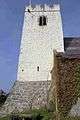
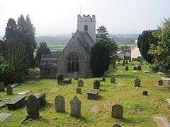 St Stephen's Parish Church, Bodfari | |
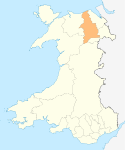
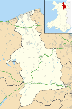 Bodfari Bodfari shown within Denbighshire | |
| Population | 327 (2011)[1] |
| OS grid reference | SJ093701 |
| Community |
|
| Principal area | |
| Country | Wales |
| Sovereign state | United Kingdom |
| Post town | DENBIGH |
| Postcode district | LL16 |
| Dialling code | 01745 |
| Police | North Wales |
| Fire | North Wales |
| Ambulance | Welsh |
| EU Parliament | Wales |
| UK Parliament | |
| Welsh Assembly | |
Bodfari is a village and community in Denbighshire, Wales. Until the local government reorganisation of 1974, Bodfari was in the historic county of Flintshire.
The ancient parish of Bodfari comprised the townships of Bodfari, which was in historic Flintshire, and Aberwheeler, in historic Denbighshire.
Location
Bodfari is located at the approximate grid reference SJ093701. The village lies on the A541 road at the point where the road passes through a gap in the Clwydian Hills, the gap being part of the valley of the River Wheeler (Welsh: Afon Chwiler).
The Offa's Dyke National Trail passes through the village, and for walkers completing the trail south to north, Bodfari is usually the final overnight stop on the 177 mile route.
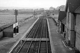
Bodfari had a railway station until 1962
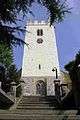
The parish church

References
- ↑ "Community population 2011". Neighbourhood Statistics. Office for National Statistics. Retrieved 24 May 2015.
External links
| Wikimedia Commons has media related to Bodfari. |
This article is issued from
Wikipedia.
The text is licensed under Creative Commons - Attribution - Sharealike.
Additional terms may apply for the media files.