Bluefields
| Bluefields | ||
|---|---|---|
 Bluefields and Bluefields Bay (Bahia de Bluefields) | ||
| ||
 Bluefields | ||
| Coordinates: 12°0′N 83°45′W / 12.000°N 83.750°W | ||
| Country |
| |
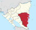
| Autonomous Region | South Caribbean Autonomous Region | |
| Municipality | Bluefields | |
| Government | ||
| • Mayor | Gustavo Castro Jo (FSLN) | |
| Area | ||
| • City | 4,774.75 km2 (1,843.54 sq mi) | |
| Elevation | 25 m (82 ft) | |
| Population (2005) | ||
| • City | 45,547 | |
| • Urban | 38,623 | |
| Time zone | UTCGMT-6 | |
| Climate | Af | |

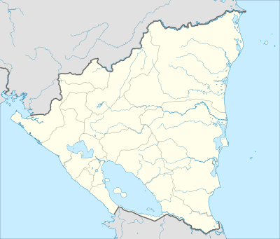
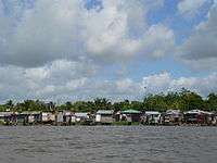
Bluefields (Spanish pronunciation: [bluˈfjelds]) is the capital of the South Caribbean Autonomous Region (RAAS) in Nicaragua. It was also the capital of the former Zelaya Department, which was divided into North and ATLANTIC COST Coast Autonomous Regions. It is located on Bluefields Bay at the mouth of the Escondido River in the municipality of the same name.
Bluefields was named after the Dutch pirate Abraham Blauvelt who hid in the bay’s waters in the early 17th century.[1] It has a population of 87,000 (2005)[2] and its inhabitants are mostly Mestizo then in smaller percentage Afro-descendant Creoles, and indigenous Miskitu, along with smaller communities of Garifuna, White People, Chinese, Mayangnas, Ulwas, and Ramas; that is the reason why English language is the most spoken language in the city's urban area. Bluefields is Nicaragua’s chief Caribbean port, from which hardwood, seafood, shrimp and lobster are exported. Bluefields was a rendezvous for English and Dutch buccaneers in the 16th and 17th century and became capital of the English protectorate over the Mosquito Coast in 1678. During United States interventions (1912–15, 1926–33) in Nicaragua, American Marines were stationed there. In 1984, the United States mined the harbor (along with those of Corinto and Puerto Sandino) as part of the Nicaraguan Revolution. Bluefields was destroyed by Hurricane Joan in 1988 but was rebuilt.
History
The origin of the city of Bluefields is connected with the presence of European pirates on the Nicaraguan Caribbean coast, subjects of powers at the time hostile to Spain. These pirates used the Escondido River to rest, to repair damages and to be provisioned. By then, the territory of the present municipality was populated by the native towns of Kukra and Branch. In 1602 one of these soldiers of fortune chose the bay of Bluefields as his center of operations due to its tactical advantages, a Dutchman named Blauvelt, and from him originates the name of the municipality.
Black Africans first appeared in the Caribbean coast in 1641, when a Portuguese ship that transported slaves wrecked in the Miskito Cays. From the original settlement the bay began to be populated; the English subjects burst in 1633 and from 1666 they were already organized into colonies, and by 1705 there were authorities established. In 1730 the Kingdom of Mosquitia came to depend on the British government of Jamaica. For this, an alliance with the Miskito people was decisive, and the British provided them with armaments that allowed them to subdue the other ethnic groups of the Caribbean coast—the Afro-descendant Creoles and the indigenous Mayangnas, Ulwas, and Ramas.
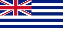
In 1740 the Miskitos yielded to British sovereignty over the territory, and in 1744 a transfer of British colonists was organized from Jamaica to the Mosquito Coast; they brought along with them black slaves. French citizens were also installed. The area was a British Protectorate until 1796, when Britain recognized the sovereignty of Spain on the Mosquito Coast; the British subjects also abandoned the islands, but the Spaniards did not take firm positions in them.
With the independence of the Viceroyalty of New Granada, the area of the Coast of the Mosquitos became part of the Gran Colombia until its dissolution in 1831. Then it became part of the Republic of New Granada, now Colombia, until through the Esguerra-Bárcenas Treaty, the Colombian state formally cedes the territory to Nicaragua.
The Moravian Church was installed in 1847, and in 1860 the Miskito Reserve was created in the Caribbean Coast of Nicaragua, by an agreement between the British and American governments in which Nicaragua as a country did not have part, and the British crown intervened again, putting it under its protection. The city of Bluefields was declared capital of that Reserve.
On the other hand, slaves originating in Jamaica that sought freedom on the Nicaraguan coast continued arriving during the greater part of the 19th century.
The plan of “Europeanization” of the natives was completed by the 1880s, when British and Americans expanded the production of banana and wood, creating an enclave economy; by the 1880 Bluefields was already a city of cosmopolitan character, with an intense commercial activity.
Economic growth also brought a marked process of social differentiation, by which the races and ethnic groups were distributed spatially and in terms of work: the white population represented the interests of the foreign businesses; those of mixed race worked as artisans and in working class occupations; the darker-skinned Creoles had their niche in physical work, and the native population were employed as servants and for other smaller works. In 1894, the government of Nicaragua incorporated the Miskito Reserve into the national territory, extinguishing the Miskito monarchy, and on October 11, 1903, Bluefields was proclaimed capital of the Department of Zelaya.
In recent years however, due to American Coast Guard patrols attempting to intercept Colombian drug smugglers, cocaine (often referred to locally as "white lobster") has become an important part of the local economy. When threatened with potential boarding by US Coast Guard ships, cocaine smugglers try to dispose of their illegal cargo by throwing it overboard, simultaneously lightening their load for a faster escape and eliminating the evidence in case of capture. A percentage of the cocaine bales used to be carried by ocean currents into the lagoon around Bluefields. Residents may find the bales washed up on the beach or seek them by boat in the lagoon or at sea. In recent years this is not that common any more due to more strict legislations.
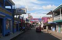
Bluefields remains a deeply impoverished city with extremely high rates of unemployment.
Climate
According to Köppen climate classification, Bluefields features a tropical rainforest climate (Köppen Af). There is a drier period from February to April, but the trade winds ensure that unlike the Pacific coast of Nicaragua, rain still falls frequently during this period. For the rest of the year when tropical low pressure dominates rainfall is extremely heavy, helped by the coast being shaped in such a manner as to intercept winds from the south as prevail during the northern summer.
| Climate data for Bluefields, Nicaragua | |||||||||||||
|---|---|---|---|---|---|---|---|---|---|---|---|---|---|
| Month | Jan | Feb | Mar | Apr | May | Jun | Jul | Aug | Sep | Oct | Nov | Dec | Year |
| Average high °C (°F) | 27.8 (82) |
28.4 (83.1) |
29.0 (84.2) |
29.8 (85.6) |
29.9 (85.8) |
28.9 (84) |
28.1 (82.6) |
28.5 (83.3) |
29.1 (84.4) |
28.8 (83.8) |
28.4 (83.1) |
28.0 (82.4) |
28.7 (83.7) |
| Daily mean °C (°F) | 24.9 (76.8) |
25.2 (77.4) |
26.2 (79.2) |
27.0 (80.6) |
27.0 (80.6) |
26.0 (78.8) |
25.6 (78.1) |
25.6 (78.1) |
25.8 (78.4) |
25.6 (78.1) |
25.3 (77.5) |
25.2 (77.4) |
25.8 (78.4) |
| Average low °C (°F) | 22.2 (72) |
22.3 (72.1) |
23.3 (73.9) |
23.7 (74.7) |
24.2 (75.6) |
23.9 (75) |
23.7 (74.7) |
23.6 (74.5) |
23.5 (74.3) |
23.1 (73.6) |
22.8 (73) |
22.6 (72.7) |
23.2 (73.8) |
| Average precipitation mm (inches) | 218 (8.58) |
114 (4.49) |
71 (2.8) |
101 (3.98) |
264 (10.39) |
581 (22.87) |
828 (32.6) |
638 (25.12) |
383 (15.08) |
418 (16.46) |
376 (14.8) |
328 (12.91) |
4,320 (170.08) |
| Average rainy days (≥ 1.0 mm) | 19 | 13 | 10 | 10 | 15 | 23 | 26 | 25 | 21 | 21 | 20 | 22 | 225 |
| Source: HKO[3] | |||||||||||||
Districts
The city is located beside the eponymous bay; consisting of 17 neighborhoods including the port of El Bluff, located on a peninsula of the same name. Due to gradual erosion, the peninsula is becoming a true island that closes the Bay of Bluefields on the east side. El Bluff has an extension of 1.29 km² and it is about 8 km from Bluefields.
Bluefields has several municipal headquarters and rural communities including:
Urban Level: Santa Rosa, Central, San Mateo, Pointeen, Fátima, Tres Cruces, Ricardo Morales, Old Bank, San Pedro, Teodoro Martínez, 19 de Julio, Pancasán, Punta Fría, Nueva York, Beholden, El Canal ghetto, Loma Fresca.
Rural Level: Cuenca Río Escondido, Cuenca Río Maíz, San Nicolás, La Fonseca, Rama Cay, San Luís, Caño Frijol, Torsuani, Long Beach, Dalzuno, Cuenca Río Indio, Río Maíz, Guana Creek, Nueva Chontales, Neysi Ríos, La Palma, Sub-Cuenca Mahagony, Krisinbila, Sub-Cuenca Caño Negro, Río Kama, El Bluff, Las Mercedes, Monkey Point, El Corozo, Cuenca Punta Gorda, Caño Dalzuno, Haulover, Villa Hermosa, San Ramón, Río Cama (El Cilicio), San Brown, La Virgen, San Mariano, La Pichinga, Musulaine, Caño Blanco, Aurora (San Francisco), Kukra River (Delirio), Barra Punta Gorda, Kukra River.
Education
There are currently two universities in Bluefields. One is the Bluefields campus of the University of the Autonomous Regions of the Nicaraguan Caribbean Coast, and the other is the Bluefields Indian and Caribbean University (BICU).[4]
Transportation
Until recently, there was no road access to Bluefields from the west coast of Nicaragua. There is now an ongoing construction of a highway from Nueva Guinea with regular bus service, and at February 2018 about 10km was still incomplete and unpaved. It is open year-round but not practical for ordinary cars, and visitors usually either fly in to Bluefields Airport from Managua and other cities or take a Panga (boat) down the Rio Escondido from the city of El Rama, easily accessible by bus. In the town, taxis are readily available at a fixed price of 12 cordobas per person (2018) and work on a shared basis. The municipal wharf is the home of commercial boat traffic to Corn Island, LaBarra and many other locations which are only accessible by boat. Car ownership is very limited in Bluefields.
References
- ↑ Leonardi, Richard (2001). Nicaragua Handbook: The Travel Guide. Footprint Travel Guides. p. 248. ISBN 1-903471-14-1.
- ↑ "VIII Censo de Población y IV de Vivienda" (in Spanish). Archived from the original on 2007-09-13. Retrieved 2007-09-12.
- ↑ "Climatological Normals of Bluefields, Nicaragua". Hong Kong Observatory. Retrieved 2012-03-13.
- ↑ bicu.edu.ni/
External links
| Wikimedia Commons has media related to Bluefields, Nicaragua. |
- RightSide Guide
- Paradise Zone Bluefields Evolution
- Bluefields Sound System
- Bluefields Multimedia Archive
Coordinates: 12°00′N 83°45′W / 12.000°N 83.750°W
Capital: Bluefields | ||
| Municipalities | | |