South Caribbean Coast Autonomous Region
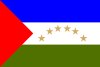
| South Caribbean Coast Autonomous Region Región Autónoma de la Costa Caribe Sur (in Spanish) | |||
|---|---|---|---|
| Autonomous region | |||
| |||
| Anthem: Himno de la Autonomía | |||
 Location of the South Caribbean Autonomous Region in Nicaragua. | |||
| Coordinates: 12°0′N 83°45′W / 12.000°N 83.750°WCoordinates: 12°0′N 83°45′W / 12.000°N 83.750°W | |||
| Country | Nicaragua | ||
| Largest city | Bluefields | ||
| Capital | Bluefields | ||
| Municipalities | |||
| Government | |||
| • Type | Devolved government under presidential republic | ||
| • Body | Government of the RAAS | ||
| • Regional Coordinator (Governor) | Shayra Downs Morgan (FSLN) | ||
| Area | |||
| • Total | 27,407 km2 (10,582 sq mi) | ||
| Area rank | 2nd (20.9% of Nicaragua) | ||
| Population (2005) | |||
| • Total | 306,510 | ||
| • Density | 11/km2 (29/sq mi) | ||
| • Rank | 7th (6.0% of Nicaragua) | ||
| Demonym(s) | Costeño (m), costeña (f) | ||
| ISO 3166 code | NI-AS | ||
| Autonomy Statute | 30 October 1987 | ||
| Official languages |
National Spanish Regional Creole (Miskito Coast Creole and Rama Cay Creole) Miskito Sumo (Mayangna and Ulwa) Garifuna Rama English | ||
| Regional Council | 47 councilors | ||
| National Assembly | 2 deputies (of 92) | ||
The South Caribbean Coast Autonomous Region (Spanish: Región Autónoma de la Costa Caribe Sur, pronounced [reˈxjon au̯ˈtonoma ðe la ˈkosta kaˈɾiβe suɾ]), sometimes shortened to RACCS, RACS, or RAAS (for its former name, Región Autónoma del Atlántico Sur), is one of two autonomous regions in Nicaragua. It covers an area of 27,407 km2 (10,582 sq mi) and has a population of 382,100 (2005 census). The capital is Bluefields. Bordering the Caribbean Sea, it contains part of the region known as the Mosquito Coast.
See also
- North Caribbean Coast Autonomous Region
External links
- The autonomous regions of Nicaragua's Caribbean Coast
- From Conflict to Autonomy in Nicaragua: Lessons Learnt, report by Minority Rights Group International, April 2007
| Wikimedia Commons has media related to Región Autónoma de la Costa Caribe Sur. |
This article is issued from
Wikipedia.
The text is licensed under Creative Commons - Attribution - Sharealike.
Additional terms may apply for the media files.