Blue Mountains (Pacific Northwest)
| Blue Mountains | |
|---|---|
 Baker City, Oregon with the Blue Mountains in the background, seen from the National Historic Oregon Trail Interpretive Center observatory | |
| Highest point | |
| Peak | Rock Creek Butte Oregon |
| Elevation | 9,106 ft (2,776 m) |
| Dimensions | |
| Area | 4,060 sq mi (10,500 km2) |
| Geography | |
| Country | United States |
| States | Oregon, Washington |
The Blue Mountains are a mountain range in the western United States, located largely in northeastern Oregon and stretching into southeastern Washington. The range has an area of 4,060 square miles (10,500 km2), stretching east and southeast of Pendleton, Oregon, to the Snake River along the Oregon-Idaho border. The Blue Mountains cover seven counties in Oregon and Washington; they are Union, Umatilla, Grant, Baker, and Wallowa counties in Oregon, and Walla Walla, Columbia and Garfield counties in Washington.[1] They are home to the world's largest organism and fungal mycelial mat, the Armillaria ostoyae.[2] The Blue Mountains were so named due to thick smoke from the fires which frequently engulf the area.[3]
Geology
The Blues are uplift mountains.[4][5][6]
Geologically, the range is a part of the larger rugged Columbia River Plateau, located in the dry area of Oregon and Washington east of the Cascade Range. The highest peak in the range is Rock Creek Butte in Baker County, Oregon at 9,106 feet (2,776 m).
Other ranges in the Blue Mountains physiographic section include the Wallowa Mountains (the highest peak is Sacajewea at 9,843 feet (3,000 m)), the Elkhorn Mountains (the highest peak is Elkhorn Peak at 9,238 feet (2,816 m)), and the Strawberry Mountains (the highest peak is Strawberry Mountain at 9,042 feet (2,756 m)).
History
Habitation by Native Americans
The river valleys and lower levels of the range were occupied by indigenous peoples for thousands of years. Historic tribes of the region included the Walla Walla, Cayuse people and Umatilla, now acting together as the Confederated Tribes of the Umatilla Indian Reservation, located mostly in Umatilla County, Oregon. Native American tribes originally migrated to the Blue Mountains for hunting and salmon runs.[7] The Natives used to purposefully burn parts of the forest or allow campfires to burn over wide areas.[3]
During westward expansion of the United States
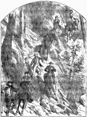
In the mid-1800s, the Blue Mountains were a formidable obstacle to settlers traveling on the Oregon Trail and were often the last mountain range American pioneers had to cross before either reaching southeast Washington near Walla Walla or passing down the Columbia River Gorge to the end of the Oregon Trail in the Willamette Valley near Oregon City.
Modern travel
The range is currently traversed by Interstate 84, which crosses the crest of the range at a 4,193 feet (1,278 m) summit, from south-southeast to north-northwest between La Grande and Pendleton. The community of Baker City is located along the south-eastern flank of the range. U.S. Route 26 crosses the southern portion of the range, traversing the Blue Mountain Summit and reaching an elevation of 5,098 feet (1,554 m).
Wildlife
Elk
The Washington Blue Mountains, in 1989, regulated elk hunting with a spike-only general hunting season. This was in response to a decline in the elk population creating a heavy female biased population. By the mid 1990s the area then became known for its mature males and trophy hunting.[8] During winter months elk will prefer to use "moderately steep south slopes" rather than northern slopes because of the southern slopes being warmer and containing less snow.[9]
Throughout the Blue Mountains physiographic section, foresters have been, nearly a century, attempting to create a regulated, scientific forest, in a process referred to as restoration. [10]
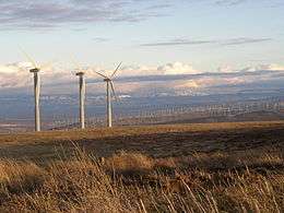
seen from the west
Location
Much of the range is included in the Malheur National Forest, Umatilla National Forest, and Wallowa–Whitman National Forest. Several wilderness areas encompass remote parts of the range, including the North Fork Umatilla Wilderness, the North Fork John Day Wilderness, the Strawberry Mountain Wilderness, and the Monument Rock Wilderness, all of which are in Oregon. The Wenaha–Tucannon Wilderness sits astride the Oregon–Washington border.
Drainage
The range is drained by several rivers, including the Grande Ronde and Tucannon, tributaries of the Snake, as well as the forks of the John Day, Umatilla and Walla Walla rivers, tributaries of the Columbia. The rivers in the Blue Mountain region have about a one-hundred-year flood event.[11]
References
- ↑ "Blue Mountains". Geographic Names Information System. United States Geological Survey. 1986-05-22. Retrieved 2014-09-21.
- ↑ Casselman, Anne. "Strange but True: The Largest Organism on Earth Is a Fungus". Scientific American. Retrieved 2017-06-14.
- 1 2 Shinn, Dean (1980). "Historical perspectives on range burning in the inland Pacific Northwest". Journal of Range Management. 33 (6): 418. doi:10.2307/3898574.
- ↑ Britannica.com: Blue Mountains | mountains, Oregon-Washington, United States | Britannica.com, accessdate: February 8, 2017
- ↑ Google Books: The Oregon Companion: An Historical Gazetteer of the Useful, the Curious ... - Richard H. Engeman - Google Books, accessdate: February 8, 2017
- ↑ cbgwma.org:The Columbia River Basalt Group | Continental flood basalt flows | cbgwma.org, accessdate: February 8, 2017
- ↑ Langston, Nancy (1996). Forest Dreams, Forest Nightmares: The Paradox of Old Growth in the Inland West. Seattle: University of Washington Press. p. 204. ISBN 9780295975504.
- ↑ McCorquodale, Scott; Wik, Paul (2011). "Elk Survival and Mortality Causes in the Blue Mountains of Washington". The Journal of Wildlife Management. 75 (4): 897. doi:10.1002/jwmg.121.
- ↑ Thomas, Jack (1979). Wildlife Habitats in Managed Forests: The Blue Mountains of Oregon and Washington. U.S. Department of Agriculture, Forest Services. p. 107.
- ↑ Langston, Nancy (October 1999). "Environmental History and Restoration in the Western Forests". Environmental History and Restoration in the Western Forests. 38 (4): 47.
- ↑ Fitzgerald, Jim, and Caty Clifton. "Flooding, land use, and watershed response in the Blue Mountains of northeastern Oregon and southeastern Washington." In Inland Northwest Water Resources Conference, Program and abstracts: Inland Northwest Water Resources Conference,[1 p., unpaginated]. 1997.
External links
- "Blue Mountains (mountain range)". Getty Thesaurus of Geographic Names. 2004. Retrieved 2007-07-28.
Coordinates: 45°30′00″N 118°00′05″W / 45.50000°N 118.00139°W