Blue Line (Sacramento RT)
| Blue Line | |
|---|---|
 | |
| Overview | |
| Type | Light rail |
| System | Sacramento RT Light Rail |
| Status | Operational |
| Locale | Sacramento, California |
| Termini |
Watt/I-80 (north) Cosumnes River College (south) |
| Stations | 28 |
| Services | Route 533 |
| Operation | |
| Opened | 1987 (as Watt/I-80–Downtown–Butterfield) |
| Operator(s) | Sacramento Regional Transit District |
| Technical | |
| Track gauge | 1,435 mm (4 ft 8 1⁄2 in) (standard gauge) |
The Blue Line is a light rail line in the Sacramento Regional Transit District (RT) system. It runs primarily north-south in Sacramento between Watt/I-80 and Cosumnes River College. Along the route, the Blue Line serves North Highlands, North Sacramento, Downtown and South Sacramento. Portions of the Blue Line run along the original initial alignment between Watt/I-80 and 16th Street stations.
History
The first light rail line of the RT opened March 12, 1987.[1] Initial service commenced between Watt/I-80 and 8th & O stations only for the first six months. It was extended to Butterfield that same year on September 5.[1] In all, it was an 18.3-mile (29.5 km) route between Watt/I-80 station in North Sacramento, through downtown, and continuing east on Folsom Blvd. to Butterfield Way station. It was built at a cost of $176 million USD ($379 million adjusted for inflation), which included the cost of vehicles and maintenance and storage facilities. Much of the line, when it was first built, was single-tracked, though improvements over the 1990s allowed much of the original system to be double-tracked. The line was built mainly using a railroad right-of-way, coupled with use of structures of an abandoned freeway project. A limited portion of the route runs on streets, mainly in downtown Sacramento.
The line became more popular than anyone anticipated, necessitating further expansions and improvements to the system.
Sacramento RT has proposed extending the light rail system 11.2-mile (18.0 km) south to the town of Elk Grove in phases.
The first phase of the southern extension opened on September 26, 2003 with 6.3 miles (10.1 km) added from 16th Street station to Meadowview Road. The extension added seven new stations to the system and runs parallel to a railroad right-of-way. The light rail system was reconfigured in June 2005 with the South Line connected to the Watt I-80/Downtown Line and designated as the Blue Line.
The second phase of the southern extension opened more than a decade later on August 24, 2015, with 4.3 miles (6.9 km) added from Meadowview Road to Cosumnes River College.[2] The extension added seven new stations to the system. A fourth station, Morrison Creek, will open as an infill station after the adjacent land had been developed.[3] Sacramento RT added a large parking structure at Cosumnes River College to attract riders from southern Sacramento County and boost ridership.[4]>[5][6]
A third planned phase which would extend the line to Elk Grove is on hold due to a lack of funding. Land use and station accessibility must be improved to qualify the extension for Federal Transit Administration (FTA) grant funding.[4][6]
Line description
The Blue Line begins at its northern terminus, the Watt/I-80 station. From there it initially travels southwest in the median of I-80, utilizing a bridge from an abandoned freeway project, then parallels Roseville Road before turning westward paralleling Arden Way in North Sacramento. (It passes up the Siemens plant nearby.) Then the line turns southwest again running in the median of Del Paso Boulevard, merges into a single track crossing the 12th Street viaduct (Highway 160) over the American River. Reaching downtown, the Blue Line goes back to two tracks going south on 12th, turns west on K Street, and splits into one-way tracks for 7th and 8th Streets where it joins the Gold and Green Lines. It then turns westward on O Street, southward on 12th, then eastward in an alley paralleling Q and R Streets. After passing the 16th Street station, the Blue Line splits from the Gold Line (the Green Line terminates at 13th Street station), crossing under the Bee Bridge before going south in its own right-of-way into South Sacramento. It then jogs eastward along Cosumnes River Boulevard before crossing it and reaching its southern terminus at Cosumnes River College station.
Listing of stations on the Blue Line
Note: former stations are highlighted in gray. The 7th & K platform of the St. Rose of Lima Park station closed permanently as of September 30, 2016.
| Station | Opened | Bike lockers | Transfers |
|---|---|---|---|
| Watt/I-80 | 1987 | Yes | RT buses 1, 15, 19, 26, 80, 84, 93, 103 Placer County Transit |
| Watt/I-80 West | 1987 | Yes | No transfers on site |
| Roseville Road | 1987 | Yes | 85 |
| Marconi Arcade | 1987 | Yes | RT buses 25, 86, 87 |
| Swanston | 1987 | Yes | No transfers on site |
| Royal Oaks | 1987 | No | RT buses 22 and 23 |
| Arden/Del Paso | 1987 | Yes | RT buses 13, 14, 15, 16, 19, 22, 23, 25, 88 |
| Globe | 1987 | No | RT bus 15 |
| Alkali Flat/La Valentina | 1987 | No | RT bus 33 |
| 12th & I | 1987 | No | No transfers on site |
| Cathedral Square (westbound: 10th & K, eastbound: 11th & K) | 1987 | No | No transfers on site |
| St. Rose of Lima Park (eastbound: 9th & K) | 1987 | No | Many RT buses |
| St. Rose of Lima Park (southbound: 7th & K) | 1987-2016 | No | Gold and Green Lines Many RT buses |
| 7th & Capitol (southbound); 8th & Capitol (northbound) | 1987 | No | Gold and Green Lines |
| 8th & O | 1987 | No | Gold and Green Lines |
| Archives Plaza | 1987 | No | Gold and Green Lines |
| 13th Street | 1987 | No | Gold and Green Lines |
| 16th Street | 1987 | No | Gold Line RT bus 6 |
| Broadway | 2003 | No | RT buses 51, 62 |
| 4th Avenue/Wayne Hultgren | 2003 | No | RT bus 62 |
| City College | 2003 | No | No Transfers on site |
| Fruitridge | 2003 | No | RT buses 61, 205, 252 |
| 47th Avenue | 2003 | Yes | No Transfers on site |
| Florin | 2003 | Yes | RT buses 54, 65, 81 |
| Meadowview | 2003 | Yes | RT buses 4, 5, 47, 56, E-Tran 156 |
| Morrison Creek | 2017 (planned) | ||
| Franklin | 2015 | ||
| Center Parkway | 2015 | ||
| Cosumnes River College | 2015 |
Blue Line extension project
The 'Blue Line to Cosumnes River College light rail extension Project' — the second phase in the South Sacramento Corridor Study — commenced construction in 2011. [7] [8][9] The first phase of this study (Downtown Sacramento to Meadowview Road) has been completed and is operating.[7] Both Blue Line extensions are component in the 10-year Rail Development Plan for a new light rail corridor in the South Sacramento area.[7] Completion of the project, including four new stations, and initiating revenue service is anticipated to begin in September 2015. [8] The current project will extend the Blue Line south to a new Cosumnes River College—CRC terminus.[7]
- New stations
New Blue Line stations under construction, north to south from the existing Meadowview Station, are: [10]
- Morrison Creek Station
- Franklin Station
- Center Parkway Station
- Cosumnes River College Station
Extension planning issues
The line is currently ending at the college in response to the Federal Transit Administration (FTA) land use, station accessibility, and federal grants needs. Other changes include: a new station at Morrison Creek (midway between Meadowview and Franklin Stations); improved pedestrian access to Franklin and Center Parkway Stations; and a 2000—car parking structure at Cosumnes River College, replacing a previously planned surface parking lot.[7] [11] [6]
California's ongoing financial crisis also contributed to the decision to terminate the Blue Line extension project at Cosumnes River College. Expansion to Elk Grove is covered in the TransitAction Plan, which is tied to the SACOG Blueprint, and a schedule has yet to be determined. [7][6]
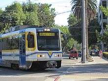
Blue Line gallery
_2009.JPG) Downtown Sacramento
Downtown Sacramento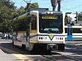 At Archives Plaza Station
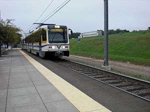 At Roseville Road
 Downtown Sacramento
References
- 1 2 Sebree, Mac (February 1988). "Sacramento Light Rail". Pacific RailNews, pp. 16–17. Glendale: Interurban Press.
- ↑ Bizjack, Tony (August 24, 2015). "Transit advocates, riders celebrate opening of light rail's south line". The Sacramento Bee. Retrieved February 2, 2016.
- ↑ Masui, Alane (August 22, 2015). "RT Celebrates Grand Opening of Blue Line to Cosumnes River College Light Rail Extension" (Press release). Sacramento Regional Transit District. Retrieved February 2, 2016.
- 1 2 "Information Center - Blue Line". Sacramento Regional Transit District. Retrieved 2013-07-30.
- ↑ Official Blue Line extension website: "In order to compete for Federal funding, terminus stations (such as the one proposed at Cosumnes River College) need to provide sufficient parking to claim ridership. A computer model generates the anticipated demand for spaces required at each of the stations. The model calculated a demand of 2,000 spaces for the College." . accessed 4.14.2013
- 1 2 3 4 South Sacramento Corridor Phase 2 Project
- 1 2 3 4 5 6 Blue Line to Cosumnes River College (CRC) light rail extension project Website . accessed 4.14.2013
- 1 2 Official Blue Line extension website: Project Schedule (completed and current) . accessed 4.14.2013
- ↑ Official Blue Line extension website: Current Construction Activity (Latest Construction Activity + Lane Closures Updates webpage) . accessed 4.14.2013
- ↑ Official Blue Line extension website: Blue Line extension Map (with route, stations, and flyover bridges).
- ↑ Official Blue Line extension website: "In order to compete for Federal funding, terminus stations (such as the one proposed at Cosumnes River College) need to provide sufficient parking to claim ridership. A computer model generates the anticipated demand for spaces required at each of the stations. The model calculated a demand of 2,000 spaces for the College." . accessed 4.14.2013
External links
| Wikimedia Commons has media related to Blue Line (Sacramento RT). |
Route map:
| Management | |||
|---|---|---|---|
| Bus System | |||
| RT Light Rail |
| ||
| Other | |||