Blacksod Lighthouse
.jpg) Blacksod in 2015 | |
 | |
| Location | Blacksod, Mullet Peninsula, Erris, County Mayo, Ireland |
|---|---|
| Coordinates | 54°05′55″N 10°03′38″W / 54.098520°N 10.060472°WCoordinates: 54°05′55″N 10°03′38″W / 54.098520°N 10.060472°W |
| Year first constructed | 1864 |
| Year first lit | 1864 |
| Automated |
1999 |
| Construction | local granite blocks tower |
| Tower shape | tower rising from a 2-story keeper's house |
| Markings / pattern | unpainted house, white lantern |
| Height | 12 metres (39 ft) |
| Focal height | 13 metres (43 ft) |
| Range |
white: 12 nautical miles (22 km; 14 mi) red: 9 nautical miles (17 km; 10 mi)[1] |
| Characteristic | Fl (2) WR 7.5s |
| Admiralty number | A6272 |
| NGA number | 7392 |
| ARLHS number | IRE-012 |
| Ireland number | CIL-1870 |
| Managing agent | Commissioners of Irish Lights[2] |
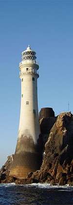
Blacksod Lighthouse (Gaelic: Fód Dubh) is a lighthouse at the southern end of the Mullet Peninsula, Erris, County Mayo, at the entrance to Blacksod Bay. It is made of local granite blocks, which are believed to have come from Termon Hill, a nearby isolated outcrop of high quality granite.[3] The keeper's house is a two-storey square building, which has always been unpainted. It is occupied by a resident lighthousekeeper who is also responsible for Blackrock Lighthouse. Blacksod is of unusual design for a lighthouse, being a square block of a building with only a small conical lantern section on top of it which is painted white. Although it is easily accessible as it is beside Blacksod Pier, it is not open to the general public.
History
Blacksod Lighthouse was built in 1864 by one of the leading merchants in Belmullet at that time, Bryan Carey.[4][5]
Weather observations in June 1944 by lighthousekeeper Ted Sweeney cause the Normandy landings to be postponed. While remaining neutral during World War II, Ireland continued to supply weather reports to Britain under an agreement in place since independence.[6] D-Day had been scheduled to commence on 5 June 1944, but Sweeney's report of approaching bad weather fronts caused Eisenhower to delay the invasion until 6 June 1944, when conditions were more favourable.[7][8]
The house at Blacksod was badly damaged in 1989 by a rogue wave. It was repaired and is still occupied.
Associated lighthouses
The keeper for Blacksod Lighthouse is also responsible for Blackrock Lighthouse at Blackrock Island. Located 12 miles west of Blacksod Bay, the lighthouse on Blackrock is automated and accessible only by helicopter. On 14 March 2017, four Irish Coast Guard personnel were killed in a crash off Blackrock Lighthouse when after it was understood they were seeking to refuel at Blacksod lighthouse.
See also
References
- ↑ Blacksod Lighthouse Commissioners of Irish Lights
- ↑ Rowlett, Russ. "Lighthouses of Western Ireland (Ulster and Connacht)". The Lighthouse Directory. University of North Carolina at Chapel Hill. Retrieved February 10, 2016.
- ↑ "Blacksod Lighthouse". Iol.ie. 1990-10-18. Retrieved 2010-06-26.
- ↑ "Blacksod". Commissioners of Irish Lights. 2010-04-26. Retrieved 2010-06-26.
- ↑ "Blacksod Point Light". Lighthousedepot.com. Retrieved 2010-06-26.
- ↑ Walsh, Jane (2 June 2014). "How weather forecast from Mayo lighthouse saved D-Day invasion". Irish Central. Irish Centralm LLC. Retrieved 3 June 2014.
- ↑ McCarthy, Dan (6 June 2014). "The Irishman who gave the D-Day go-ahead". Irish Examiner. Irish Examiner Ltd,. Retrieved 6 June 2014.
- ↑ McCabe, Joe (1 June 2014). "How Blacksod lighthouse changed the course of the Second World War A weather forecast from a station in Co Mayo saved the D-Day invasion from potential disaster". Irish Independent. Irish Independent. Retrieved 6 June 2014.
External links
- Commissioners of Irish Lights
- Blacksod Lighthouse and Eagle Island lighthouse photos
- Blacksod, Blackrock and other lighthouse pictures
- Photos and descriptions of lighthouses on west coast of Ireland incl Blacksod, Blackrock, Erris