Black Rock, Millard County, Utah
| Black Rock, Utah | |
|---|---|
| Ghost town | |
 Black Rock Location of Black Rock within the State of Utah  Black Rock Black Rock (the US) | |
| Coordinates: 38°42′30″N 112°57′30″W / 38.70833°N 112.95833°WCoordinates: 38°42′30″N 112°57′30″W / 38.70833°N 112.95833°W | |
| Country | United States |
| State | Utah |
| County | Millard |
| Founded | 1876 |
| Abandoned | 1959 |
| Elevation[1] | 4,856 ft (1,480 m) |
| GNIS feature ID | 1425709[1] |
Black Rock was a small, unincorporated village located the Beaver Bottoms in southern Millard County, Utah, United States, about 20 miles (32 km) north of Milford.[1][2]
| Historical population | |||
|---|---|---|---|
| Census | Pop. | %± | |
| 1900 | 61 | — | |
| 1910 | 52 | −14.8% | |
| 1920 | 41 | −21.2% | |
| 1930 | 72 | 75.6% | |
| 1940 | 46 | −36.1% | |
| 1950 | 19 | −58.7% | |
| Source: U.S. Census Bureau[3] | |||
Description
The town was a station stop on the Los Angeles and Salt Lake Railroad (later Union Pacific Railroad), and was a community center for a small number of early twentieth century homesteaders and ranchers. A post office operated at Black Rock from 1891 to 1959.[4] The site is now a ghost town.
The town was named after the nearby rock formation.[5]
See also
References
- 1 2 3 "Black Rock". Geographic Names Information System. United States Geological Survey.
- ↑ "MyTopo Maps - Black Rock, UT, USA" (Map). mytopo.com. Trimble Navigation, Ltd. Retrieved 20 Mar 2018.
- ↑ "Census of Population and Housing". census.gov. United States Census Bureau. Archived from the original on 8 Feb 2006. Retrieved 18 Nov 2011 – via Wayback Machine.
- ↑ "Post Offices: Utah: Millard County". postalhistory.com. Las Vegas, Nevada: Jim Forte. 9 Sep 2005.
- ↑ Van Cott, John W. (1990). Utah Place Names: A Comprehensive Guide to the Origins of Geographic Names: A Compilation. Salt Lake City: University of Utah Press. p. 37-38. ISBN 978-0-87480-345-7. OCLC 797284427. Retrieved 20 Mar 2018.
External links
- Blackrock at GhostTowns.com
Municipalities and communities of Millard County, Utah, United States | ||
|---|---|---|
| Cities | 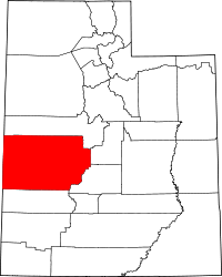 | |
| Towns | ||
| CDPs | ||
| Unincorporated communities | ||
| Ghost towns | ||
| Indian reservation | ||
| Footnotes | ‡This populated place also has portions in an adjacent county or counties | |
This article is issued from
Wikipedia.
The text is licensed under Creative Commons - Attribution - Sharealike.
Additional terms may apply for the media files.