Birpur, Vaishali
| Birpur | |
|---|---|
| Village | |
 Birpur Location in Bihar, India | |
| Coordinates: 25°31′25″N 85°27′26″E / 25.523570°N 85.457191°ECoordinates: 25°31′25″N 85°27′26″E / 25.523570°N 85.457191°E | |
| Country |
|
| State | Bihar |
| District | Vaishali |
| Government | |
| • Type | Gram panchayat |
| • Body | Mukhiya |
| Area | |
| • Total | 20 km2 (8 sq mi) |
| Area rank | 1 |
| Elevation | 46 m (151 ft) |
| Population (2016) | |
| • Total | 25,000 |
| • Density | 1,300/km2 (3,200/sq mi) |
| Languages | |
| • Regional | Maithili, Bajjika |
| Time zone | UTC+5:30 (IST) |
| PIN | 844508 |
| Telephone code | 06224 |
| Lok Sabha constituency | Hajipur |
| Vidhan Sabha constituency | Raghopur |
Birpur[1] is a village in vaishali district, Bihar which is situated at the river island called Raghopur Diyara Island. It is one of the largest village in Raghopur community block. People of this village are mostly dependent on agriculture.People in this area has long tradition of joining armed forces. Its population is approximately 20,000 (Twenty Thousand) and peoples of this village are living their life in peaceful manner. Birpur is named upon Raja Bir Singh, a migrant from Jodhpur in the 17th century. Birpur comes under raghopur community block and a police station is Jurawanpur. It is one of the largest village in the raghopur block in terms of area and population. its pin code is 844508. One post office is there which is located at one its tola(blocks in village) called SatGhar. literacy rate of this village is very low around 33%. Higher education facility is not available in the village and also there is no any good hospitals only small private clinic exists here, which is organised by non-professional or we can call it as a jhola chhap doctor means one who doesn't have any degree. Vajjika and Maithili are the languages which people speaks. It is spread over in the area of 20 km.
Gallery
Geography and Nearby cities
Birpur Village is mainly consisting of two major area known as Birpur dakshni (South Birpur) and Birpur Utari (North Birpur) this two area consist several samll tola ( Blocks or Wards). Utari Birpur having many tola(blocks) named upon division among the sons of Shri Bir Singh like Sat Ghar, Chaw Ghar, Teenpa, Allipur, Panchpaunia and Harijan tola among others. Dakshini Birpur having only three tola(blocks) namely Yadav Tola, Sengar Tola and Chamar toli. Birpur is surrounded by Rupas Mahaji in West , Shiv Nagar in East, Kala Diyara in South and by River Gnaga in North. the Land in north near river Ganga is main agricultural land in the village. Headquarter of this village is Hajipur and the local Registrar sits in the Mahanar.It is Part of Raghopur community Development block. Every year village is getting affected due to flood by Ganga river and it cannot be stopped due to its proximity with river.People of the village face very much hardship in the time of flooding. After the flood land becomes very fertile due to good water absorption and change in soil layer that brings the hope and strength in villagers to face the hardship..After 70 year's of Independence, the village has been recently electrified in 2017 and 20 modern big toilets (each consisting 4 toilets and 2 bath rooms) has been built in different location of village by the effort of Village born Business man Mr. Vikash Singh's NGO in collaboration with KPS foundation and BIT Sindri Alumni Associations . Availability of Electricity has brought significant development in the villager life style.
Near By Cities
- Hajipur
- Bakhtiyarpur
- Fatuha
- Khushropur
- Patna
Schools
- Govt. middle school, Fenuabad, Birpur
- Govt. middle school, Sengar tola, Birpur
- Harijan middle school, Birpur Purbi
- Govt. High school, Birpur
- Shishu gyan shala, Birpur, Raghopur, Vaishali
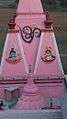
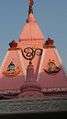
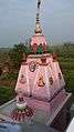
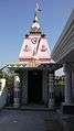
Temples
- Mahavireshwar Nath Mandir, Uparki, Birpur
- Maa Kaali mandir, Birpur purbi
- Maa Kaali Mandir, Birpur Badka Tola
- Mahavir Mandir, Birpur Badka Tola
- Janakeshwar nath mandir, Birpur,purbi
- Maa durga mandir,saat ghar, Birpur
- Maa Durga mandir, Birpur purbi
- Shiv mandir, uparki tola, Birpur
Hospitals
There are currently no hospitals in Birpur village. For better treatment people of this village used to go to the nearest cities like Bakhtiyarpur, Khushropur, Fatuha and Patna.
- APHC, Birpur(closed)
Transportation
Birpur is connected to Patna by Pipa Pool, Kachidargah and Pipa Pool, Gyaspur. when floating bridge(pipa pul) is not operational, people use boat or strimmer to cross the river because Pipa Pool is a seasonal floating bridge which operates from January to August or September due to an increase in the water of Ganga river, bridge gets removed. Local Van keeps plying in the village for Gayashpur or Kachidragh in day time from 7'0 clock to 5'o clock evening.Due to less public vehicle people use their own motorbike and car for transportation.
Nearby railway stations
- Karauta
- Bakhtiyarpur
- Khushropur
- Fatuha
Market
Groceries and household items are available in the shop located in every corner of village.There is regular evening market on twice a week is getting organised from many decades at Uparki Durga Temple, where you will find some permanent shops also. This is a small market in this village where vegetables ,fruits, fish, meat, chicken and other groceries are being sold by framers and traders also. People used to go to Bakhtiyarpur, Kachidargah, Hajipur , Mahanar and Patna for bigger marketing purchase.