Bilchar Dobani
| Dobani Peak بلچھار دوبانی | |
|---|---|
|
Bilchar-Dobani | |
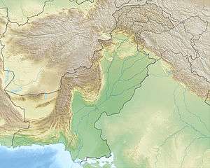 Dobani Peak بلچھار دوبانی Location in Pakistan 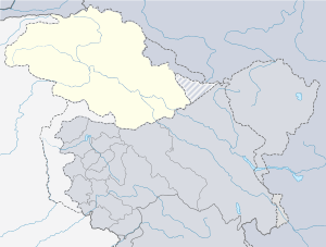 Dobani Peak بلچھار دوبانی Dobani Peak بلچھار دوبانی (Gilgit Baltistan) | |
| Highest point | |
| Elevation | 6,143 m (20,154 ft) |
| Listing | Ultra |
| Coordinates | 35°57′20.5″N 74°37′59.0″E / 35.955694°N 74.633056°ECoordinates: 35°57′20.5″N 74°37′59.0″E / 35.955694°N 74.633056°E |
| Geography | |
| Location | Bagrot Valley, Gilgit–Baltistan, Pakistan |
| Parent range | Rakaposhi-Haramosh Mountains, Karakoram |
| Climbing | |
| First ascent | Isao Ikeuchi and Masaru Hashimoto on 9th June, 1979 |
Bilchar Dobani or Dobani Peak (Urdu: بلچھار دوبانی) is a mountain located between Taisot, Haramosh and Bagrot valley, in Gilgit district of the autonomous territory of Gilgit-Baltistan, in Pakistan.[1]
Location
At western face of the Dobani Peak it is located Tesot valley, and in north it is the Bulche village of Bagrot valley. In the northwest of the mountain is found the Rakaposhi-Haramosh mountain range. The mountain is 6143 m high and located 29 km east of the city of Gilgit. The Bagrot Valley runs along the western flank of Bilchhar Dobani.[2][3]
First ascent
The Bilchhar Dobani was first ascended by two Japanese mountaineers Isao Ikeuchi and Masaru Hashimoto from west face and the northern ridge on 9 June 1979.[4]
Voci correlate
- Taisot valley
- Bagrot valley
- Jalaalabad
- Danyor
- Khaltaro Haramosh
External links
- Bilchar Dobani at Peakbagger.com
- Bilchhar Dobani bei panoramio.com (Foto)
- Bilchhar Dobani bei flickr.com (Foto)
- himalaya-info.org
Note
- ↑ Singh, Sarina (2008). Pakistan & the Karakoram Highway. Lonely Planet. p. 426. ISBN 9781741045420.
- ↑ "Asia, Pakistan—Karakoram, Dobani - AAC Publications - Search The American Alpine Journal and Accidents". publications.americanalpineclub.org.
- ↑ Singh, Sarina (2008). Pakistan & the Karakoram Highway. Lonely Planet. ISBN 9781741045420.
- ↑ Masaru Hashimoto. "Asia, Pakistan—Karakoram, Dobani". American Alpine Journal, 1980, vol. 22.
This article is issued from
Wikipedia.
The text is licensed under Creative Commons - Attribution - Sharealike.
Additional terms may apply for the media files.