Bierley, West Yorkshire
| Bierley, West Yorkshire | |
|---|---|
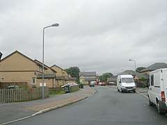 A street in Bierley | |
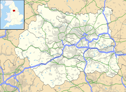 Bierley, West Yorkshire Bierley, West Yorkshire shown within West Yorkshire | |
| OS grid reference | SE1730 |
| Metropolitan borough | |
| Metropolitan county | |
| Region | |
| Country | England |
| Sovereign state | United Kingdom |
| Post town | BRADFORD |
| Postcode district | BD4 |
| Dialling code | 01274 |
| Police | West Yorkshire |
| Fire | West Yorkshire |
| Ambulance | Yorkshire |
| EU Parliament | Yorkshire and the Humber |
Bierley is a former township in the West Riding of Yorkshire whose name now mainly refers to a housing estate in the Tong ward of the City of Bradford, West Yorkshire, England.
Geography
Bierley housing estate is situated about 2.3 miles (3.7 km) southeast of the centre of Bradford, south of the A650 road and the A6036 road. Neighbouring places are in clockwise order: Oakenshaw in the south, Low Moor, West Bowling, Bowling, Holme Wood, and Tong in the City of Bradford and East Bierley in Kirklees in the southeast.
History
In 1872 Bierley was recorded as a township that included the village of Wibsey, the hamlets of Bierley Lane, Carr Lane, Hilltop, Odsal Moor, Woodhouse Hill and Folly Hall, and the districts of Low Moor (where the Leeds, Bradford and Halifax Junction Railway had a station) and Slack. Its population was about 9,500 persons in 1841 and 12,500 in 1861. The township was also known as North Bierley, to distinguish it from similarly named places.[1] This is remembered in the name of North Bierley cemetery, opened in 1902 and situated between Low Moor and Buttershaw.[2]
The former township has been split up following administrative reorganisation. The modern housing estate of Bierley, Bierley Hall Wood, and the hamlets of Bierley Lane and Hilltop now belong to Tong ward.[3] Low Moor and Carr Lane are part of Wyke ward,[4] while Wibsey, Slack and Folly Hall are in Wibsey ward.[5]
Notable Buildings
.jpg)
The church of St John the Evangelist in the north of Bierley was built in 1766 by John Carr as an estate chapel for Richard Richardson of Bierley Hall, but only consecrated in 1824. In 1828 and 1831 it was enlarged, when the north transept and a west porch were added. It is now a Grade II* listed building.[6]
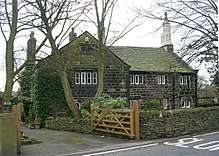
A set of two-storey yeoman's houses in Shetcliffe Lane dates back to the 15th or 16th century. The originally timber-framed buildings were encased in gritstone masonry in 1625 and have also been declared Grade II* listed buildings.[7]
References
- ↑ "Bierley West Riding". A Vision of Britain through Time. Retrieved 10 July 2017.
- ↑ "North Bierley Municipal Cemetery". South Bradford Local History Alliance. Retrieved 13 July 2017.
- ↑ BMDC Tong Ward Polling Districts (Map). City of Bradford Metropolitan District Council. October 2005.
- ↑ BMDC Wyke Ward Polling Districts (Map). City of Bradford Metropolitan District Council. October 2005.
- ↑ BMDC Wibsey Ward Polling Districts (Map). City of Bradford Metropolitan District Council. October 2005.
- ↑ Historic England (4 September 1952). "Church of St John (1314522)". National Heritage List for England. Retrieved 13 July 2017.
- ↑ Historic England (4 September 1952). "439-443, Shetcliffe Lane, Bradford (1219429)". National Heritage List for England. Retrieved 13 July 2017.