Benton Township, Elkhart County, Indiana
| Benton Township | |
|---|---|
| Township | |
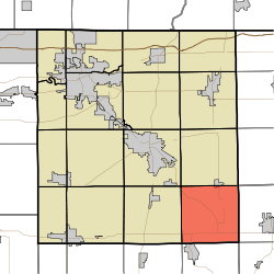 Location of Benton Township in Elkhart County | |
| Coordinates: 41°28′55″N 85°42′27″W / 41.48194°N 85.70750°WCoordinates: 41°28′55″N 85°42′27″W / 41.48194°N 85.70750°W | |
| Country | United States |
| State | Indiana |
| County | Elkhart |
| Government | |
| • Type | Indiana township |
| Area | |
| • Total | 35.9 sq mi (93 km2) |
| • Land | 35.84 sq mi (92.8 km2) |
| • Water | 0.06 sq mi (0.2 km2) |
| Elevation[1] | 853 ft (260 m) |
| Population (2010) | |
| • Total | 2,963 |
| • Density | 82.7/sq mi (31.9/km2) |
| FIPS code | 18-04798[2] |
| GNIS feature ID | 453105 |
Benton Township is one of sixteen townships in Elkhart County, Indiana. As of the 2010 census, its population was 2,963.[3]
Geography
According to the 2010 census, the township has a total area of 35.9 square miles (93 km2), of which 35.84 square miles (92.8 km2) (or 99.83%) is land and 0.06 square miles (0.16 km2) (or 0.17%) is water.[3]
Cities and towns
- Millersburg (south quarter)
Unincorporated towns
Adjacent townships
- Clinton Township (north)
- Eden Township, LaGrange County (northeast)
- Perry Township, Noble County (east)
- Sparta Township, Noble County (southeast)
- Turkey Creek Township, Kosciusko County (south)
- Van Buren Township, Kosciusko County (southwest)
- Jackson Township (west)
- Elkhart Township (northwest)
Major highways
Cemeteries
The township contains two cemeteries: Brown and Hire.
References
- "Benton Township, Elkhart County, Indiana". Geographic Names Information System. United States Geological Survey. Retrieved 2009-09-24.
- United States Census Bureau cartographic boundary files
- ↑ "US Board on Geographic Names". United States Geological Survey. 2007-10-25. Retrieved 2008-01-31.
- ↑ "American FactFinder". United States Census Bureau. Archived from the original on 2013-09-11. Retrieved 2008-01-31.
- 1 2 "Population, Housing Units, Area, and Density: 2010 - County -- County Subdivision and Place -- 2010 Census Summary File 1". United States Census. Retrieved 2013-05-10.
External links
Municipalities and communities of Elkhart County, Indiana, United States | ||
|---|---|---|
| Cities | ||
| Towns | ||
| Townships | ||
| CDPs | ||
| Unincorporated communities | ||
| Footnotes | ‡This populated place also has portions in an adjacent county or counties | |
This article is issued from
Wikipedia.
The text is licensed under Creative Commons - Attribution - Sharealike.
Additional terms may apply for the media files.