Benjamín Rivera Noriega Airport
| Benjamín Rivera Noriega Airport Aeropuerto Benjamín Rivera Noriega | |||||||||||
|---|---|---|---|---|---|---|---|---|---|---|---|
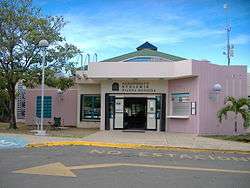 Airport entrance, September 2007 | |||||||||||
| Summary | |||||||||||
| Airport type | Public | ||||||||||
| Owner/Operator | Puerto Rico Ports Authority | ||||||||||
| Serves | Isla de Culebra, Puerto Rico | ||||||||||
| Elevation AMSL | 49 ft / 15 m | ||||||||||
| Coordinates | 18°18′48″N 65°18′16″W / 18.31333°N 65.30444°WCoordinates: 18°18′48″N 65°18′16″W / 18.31333°N 65.30444°W | ||||||||||
| Map | |||||||||||
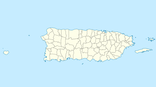 CPX Location of airport in Puerto Rico | |||||||||||
| Runways | |||||||||||
| |||||||||||

Benjamín Rivera Noriega Airport (IATA: CPX, ICAO: TJCP, FAA LID: CPX) is a public use airport on the island of Culebra in Puerto Rico. The airport is owned by the Puerto Rico Ports Authority.[1] It is included in the National Plan of Integrated Airport Systems for 2011–2015, which categorized it as a general aviation airport.[4] However, the airport does offer scheduled passenger service.
History
The airport of Culebra was originally built as a military airport by the United States Marine Corps, opening in 1957. In 1965, the government of Puerto Rico started flying civilians from San Juan to the island with a Legislative compensation.
After the Navy-Culebra protests, the Puerto Rico Ports Authority started administering the civilian flight operations in Culebra, inaugurating the first passenger terminal in October 24, 1976. The airport and its 80 acres were officially transferred to the Ports Authority in 1980.
A new passenger terminal was inaugurated in 1994, and its name was changed to Benjamín Rivera Noriega, in honor of a pilot from Ciales. He became a community leader recognized by his service to the residents of Culebra.[5]
Facilities and aircraft
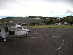
Benjamín Rivera Noriega Airport covers an area of 15 acres (6 ha) at an elevation of 49 feet (15 m) above mean sea level. It has one runway designated 13/31 with an asphalt surface measuring 2,600 by 50 feet (792 x 15 m).
The airport is noted for the mountain less than 1,000 feet (300 m) from the north end of the runway. This obstacle and the short length of the runway keep jet aircraft from using this airport. Commercial operations are currently limited to propeller aircraft with 10 seats or less. The approach to this airport is considered good practice for pilots before flying to Saint Barthélemy Airport.
The St Thomas VOR/DME (Ident: STT) is located 16.1 nautical miles (18.5 mi) east of the airport. The Roosevelt Roads TACAN (Ident: NRR) is located 19.9 nautical miles (22.9 mi) west-southwest of the airport.[6][7]
Airlines and destinations
| Airlines | Destinations |
|---|---|
| Air Flamenco | Ceiba, San Juan-Isla Grande, San Juan-LMM |
| Cape Air | San Juan-LMM |
| Vieques Air Link | Ceiba, San Juan-Isla Grande, Vieques |
Incidents
On July 1, 2011, a Cessna 185 that took off from Benjamin Rivera Noriega airport with a family of five on board, registration number N8436Q, crashed while on its way to Mercedita Airport in Ponce. One body was found in Humacao. The other four passengers are presumed dead.[8] [9] The plane's wreckage was found immersed in water at the Atlantic Ocean, near Yabucoa.[10]
See also
References
- 1 2 FAA Airport Master Record for CPX (Form 5010 PDF). Federal Aviation Administration. Effective April 5, 2012.
- ↑ Airport information for Benjamín Rivera Noriega Airport at Great Circle Mapper.
- ↑ "Culebra". Google Maps. Google. Retrieved 7 June 2018.
- ↑ "2011–2015 NPIAS Report, Appendix A" (PDF). National Plan of Integrated Airport Systems. Federal Aviation Administration. October 4, 2010. Archived from the original (PDF, 2.03 MB) on 2012-09-27.
- ↑ Aeropuerto Benjamín Rivera Noriega Archived January 17, 2012, at the Wayback Machine. at Autoridad de Puertos de Puerto Rico
- ↑ St Thomas VOR
- ↑ Roosevelt Roads TACAN
- ↑ "Archived copy". Archived from the original on 2012-03-18. Retrieved 2016-02-07.
- ↑ http://www.ntsb.gov/aviationquery/brief.aspx?ev_id=20110704X21533&key=1
- ↑ https://aviation-safety.net/wikibase/wiki.php?id=137118
External links
- OpenStreetMap - Isla De Culebra
- SkyVector - Benjamin Rivera Noriega Airport
- Resources for this airport:
- FAA airport information for CPX
- AirNav airport information for TJCP
- ASN accident history for CPX
- FlightAware airport information and live flight tracker
- SkyVector aeronautical chart for TJCP