Ben Hur, Arkansas
| Ben Hur, Arkansas | |
|---|---|
| Unincorporated community | |
 Ben Hur, Arkansas  Ben Hur, Arkansas | |
| Coordinates: 35°43′49″N 92°58′23″W / 35.73028°N 92.97306°WCoordinates: 35°43′49″N 92°58′23″W / 35.73028°N 92.97306°W | |
| Country | United States |
| State | Arkansas |
| County | Newton |
| Elevation | 1,732 ft (528 m) |
| Time zone | UTC-6 (Central (CST)) |
| • Summer (DST) | UTC-5 (CDT) |
| GNIS feature ID | 70624[1] |
Ben Hur is an unincorporated community in Newton County, Arkansas, United States.[1]
The Pedestal Rocks Scenic Area, part of the Ozark–St. Francis National Forest, is located 2.5 mi (4.0 km) west of Ben Hur along Arkansas Highway 16.
References
Municipalities and communities of Newton County, Arkansas, United States | ||
|---|---|---|
| City | 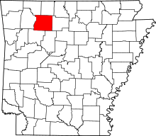 | |
| Town | ||
| Townships |
| |
| Unincorporated communities | ||
This article is issued from
Wikipedia.
The text is licensed under Creative Commons - Attribution - Sharealike.
Additional terms may apply for the media files.