Basilisa, Dinagat Islands
| Basilisa | |
|---|---|
| Municipality | |
| Municipality of Basilisa | |
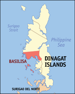 Map of Dinagat Islands with Basilisa highlighted | |
.svg.png) Basilisa Location within the Philippines | |
| Coordinates: 10°00′N 125°30′E / 10°N 125.5°ECoordinates: 10°00′N 125°30′E / 10°N 125.5°E | |
| Country |
|
| Region | Caraga (Region XIII) |
| Province | Dinagat Islands |
| District | Lone District |
| Founded | June 17, 1967 |
| Barangays | 27 (see Barangays) |
| Government [1] | |
| • Type | Sangguniang Bayan |
| • Mayor | Allan I B. Ecleo |
| • Electorate | 13,448 voters (2016) |
| Area [2] | |
| • Total | 92.68 km2 (35.78 sq mi) |
| Population (2015 census)[3] | |
| • Total | 36,880 |
| • Density | 400/km2 (1,000/sq mi) |
| Time zone | UTC+8 (PST) |
| ZIP code | 8413 |
| PSGC | 168501000 |
| IDD : area code | +63 (0)86 |
| Climate type | Tropical monsoon climate |
| Income class | 4th municipal income class |
| Revenue (₱) | 88,259,597.07 (2016) |
| Native languages |
Surigaonon Cebuano Tagalog |
| Website |
basilisadinagatislands |
Basilisa, officially the Municipality of Basilisa, is a 4th class municipality in the province of Dinagat Islands, Philippines. According to the 2015 census, it has a population of 36,880 people.[3]
It is formerly known as Rizal.
The town became a part of the province of Dinagat Islands in December 2006, when the province was created from Surigao del Norte by Republic Act No. 9355. However, in February 2010, the Supreme Court ruled that the law was unconstitutional, as the necessary requirements for provincial land area and population were not met. The town reverted to Surigao del Norte.[4] On October 24, 2012, however, the Supreme Court reversed its ruling from the previous year, and upheld the constitutionality of RA 9355 and the creation of Dinagat Islands as a province.[5]
Barangays
Basilisa is politically subdivided into 27 barangays.
- Benglen
- Catadman (Kapakyan)
- Columbus
- Coring
- Cortes
- Diegas
- Doña Helene
- Edera
- Ferdinand
- Geotina
- Imee (Bactasan)
- Melgar
- Montag
- Navarro
- New Nazareth
- Poblacion
- Puerto Princesa
- Rita Glenda
- Roma
- Roxas
- Santa Monica
- Santo Niño
- Sering
- Sombrado
- Tag-abaca
- Villa Ecleo
- Villa Pantinople
Demographics
| Population census of Basilisa | ||
|---|---|---|
| Year | Pop. | ±% p.a. |
| 1970 | 5,047 | — |
| 1975 | 10,614 | +16.08% |
| 1980 | 13,900 | +5.54% |
| 1990 | 20,953 | +4.19% |
| 1995 | 24,141 | +2.69% |
| 2000 | 26,489 | +2.01% |
| 2007 | 31,363 | +2.36% |
| 2010 | 33,880 | +2.85% |
| 2015 | 36,880 | +1.63% |
| Source: Philippine Statistics Authority[3] [6] [7] | ||
References
- ↑ "Municipality". Quezon City, Philippines: Department of the Interior and Local Government. Retrieved 31 May 2013.
- ↑ "Province: Dinagat Islands". PSGC Interactive. Quezon City, Philippines: Philippine Statistics Authority. Retrieved 12 November 2016.
- 1 2 3 Census of Population (2015). "Caraga". Total Population by Province, City, Municipality and Barangay. PSA. Retrieved 20 June 2016.
- ↑ Tetch Torres (2010-02-11). "Dinagat Islands province back to being a town". Philippine Daily Inquirer. Archived from the original on 12 February 2010. Retrieved 10 February 2010.
- ↑ "IRA Shares for LGUs Jump by 37.5% in 2013". Office of the President of the Philippines. January 9, 2013. Archived from the original on September 3, 2014.
- ↑ Census of Population and Housing (2010). "Caraga". Total Population by Province, City, Municipality and Barangay. NSO. Retrieved 29 June 2016.
- ↑ Censuses of Population (1903–2007). "Caraga". Table 1. Population Enumerated in Various Censuses by Province/Highly Urbanized City: 1903 to 2007. NSO.
External links
Places adjacent to Basilisa, Dinagat Islands | ||||||||||
|---|---|---|---|---|---|---|---|---|---|---|
| ||||||||||
San Jose (capital) | |
| Municipalities | |