Bashi, Alabama
| Bashi, Alabama | |
|---|---|
| Unincorporated community | |
 Bashi, Alabama Location within the state of Alabama  Bashi, Alabama Bashi, Alabama (the US) | |
| Coordinates: 31°58′17″N 87°51′41″W / 31.97126°N 87.86140°W | |
| Country | United States |
| State | Alabama |
| County | Clarke |
| Elevation | 174 ft (53 m) |
| Time zone | UTC-6 (Central (CST)) |
| • Summer (DST) | UTC-5 (CDT) |
| ZIP code | 36784 |
| Area code(s) | 334 |
Bashi is an unincorporated community in Clarke County, Alabama, United States.[1] It takes its name from the nearby Bashi Creek that flows westward into the Tombigbee River.
Geography
Bashi is located at 31°58′17″N 87°51′41″W / 31.97126°N 87.86140°WCoordinates: 31°58′17″N 87°51′41″W / 31.97126°N 87.86140°W at an elevation of 174 feet (53 m).[1] Bashi is in the Central Time Zone [2]
References
Municipalities and communities of Clarke County, Alabama, United States | ||
|---|---|---|
| Cities | 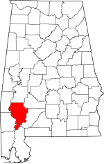 | |
| Towns | ||
| CDPs | ||
| Unincorporated communities | ||
| Ghost towns | ||
This article is issued from
Wikipedia.
The text is licensed under Creative Commons - Attribution - Sharealike.
Additional terms may apply for the media files.