Carlton, Alabama
| Carlton, Alabama | |
|---|---|
| Census-designated place | |
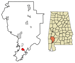 Location of Carlton in Clarke County, Alabama. | |
 Carlton Location within the state of Alabama | |
| Coordinates: 31°20′34.8″N 87°50′42″W / 31.343000°N 87.84500°W | |
| Country | United States |
| State | Alabama |
| County | Clarke |
| Area[1] | |
| • Total | 4.52 sq mi (11.72 km2) |
| • Land | 4.52 sq mi (11.71 km2) |
| • Water | 0.01 sq mi (0.01 km2) |
| Elevation | 171 ft (52 m) |
| Population (2010)[2] | |
| • Total | 55 |
| • Estimate (2016)[3] | N/A |
| Time zone | UTC-6 (Central (CST)) |
| • Summer (DST) | UTC-5 (CDT) |
| ZIP code | 36515 |
| Area code(s) | 251 |
| FIPS code | 01-12112 |
Carlton is an unincorporated community and census-designated place in Clarke County, Alabama, United States. As of the 2010 census, its population was 65.[4] It was formerly known as Hal's Lake.[5] The Isaac Nettles Gravestones are located in Carlton in the Mount Nebo Baptist Church Cemetery. They are listed on the National Register of Historic Places.
Geography
Carlton is located in southern Clarke County at 31°20′35″N 87°50′46″W / 31.343°N 87.846°WCoordinates: 31°20′35″N 87°50′46″W / 31.343°N 87.846°W and has an elevation of 171 feet (52 m).[5]
Demographics
| Historical population | |||
|---|---|---|---|
| Census | Pop. | %± | |
| U.S. Decennial Census[6] | |||
References
- ↑ "2016 U.S. Gazetteer Files". United States Census Bureau. Retrieved Jul 17, 2017.
- ↑ "American FactFinder". United States Census Bureau. Archived from the original on 2013-09-11. Retrieved 2011-05-14.
- ↑ "Population and Housing Unit Estimates". Retrieved June 9, 2017.
- ↑ "Geographic Identifiers: 2010 Demographic Profile Data (G001): Carlton CDP, Alabama". U.S. Census Bureau, American Factfinder. Retrieved June 5, 2014.
- 1 2 "Carlton". Geographic Names Information System. United States Geological Survey.
- ↑ "Census of Population and Housing". Census.gov. Retrieved June 4, 2016.
Municipalities and communities of Clarke County, Alabama, United States | ||
|---|---|---|
| Cities | 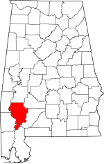 | |
| Towns | ||
| CDPs | ||
| Unincorporated communities | ||
| Ghost towns | ||
This article is issued from
Wikipedia.
The text is licensed under Creative Commons - Attribution - Sharealike.
Additional terms may apply for the media files.