Minor places in Middle-earth
The stories of J. R. R. Tolkien's Middle-earth legendarium contain references to numerous places. Some of these fictional places are described below.
Aldburg
Aldburg (O.E. 'old fortress') is a hill fort and settlement in Rohan, in the region known as the Folde, some miles to the southeast of Edoras. Aldburg was initially the capital of the realm, where Eorl the Young, the first King of Rohan, founded his hall in T.A. 2510. Though his son, King Brego, moved to Edoras early in Rohan's history (T.A. 2569), Aldburg remained the residence of the descendants of Éofor, Brego's third son.[1] One of these descendants was Éomer, who was also a nephew of King Théoden. At the time of the War of the Ring, Éomer was the Third Marshal of the Mark and became heir to the king.
All-welcome Inn
The All-welcome Inn was an inn located at the junction of the Northway and the East Road on the Hobbiton side of Frogmorton. It was much used by travellers, especially Dwarves from the Ered Luin.[2]
Amon Hen
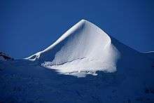
Amon Hen is a hill located on the western bank of the river Anduin, at the southern end of Nen Hithoel, the lake above the Falls of Rauros. It was one of the three peaks at the Falls of Rauros at the southern end of the Emyn Muil, the others being Amon Lhaw, the Hill of the Ear, and Tol Brandir, an island located between the two hills. The Seat of Seeing was built at the summit of Amon Hen, serving as a watchtower for the northern borders of Gondor. It was constructed in the early days of Gondor.
In The Fellowship of the Ring, the Fellowship travelled down the Anduin from Lothlórien to Parth Galen, the lake-side lawn at the feet of Amon Hen. But here the Fellowship was broken: Boromir attempted to take the One Ring by force from Frodo Baggins, who fled; Boromir was shortly afterward killed defending Meriadoc Brandybuck (Merry) and Peregrin Took (Pippin) from Orcs, who had been sent by Saruman to capture the Ring; and the Orcs absconded with Merry and Pippin. After Frodo escaped from Boromir, he sat upon the Seat of Seeing while still wearing the Ring, and was able to see events hundreds of miles distant. From Amon Hen, Frodo and Samwise Gamgee crossed the Anduin on their way east to Mordor, while Merry and Pippin were carried by Saruman's Orcs in the direction of his hold at Isengard, and the rest of the Fellowship set out in pursuit of the Orcs.
Tolkien's aerial view of the Emyn Muil shows Tol Brandir to be much taller than Amon Hen and Amon Lhaw. The sketch is published in J. R. R. Tolkien: Artist and Illustrator.[3]
The bulletin of The Tolkien Society has been named Amon Hen since December 1972.
Amon Lhaw
Amon Lhaw (S. 'Hill of the Ear') is one of the three peaks above the Falls of Rauros which drained the lake known as Nen Hithoel, it towered amongst the Emyn Muil on the eastern banks of the Anduin. Its twin, Amon Hen (The Hill of Sight), lay upon the western bank. Between them, at the centre of the stream above Rauros, was the island peak Tol Brandir upon which none had ever set foot.
Although at one time Amon Lhaw had been on the northern boundary of Gondor and a high seat was built there (probably called The Seat of Hearing), this was no longer the case at the time of the War of the Ring; by then, it had long since fallen under the influence of Mordor. Also called the Hill of Hearing and perhaps Hill of the Ear in Westron.
Tolkien's aerial view of the Emyn Muil shows Tol Brandir to be much taller than Amon Lhaw and Amon Hen. The sketch is published in J. R. R. Tolkien: Artist and Illustrator.[3]
Amon Tirith
- see: Hill of Guard
Andrath
Andrath (S. 'Long Climb') is a narrow pass through which the North-South Road (later called the Greenway) passed between the Barrow-downs on the west and the South Downs on the east. To the north of Andrath the road met the Great East Road, just west of the gates of Bree.
When the Nazgûl came north from Mordor to seek the Ring in the Shire at the end of the Third Age, their leader, the Witch-king of Angmar, camped in Andrath. It is mentioned in the appendices of The Return of the King that it is likely that the Witch-king aroused the Barrow-wights in the nearby Barrow-downs while camped at Andrath.
Angle
Two separate areas in Middle-earth were known as the Angle, each defined by the angle between two converging rivers.
The Angle in Lothlórien lay between the Anduin and Silverlode. It was more generally referred to as Egladil.[4]
The Angle in Eriador was a much larger area. It lay between the Mitheithel on the west and the Bruinen on the east; on the north it was bounded by the Great East Road. This Angle was part of the province of Rhudaur in the kingdom of Arnor.[5] Many Stoors, a tribe of Hobbits, settled in the Angle circa T.A. 1150, but left about T.A. 1356.[6] Tom Shippey notes a number of similarities between the migration history of Hobbits and that of the Anglo-Saxons; one such similarity is the Angle in Eriador and the Angle in northern Europe.[7]
Argonath
The Argonath ('stones of the Kings') is a monument comprising two enormous pillars carved in the likenesses of Isildur and Anárion, standing upon either side of the River Anduin at the northern approach to Nen Hithoel.
The figures were originally constructed about T.A. 1240 at the order of King Rómendacil II[8] to mark the northern border of Gondor, although the realm was greatly diminished in area by the time the Fellowship of the Ring passed the Argonath in T.A. 3019.
Each of the two figures was shown wearing a crown and a helm, with an axe in its right hand and its left hand raised in a gesture of defiance to the enemies of Gondor.[9] It's likely that the figure on the east bank, which technically stood in the province of Ithilien, represented Isildur, while the western figure, standing in the province of Anórien, represented Anárion.
Also known as the Pillars of the Kings or the Gate of Kings.
Ash Mountains
- see Ered Lithui
Azanulbizar
- see Dimrill Dale
Bamfurlong
Bamfurlong is the farmland of Farmer Maggot, located in the Marish of the eastern part of the Shire. The boggy nature of the land makes for above-ground habitation rather than the traditional hobbit-hole. Tolkien himself suggested the name Bamfurlong comes from Old English meaning roughly bean-field.[10]
Barazinbar
Barazinbar, the Dwarvish name for Caradhras (Redhorn), is one of the largest mountains in the Misty Mountains. It lies in close proximity to Redhorn Pass and the Dimrill Stair. Dwarves sometimes shortened the name to Baraz.
Barrow-downs
The Barrow-downs, or Tyrn Gorthad, were a series of hills east of the Shire, behind the Old Forest, and south-west of the village of Bree. Many of the hills were crowned with standing stones and barrows, hence their name.
The Barrow-downs were first inhabited by Men related to the Edain in the First Age, together with the Hills of Evendim to the north. They fled west as Easterlings invaded Eriador and passed on to Beleriand, but after these had left or been killed in the War of Wrath the Edain returned to their old homes.[11]
During the Second Age the inhabitants were fairly numerous, and when they met with the Númenóreans the Barrow-downs were the first places where the Dúnedain émigrés from Númenor settled. When Elendil returned to Middle-earth, the Barrow-downs were incorporated in the kingdom of Arnor. The Downs were revered by the Númenóreans because they were rightly recognized as the first tombs of their ancestors, long before they had encountered the Elves of Beleriand.
After Rhudaur fell to Angmar, the Dúnedain of Cardolan entrenched themselves here, but in T.A. 1409 the realm fell and the Great Plague in 1636 killed any remaining Dúnedain hiding in the Barrow-downs. The Barrow-wights were now sent there by the Witch-king. In the 1850s King Araval of Arthedain tried to recolonize Cardolan, but this failed because of the Barrow-wights.[12]
The hobbits who later became members of the Fellowship of the Ring, namely Frodo (bearing the One Ring), Sam, Merry, and Pippin, travelled through the Barrow-downs on their journey from the Old Forest to Bree. On the night of 28th 'September' T.A. 3018 they were ensnared in the downs by a barrow-wight, probably in the same barrow which held the grave of the last prince of Cardolan.[11] They were rescued by Tom Bombadil, and from the burial treasure received enchanted daggers—designed to slay the evil servants of Angmar.
The daggers from the Barrow-downs had varying fates in The Lord of the Rings. When the Nazgûl attacked Aragorn and the hobbits on Weathertop, Frodo slashed at one of them with his dagger but only damaged its cloak. Merry used his weapon to help destroy the Lord of the Nazgûl in the Battle of the Pelennor Fields, Sam left his beside Frodo in Cirith Ungol and later had it returned to him by Gandalf, while Pippin made use of his dagger in the Battle of the Black Gate to slay a Troll-chief.
Black Gate
- see Morannon
Blue Mountains
- see Ered Luin
Bridge Inn
The Bridge Inn was located on the west side of the Brandywine Bridge in the Shire. It was likely used by travellers on the East Road. Its location would have put it near the point where the road north from Stock met the main East Road. When the Shire was occupied by Saruman's men during the War of the Ring, the Bridge Inn was demolished and replaced with a guard house, with gates erected on the Bridge.[13]
Brown Lands
The Brown Lands comprise a region across the Anduin from Fangorn forest. In the First Age the Entwives settled there and began to make gardens, and they also taught the Men that already lived there to engage in agriculture. The Entwives' gardens, as the region was called at that time, lasted for a long time into the Second Age, until Sauron later blasted the entire area at some time before the Battle of Dagorlad, which was when it became known as the Brown Lands. Treebeard appeared convinced that the Entwives were not all destroyed but were "lost"; their ultimate fate remains a mystery.
The area is described as withered, as if by fire, without any living green thing. In The Fellowship of the Ring,[14] the Fellowship pass by the region in elven boats as they sail down the River Anduin. Aragorn's notable knowledge of geography and family history lets him down as he "could not tell" what had "so blasted" the region.
Bundushathûr
- see Fanuidhol
Calenardhon
Calenardhon was the north-west province of Gondor until T.A. 2510, when it was ceded to the folk of Eorl the Young and renamed Rohan.
Carach Angren
- see Isenmouthe
Carchost
Carrock
The Carrock is a large and tall mid-river monolith in the upper reaches of the Anduin, to the north of the Old Ford. In Chapter 7 of The Hobbit, Gandalf states that the steps from the base of the rock to the flat space at the top were made by Beorn and that "Carrock" is Beorn's name for it. This is somewhat of a linguistic joke on Tolkien's part: car in Anglo-Saxon means "rock", the Irish for "rock" is "carraig" - usually anglicized in place names as "carrick", and the Welsh for rock is "Carreg." Specifically, "carrock" is Beorn's word for large rocks standing in the middle of rivers, and as this is the largest such rock in the river, he took to calling it "the" Carrock.
Celebdil
Celebdil (called Zirakzigil in Khuzdul (or Zirak for short) and translated to English as Silvertine), is a peak in the Misty Mountains, the westernmost[15] of the Mountains of Moria, the three peaks that stood above the Dwarves' realm of Khazad-dûm. Celebdil stood above the main city.
Durin's Tower was located on the peak of Celebdil. The summit was the location of the final battle between Gandalf and the Balrog in the Battle of the Peak, which saw Gandalf slay the demon, before succumbing to his injuries himself and eventually, his resurrection as Gandalf the White.
In a 1968 letter, Tolkien identifies the Swiss Silberhorn as it appeared to him when camping near Mürren in 1911 as "the Silvertine (Celebdil) of my dreams".[16]
Cerin Amroth
Cerin Amroth, also known as the mound of Amroth. It stood in the heart of the Elf-realm of Lothlórien. A number of great trees, including mallorns, grew on the mound, and in the grass at their feet bloomed elanor and niphredil. Amroth lived in a house high in the greatest tree, before he left on an ill-fated voyage and was lost (T.A. 1981). It was here that Aragorn and Arwen plighted their troth centuries later (T.A. 2980), and it was here where Arwen, after Aragorn's death, went to die.
The Fellowship of the Ring visited Cerin Amroth in their travels, arriving at noon on 17th 'January' T.A. 3019. It was essentially the first sight they beheld in Lothlórien, where hitherto they had been blindfolded. Frodo Baggins climbed to the tree-house where Amroth had lived; from there he could see Caras Galadhon to the south, and to the far east could be seen the Anduin, Mirkwood and Dol Guldur.
Cirith Gorgor
Cirith Gorgor (S. 'Cleft of Terror'), called the Haunted Pass in Westron, is the main passage into Mordor, located at the point where the mountain ranges Ered Lithui and Ephel Dúath meet. It was protected by the Black Gate of Mordor and guarded by the two Towers of the Teeth, Carchost and Narchost. The name is sometimes translated 'the Haunted Pass'.
Cirith Ungol
Cirith Ungol (pronounced [ˈkiriθ ˈuŋɡɔl]) is a pass through the Ephel Dúath, the high mountain-range on the west of Mordor. The name is Sindarin for Spider's Cleft, or Pass of the Spider, referring to the guardian of the pass, Shelob, a great spider.
The pass of Cirith Ungol was one of two entrances into Mordor from the West, along with the Morgul Pass.[17] The two passes were fairly close together, but Cirith Ungol was less used, being higher, steeper and narrower.
If these difficulties weren't enough, anyone using the pass of Cirith Ungol had to go through Torech Ungol, a network of caves and tunnels near the top of the pass. Shelob had her lair in these caves, and set traps for travellers in the tunnels.
The Pass of Cirith Ungol was high above the Morgul Pass, on the northern side of the Morgul Vale. In Mordor, the road from Cirith Ungol came down to join the Morgul-road. These routes were guarded by the Tower of Cirith Ungol, built by the Men of Gondor after the War of the Last Alliance, but occupied by Orcs at the time of the War of the Ring.
The Tower of Cirith Ungol overlooked the crest of the pass from the north; a natural tower of stone overlooked the crest from the south. As a result the top of the pass appears to be adorned by two horns. Tolkien's visualization of the pass, as viewed from the west, is depicted in his sketches.[18]
During the Quest of the Ring, Frodo Baggins and Samwise Gamgee were led to the Pass of Cirith Ungol by Gollum, in order to get into Mordor.
Tower of Cirith Ungol
The Tower of Cirith Ungol is a watchtower and fortress on the border of Mordor. It is an important scene in The Lord of the Rings, in particular the chapter which bears its name: chapter 1 of book 6.
The Tower of Cirith Ungol was located high in the Mountains of Shadow overlooking the pass that was called Cirith Ungol—the Pass of the Spider—because the Great Spider Shelob dwelt there. The Tower was located near the top of the pass on the north side, and the base of the tower joined the eastern face of the mountain. The Tower of Cirith Ungol was made of black stone. It had three tiers, each set back from the next lower one like steps. The sheer sides faced northeast and southeast and formed a bastion pointing eastward. At the top of the Tower was a round turret that could be seen above the pass.
A road ran down from the pass and skirted the Tower alongside a sheer precipice before turning southward to join the Morgul-road. The Tower of Cirith Ungol was surrounded by an outer wall that was 30 feet (9.1 m) high. The sides of the wall were smooth. At the top was overhanging stonework that prevented anyone from climbing over it.
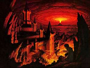
The Tower of Cirith Ungol has been illustrated by artists such as John Howe, the Brothers Hildebrandt, and Alan Lee. The image by Tim and Greg Hildebrandt features an eruption of Mount Doom in the background and one of the Hobbits looking at the tower from a rock spire in the foreground. The Two Watchers are not depicted, although the castle-like structure of the tower shows a gate.
History of the Tower
The Tower of Cirith Ungol was built by the Men of Gondor after Sauron was defeated in the War of the Last Alliance at the end of the Second Age. The Tower was the easternmost outpost of the defences of Ithilien. Its original purpose was to keep watch on the land of Mordor to ensure that no evil things escaped and to guard against the possibility of the Dark Lord's return. But over time, as Gondor's power declined, the vigilance on Mordor became lax and the Tower was deserted.
After the Lord of the Nazgûl returned to Mordor in T.A. 1980, the Tower came under his control. From Cirith Ungol, he led an assault on Minas Ithil, which was captured in 2002 and became his stronghold, known as Minas Morgul. Sauron returned to Mordor in 2942, and used the Tower of Cirith Ungol to prevent any of his slaves or prisoners from escaping from Mordor. A garrison of Orcs were stationed in the Tower, and at the time of the War of the Ring their captain was Shagrat.
Entrances to the fortress
The main gate was in the southeastern side of the fortress's outer wall. It was guarded by the Two Watchers—hideous statues seated on thrones. Each Watcher had three joined bodies facing inward, outward, and toward the other. The description in the book is as follows:
They were like great figures seated upon thrones. Each had three joined bodies, and three heads facing outward, and inward, and across the gateway. The heads had vulture-faces, and on their great knees were laid clawlike hands. They seemed to be carved out of huge blocks of stone, immovable, and yet they were aware: some dreadful spirit of evil vigilance abode in them. They knew an enemy. Visible or invisible none could pass unheeded. They would forbid his entry, or his escape.
They thus had a kind of "psychic barrier" that barred the gate. Sam Gamgee had to overcome this obstacle while searching for his master Frodo Baggins. He did so by using the phial of Galadriel, which overcame their will and allowed him to pass. As soon as he was through, however, they sounded an alarm. It is not known if the Watchers were built by men of Gondor, as was the Tower itself, or if it had been added later by Sauron. Certainly, the spirit that dwelt within them must have come later, as it was clearly identified as being evil.
The fortress had a second entrance at the rear, known as the Undergate. This was located inside the Tower itself where its base abutted the mountainside. The Undergate opened onto a tunnel that joined with Shelob's Lair.
Interior of the fortress
Within the outer wall was a paved courtyard, and of course the Tower itself.
There was a great door on the southeastern side of the Tower. The door opened into a passageway which ran back through the base of the Tower. There were rooms on either side, and at the far end was the arched door of the Undergate.
To the right of the Undergate was a winding stairway to the upper levels of the Tower. At the top of the stairs was a domed chamber with doors facing east and west leading out onto the roof of the third tier. The roof was about 20 yards (18 m) across and was surrounded by a parapet. On the western side of the roof stood the turret of the Tower.
The turret had slitted windows facing westward and eastward through which torchlight glowed like red eyes. A winding stairway led up to a passage running through the middle of the turret. A trapdoor in the ceiling of the passage opened onto a large round chamber at the very top of the Tower of Cirith Ungol.
The Tower in the War of the Ring
At the time of the War of the Ring, the captain of the Orc-garrison of the Tower of Cirith Ungol was Shagrat. On 13th 'March' T.A. 3019, he was leading a patrol down the Pass of Cirith Ungol at the same time as another Orc-patrol, led by Gorbag, was coming up from Minas Morgul. Frodo Baggins was caught by the two patrols as they met.
The Orcs took Frodo through the Undergate to the Tower of Cirith Ungol and imprisoned him in the topmost chamber of the turret. Frodo was stripped and questioned mercilessly. Gorbag coveted Frodo's mithril shirt and fought Shagrat for it. Gorbag's orcs and those of Shagrat's garrison joined the fight, killing one another until virtually all of them were dead.
Sam Gamgee came to the Tower of Cirith Ungol to rescue Frodo. He got past the Two Watchers by raising the Phial of Galadriel, but once he was through the gate the Watchers gave a terrible cry and an alarm bell rang in the Tower. Sam entered the Tower and encountered Snaga, one of the few surviving orcs. Snaga mistook Sam for a great Elf-warrior and fled back up the stairs. Sam followed him to the roof of the third tier. There Sam confronted Shagrat, who fled with the mithril shirt and left the fortress.
Sam entered the turret in search of Frodo, but he could not find a way to the uppermost chamber until he saw Snaga climb up through the trapdoor in the ceiling and followed him. When he saw Snaga whipping Frodo he charged at the orc, who fell through the trapdoor to his death, the last living orc in the fortress.
Sam returned the Ring to Frodo and they escaped from the Tower disguised in its Orc armour and livery. They used the Phial to pass the Watchers, and the archway collapsed behind them. As they fled, a winged Nazgûl descended from the sky and perched on the wall of the Tower of Cirith Ungol, now in charge.
Cloudyhead
- see Fanuidhol
Coldfells
The Coldfells were highlands in north-eastern Eriador. They lay west of the Misty Mountains and south of the Ettenmoors, separated from them by the northern branch of the river Bruinen.
Dagorlad
Dagorlad is the great, treeless, open plain between the Emyn Muil and Cirith Gorgor, the north-west entrance to Mordor. The name means the Battle Plain in Sindarin, and refers to the Battle of Dagorlad fought there between the forces of Sauron (the Lord of Mordor) and the Last Alliance of Elves and Men at the end of the Second Age. The bodies of the dead decayed as normal, but over time part of the field became a wetland, the Dead Marshes, where the images of the fallen could be seen.
Later, in the Third Age, the Dagorlad was the site of many battles between Gondor and various Easterling armies, including the Battle of the Morannon. The countless battles of two ages left Dagorlad as a devastated wasteland, contaminated and unhealthy, with sumps of poisonous slick and mounds of scorched earth.
Dale
Dale is a city-state of Men on the Celduin (the River Running) in the north-east of Wilderland. It appears to have been an independent monarchy, whose ruler was styled "Lord" (and later "King").
The city itself, a large town, was located between the ends of the southern arms of the Lonely Mountain, and thus had a very close relationship with Erebor, the kingdom of Dwarves under the Mountain. Indeed the heights of Ravenhill, where the Dwarves had built a guard-post, overlooked the town on its west. Dale also had a close relationship with Esgaroth, about 30 miles south on the Long Lake.
The town of Dale, famous for its ringing bells, had many buildings, and was defended by "towers, and walls".[19]
The geographic position of Dale enabled it to thrive on the trade between Erebor and other places. The "toy market of Dale was the wonder of the North" of Middle-earth. Gold, jewels, metalwork and food were also traded;[20] the travel-food cram was produced in Dale.[21] Bilbo Baggins imported toys and festive crackers from Dale to the Shire as presents for guests at his Farewell Party (T.A. 3001). Inside the crackers were small but high-quality musical instruments, including trumpets, horns, pipes and flutes.[22]
The people of Dale had the special ability to understand the language of thrushes.[23]
History of Dale
Dale existed in three main phases. It was first established after Dwarves returned to Erebor[24] in T.A. 2590. It was this first phase that Elrond was referring to when remembering Dale and its "merry bells",[25] indicating he had visited the city. The city flourished until T.A. 2770, when it was destroyed by the dragon Smaug, and its last lord Girion killed. The city then lay in uninhabited ruins for about seven generations of Men.
The Battle of Five Armies passed through the ruins in late T.A. 2941; Thorin Oakenshield died in a tent in Dale the day after the battle.[26]
After the battle, Dwarves restored their kingdom under the Lonely Mountain, and Men began to settle once more in Dale, initiating its second phase. Significant rebuilding occurred in T.A. 2944; in the same year Bard the Bowman, a descendant of Girion, assumed the title King of Dale. Gollum visited Dale in secret[27] in the first few years of Bard's reign.[28]
In T.A. 2977 Bard was succeeded as King of Dale by his son Bain; he in turn was succeeded by his own son Brand in T.A. 3007.
The great progress of the kingdom was reported at Rivendell in T.A. 3018, but the report also noted that war was gathering on Brand's borders.
Dale was sacked for a second time during the War of the Ring by Easterlings, allies of Sauron. The people of Dale took refuge in Erebor with the Dwarves, and it was during the Battle of Dale that King Brand of Dale and King Dáin II Ironfoot of Erebor were slain (17th 'March' T.A. 3019).
However a week later, Sauron himself was defeated; when the news arrived the siege was broken. Dale was rebuilt once more, entering its third phase. Its new King was Bard II, son of Brand. He sent an ambassador to the coronation of King Elessar of Gondor, initiating a period of long-term mutual benefit between the kingdoms in the Fourth Age.
Deeping-coomb
The Deeping-coomb was a deep, well-defended valley in the northern White Mountains, located in Westfold in the kingdom of Rohan. The gorge of Helm's Deep and the castle of the Hornburg were situated at the head of the Coomb; there the Deeping-stream issued from the gorge before it ran down through the valley, generally in a north-easterly direction (until it left the Coomb). The Coomb was the site of an important battle, the Battle of the Hornburg, during the War of the Ring.
Tolkien sketched a detailed map of the Deeping-comb to assist him in writing parts of The Two Towers, especially the chapter 'Helm's Deep'. This map is published in J. R. R. Tolkien: Artist and Illustrator.[29]
The road which ran up through the Deeping-coomb, from the Great West Road to the Hornburg, was known as the Deeping-road.
Tolkien occasionally used other spellings—Deeping Coomb,[30] the Coombe[31]—or perhaps he missed these in the proofs of The Lord of the Rings, but he confirmed Deeping-coomb as the correct spelling.[32] The word coomb is a rare Brythonic survival word, meaning a small deep dry valley, easily defended. It gives its name to many places in the British Isles. He also used it, with the spelling "Combe", as the name of one of the four villages of the Bree-land.[33]
Dimholt
The Dimholt is a forest of pine wood and fir situated at the base of the Dwimorberg mountain, past Dunharrow. The name means literally 'dark wood'. An ancient road was visibly forged there, which led to a glen where a standing stone lay in front of the Dark Door, the entrance to the Paths of the Dead. The pathways led under the Dwimorberg and had been haunted by the spirits of the Dead Men of Dunharrow in the Third Age until they fulfilled their oath to Aragorn and departed.
Dimrill Dale
Dimrill Dale (in the tongue of Men of the North) was a great valley on the eastern side of the Misty Mountains. The valley was part of the ancient Dwarf-kingdom of Khazad-dûm; its Dwarvish name was Azanulbizar. It was called Nanduhirion in Sindarin, meaning "valley of dark streams".
Topographically the valley was embayed by the three massive Mountains of Moria: Zirakzigil (containing the Mines of Moria) on the west, Barazinbar at the valley-head (Dimrill Stair) in the north, and Bundushathûr forming the east side of the valley. A feature of the vale was the Mirrormere, a crystal clear lake in which Durin first saw the stars. The river Silverlode ran through the vale before it flowed into Lothlórien.
A bloody battle was fought in Dimrill Dale in T.A. 2799 between Dwarves and the Orcs who had occupied Moria; the latter were defeated and their leader Azog killed. In T.A. 2989 Balin and his followers fought the orcs here on the way to Moria. Thirty years later the Fellowship of the Ring paused in the valley, having escaped from Moria and the loss of Gandalf.
Dimrill Stair
The Dimrill Stair is the southeastern part of the Redhorn Pass. A waterfall flowed beside the Stair, which led down into the Dimrill Dale and past the mirror-like pool called Kheled-zâram.
Dol Baran
Dol Baran is the southernmost foothill of the Misty Mountains. King Théoden of Rohan and some of the surviving members of the Fellowship of the Ring camped here on the night of 5th 'March' T.A. 3019, after their parley with Saruman. Pippin stole away from this camp with the palantír.
Dorwinion
Dorwinion is a land which lay on the northwestern shores of the Sea of Rhûn. Known for its wine, Dorwinion was drawn at Tolkien's advice on Pauline Baynes' map of Middle-earth as lying at the end of the Carnen and Celduin, at the northwest shore of the Sea of Rhûn, and in that position it has since appeared on other maps. It was possibly part of Gondor for several centuries in the early Third Age.
The gardens of Dorwinion produced heady wine, which was exported at least as far as the Elves of Mirkwood,[34] who lived over 500 miles to the north-west.
The same name was used in earlier unpublished writings to refer to one or two other places. In the conclusion of the 1937 Quenta Silmarillion Tolkien refers to the "meads of Dorwinion", a location on the island of Tol Eressëa, and in the poem The Lay of the Children of Húrin, set in the First Age, he refers to the "wine of Dor-Winion", which may or may not be identical to the Dorwinion of the Third Age.[35]
Drúwaith Iaur
Drúwaith Iaur was a coastal region on the far west of Gondor. It was not a part of the realm of Gondor, and therefore also not of the Reunited Kingdom. It was the home to the remnants of the Drúedain, the original inhabitants of the Ered Nimrais, who were dispersed by the Númenóreans as they were hostile to them. The northern part of Drúwaith Iaur was also home to the Dunlendings, who feared the Drûgin because they used poisoned arrows. The region was also called Old Púkel-land.
Dunland
Dunland lay west of the southern Misty Mountains, generally between the Isen and Greyflood rivers. It had areas of woodland in the south, and its northern parts were described as "a green and pleasant country."[36]
Dunland was the home of the Dunlendings, swarthy and dark-haired men of shorter stock than the Dúnedain or Rohirrim. The Dunlendings were descended from the same ancient stock as the House of Haleth, making them distantly related to the Dúnedain. During the Dark Years they had settled in areas that were later ruled by Arnor and Gondor, and they remained long after Arnor had been destroyed. The Rohirrim displaced many of them from Calenardhon when Rohan was first established, leading to lasting enmity between their two peoples. As the Dunlendings had been forced into more marginal lands, they were jealous of the wealth of Rohan, and during the War of the Ring many were persuaded by Saruman to join him in the invasion of Rohan.
Following the sack of Erebor in T.A. 2770, those of its exiled Dwarves who were led by Thrór dwelt in Dunland for a time.[37]
Members of the Fellowship of the Ring travelled through Dunland in late 'August' T.A. 3019, on their journey home after the War of the Ring. While in Dunland they encountered Saruman and his sidekick Wormtongue.
Durin's Stone
Durin's Stone is a pillar that stood on the banks of Mirrormere below the East-gate of Khazad-dûm. According to the Dwarves of Durin's Folk, it was built on the site where Durin the Deathless looked down in the lake and saw a crown above his head, and its purpose was to commemorate this. The stone was ornamented with runes, but by the later Third Age the stone was broken, cracked and heavily weathered.[38]
Members of the Fellowship of the Ring visited Durin's Stone during the afternoon of 15th 'January' T.A. 3019.
Durin's Tower
Durin's Tower is the tower that stood on the peak of Celebdil above Khazad-dûm. It could be reached only by a long stairwell, the Endless Stair, which began in the deep far below the mines. Gandalf pursued the Balrog known as Durin's Bane up the Endless Stair, reaching Durin's Tower on 23rd 'January' T.A. 3019. Their ensuing battle on the peak destroyed the Stair and Durin's Tower.[39]
Durthang
Durthang (S. 'dark oppression') was an old castle in northern Mordor. It stood in the northern Ephel Dúath, on the slopes above the Isenmouthe. Possibly it was built by Gondorians after Sauron's downfall at the end of the Second Age, but later was captured by his forces and became an orc-hold.
Frodo Baggins and Sam Gamgee saw Durthang in the distance on the morning of 18th 'March' T.A. 3019. That night they were captured by a contingent of Orcs from the castle.
Dwimorberg
Dwimorberg, called the Haunted Mountain (which is what the name means), is a peak in the White Mountains; it was situated at the head of the valley of Harrowdale. Dunharrow stood above a cliff on the valley's eastern side, parallel to the Dwimorberg mountain itself. Beyond Dunharrow was a forest of pine wood and fir, known as the Dimholt.
The Dimholt itself contained a small glen, where there was a standing stone positioned in front of a doorway that led to the Paths of the Dead. The paths led under the Dwimorberg and were in the Third Age haunted by the spirits of the Men of the Mountains. After the events at the end of the Third Age when Aragorn released these spirits from their oath, the Dwimorberg was haunted no longer.
East Bight
The East Bight is a vast indentation in the south-eastern edge of Mirkwood Forest, created by the clearing of trees by the Northmen.
Eastfold
The Eastfold is the part of the kingdom of Rohan that lay east of Edoras (capital of Rohan) and the Snowbourn River. Its south-east borderland was named Fenmarch. East of the Eastfold lay the kingdom of Gondor and its province of Anórien.
Éomund of Eastfold was the Chief Marshal of Rohan from at least T.A. 2989 to his death in 3002. His main responsibility was the East-mark, of which the Eastfold was the southern section. His son Éomer also became Marshal of the East-mark, a position he held at the outbreak of the War of the Ring.[40]
Part of the Great West Road ran through the Eastfold. Gandalf and Pippin, riding on Shadowfax, travelled eastwards through Eastfold during the War of the Ring. Days later they were followed by the great Ride of the Rohirrim, which was led by Théoden, King of Rohan; the 6,000 riders included Éowyn, Meriadoc Brandybuck and the said Éomer.
Edhellond
Edhellond (S. 'elf-haven') is an ancient harbour and settlement of Elvish origin in Gondor, located just south of the junction of the rivers Morthond and Ringló.
In one account by Tolkien, Edhellond was founded by the Sindarin refugees in three small ships fleeing the ruin of Beleriand following Morgoth's successful onslaught on the Elvish kingdoms. Another version tells that some refugees of Doriath, in the course of their wandering, founded the haven. In both versions, the original founders possessed the knowledge of shipbuilding, which in the First Age was known only to Círdan and the elven-folk of the Falas. Whatever its ultimate origins, in time Edhellond was swelled by Nandorin Elves seeking for the sea.[41]
Amroth, Lord of Lothlórien, was lost at sea near Edhellond in the year 1981 of the Third Age while looking for his beloved Nimrodel. By then nearly all Elves of Edhellond had sailed into the West, seeking escape from the shadows of Middle-earth. By the time of the War of the Ring no Elves remained in Edhellond, and while it was uninhabited, the area passed into the dominion of Gondor.
Elostirion
Elostirion is the tallest of the three towers that stood on the Tower Hills. These towers were said to have been built by Gil-galad, High King of the Noldor in Middle-earth, in honour of Elendil who came to Middle-earth in the aftermath of the fall of Númenor (S.A. 3319).
Afterwards Elendil often came to the tower and set there one of the palantíri of the North, the only one that could look to Númenor; but unlike the other six, it could not be used to communicate with other palantíri. This palantír eventually became known as the Elendil Stone.
Elostirion endured for millennia after the deaths of Gil-galad and Elendil (both in S.A. 3441), under the care of Círdan and the Elves of Lindon; but the Elendil Stone palantír that it once held was taken to the Blessed Realm when Elrond and company sailed away at the end of the Third Age.
Emyn Beraid
- see: Tower Hills
Emyn Muil
The Emyn Muil (S. 'veiled hills'[42]) is a craggy, nearly impassable highland surrounding Nen Hithoel, a large lake. The Anduin river cut through the Emyn Muil, entering the north at Sarn Gebir, passed the Argonath before flowing into Nen Hithoel, and then poured out of the Emyn Muil in the great waterfall of Rauros. The three southmost peaks of the Emyn Muil were Amon Hen, Tol Brandir and Amon Lhaw. Most of these features are included in an "aerial view" of the Emyn Muil which Tolkien sketched; the sketch is published in J. R. R. Tolkien: Artist and Illustrator.[43]
The Emyn Muil marked the southern limits of Wilderland,[44] and formed the eastern wall of Rohan. Gondor claimed the Emyn Muil as far north as the Argonath.
In The Two Towers, Frodo and Sam struggled through the eastern Emyn Muil en route to the Black Gate of Mordor. Tolkien writes that he padded Frodo and Sam's difficult crossing with enough days to synchronize their movements with those of Aragorn and Gandalf. Frodo and Sam eventually escaped using a rope to descend a cliff to the Dead Marshes.
In the meantime the Uruk-hai, carrying Meriadoc Brandybuck and Peregrin Took as captives, traversed the western Emyn Muil. They were pursued by the Three Hunters: Aragorn, Legolas and Gimli.
Emyn Uial
The Emyn Uial (S. 'hills of dusk') are the highlands in northern Eriador, called also the Hills of Evendim. The hills began about a hundred Númenórean miles north of the Shire; at the southern end was the city of Annúminas, the first capital of Arnor, at Lake Evendim. The Baranduin or Brandywine River flowed out of this lake. A tributary of the river Lhûn also rose in the hills.
In the Second Age, when the Men of Númenor first returned to Middle-earth, the Hills of Evendim were populated by Men related to the ancestors of the Edain. For this reason the Númenóreans later settled nearby, and the hills formed the core of the later kingdom of Arnor. After the establishment of the Kingdoms in Exile by Elendil and his sons, the Men of Evendim merged with the Dúnedain and men not of Edain stock, like the Men of Bree, to form the population of Arnor.
Enedwaith
Enedwaith (also spelt Enedhwaith, or Enedwâith) originally referred to both a region of Middle-earth and the men that inhabited it, although the region Enedwaith retained that name even when the Enedwaith people were no more. Enedwaith is Sindarin for 'Middle-region' as well as 'Middle-folk', referring to its position between Eriador (and its kingdom Arnor) to the north and Gondor to the south.
The boundaries of the Enedwaith were defined in the north by the rivers Gwathló and Glanduin, to the east by the Misty Mountains, and to the west by Belegaer, 'The Great Sea'. The southern border was less clear, but was probably formed by the river Isen.
During the First and early Second Age Enedwaith was deeply forested, but the arrival of the timber-hungry Númenóreans, from the seventh century of the Second Age onwards, devastated the landscape. The denuded forests of Enedwaith, and much of those to the north in Eriador, were finally destroyed by the War of the Elves and Sauron around S.A. 1700, during which much of what had survived the felling was burnt. Only remote corners like Eryn Vorn survived in Eriador, and the Old Forest still further north. Many surviving natives took refuge in the eastern highlands of Enedwaith, "the foothills of the Misty Mountains", which ultimately became Dunland.
After S.A. 3320, Enedwaith formed the most northern part of the new Kingdom of Gondor, at least officially. The south-east was still "in places well-wooded", but elsewhere Enedwaith was by this time "mostly grassland." Following the Great Plague in T.A. 1636 however, Gondor's authority permanently lapsed throughout the region.
The Númenóreans founded two cities on the Gwathló, Enedwaith's north-west boundary: Tharbad and Lond Daer. Lond Daer was located on the coast, on the southern banks of the Gwathló estuary, and thus fully in Enedwaith. At a later stage it was known as Lond Daer Enedh, reinforcing its connection with Enedwaith.
The other city, Tharbad, was further inland. Located mainly on the northern banks, technically in Eriador, it nevertheless was an important centre for the inhabitants of Enedwaith across the river. Tharbad, unlike Lond Daer, remained significant beyond the early Third Age, but was finally abandoned following devastating floods in T.A. 2912. After this only two groups survived in Enedwaith: the Dunlendings in the east, and a "fairly numerous but barbarous fisher-folk" wandering the coast.
Ered Lithui
Ered Lithui is the mountain range forming the northern border of Mordor. From the Morannon, where it met the Ephel Dúath, the Ered Lithui ran generally eastward for hundreds of miles. The "Guide to the Names in The Lord of the Rings", written by Tolkien as a guide for translators, explains the name Ered Lithui as "Sindarin orod, plural ered, eryd, “mountain”; lith “ash” plus adjectival ui. Translate by sense: mountains of ash-grey hue” [45]
As an alternative to Ered Lithui, Tolkien himself used the English ("Common Speech") name "Ashen Mountains", which appears twice in The Return of the King, once in the chapter "The Land of Shadow" and once in "Mount Doom"; it is also spelt thus in the index to the second edition. On the maps prepared by Christopher Tolkien, however, the range is labelled "Ash Mountains," and that is the English name that commonly appears on fan sites.
Barad-dûr, the Dark Tower of Sauron, stood at the end of a spur of the Ered Lithui which jutted southwards onto the plateau of Gorgoroth and towards Mount Doom.
Further to the east, a longer southwards spur formed part of the escarpment between Gorgoroth and Nurn, Mordor's lower lands.
Ered Luin
The Ered Luin, also called the Blue Mountains and the Mountains of Lune, was a large mountain range which formed the western boundary of the great region of Eriador. Originally Beleriand, another great region, lay to the west of the mountains; but at the end of the First Age Beleriand was mostly destroyed and submerged, and the only mainland remaining west of the mountains was Lindon. Even before the end of the First Age, Lindon had given the mountains an alternative (but little-used) name: the Ered Lindon.
The peaks of the Blue Mountains included Mount Dolmed, roughly in the middle, and Mount Rerir in the north. Also in the north was the source of the river Lhûn. The upper Lhûn flowed to the east, but in the destruction of Beleriand the Sea forced a great gap in the middle of the Blue Mountains, and the Lhûn's lower course was diverted so that it flowed back west and into the gap, which was now partly filled by the Gulf of Lune. In the First Age, a number of rivers had flowed west from the mountains: the Gelion and the Seven Rivers of Ossiriand.
The peoples of Middle-earth encountered the Blue Mountains at different stages of the First Age. The first peoples were Elves, who crossed the range in their primeval Great Journey westwards; much later they were followed by Men: the Edain. Dwarves founded two great cities in the east face of the mountains: Belegost, just to the north of Dolmed, and Nogrod just to the south.
The Dwarves had appeared an age after the Elves (but well before Men). The Sindar (Elves who had abandoned the Great Journey and settled in Beleriand) believed that the Dwarves had followed them from the far east and across the mountains.[46] However, given that Belegost and Nogrod were the strongholds of two of the great clans of the Dwarves (the Broadbeams and Firebeards), it is possible that their patriarchs had been placed in the Blue Mountains by Aulë, and awoke there.
After the end of the First Age the power and wealth of Khazad-dûm was much increased; for it was enriched by many people and much lore and craft when the ancient cities of Nogrod and Belegost in the Blue mountains were ruined in the breaking of Thangorodrim.[47] However, by the late Third Age Dwarves were again residing in the eastern Blue Mountains. Some of Durin's folk who survived the sack of Erebor settled in the southern Ered Luin in T.A. 2802, led by Thrain II;[48] thus Thorin Oakenshield was living there prior to his quest of Erebor. Thorin's nephews Fíli and Kíli were born in the Blue Mountains, as was their distant cousin Gimli.
At one time Dwarves had mines in the far north of the Blue Mountains, but these had been abandoned by T.A. 1974 when Arvedui, the last King of Arthedain, hid in these mines with his companions. Hunger soon forced them to leave these mines and seek the assistance of the Lossoth on the nearby shores of the Bay of Forochel.
Ered Mithrin
The Ered Mithrin or Grey Mountains was a large mountain range on the north of Wilderland. The Grey Mountains were the last remnants of the wall of the Ered Engrin or Iron Mountains, which once stretched all over the north of Middle-earth, but were broken at the end of the First Age. The eastern Grey Mountains branched into two spurs, between which lay the Withered Heath.
The Dwarf-kings of Durin's line were based in the Grey Mountains from about T.A. 2200, until they returned to Erebor in 2590.
To the north of the Grey Mountains lay the large cold region of Forodwaith.
Ered Wethrin
Ered Wethrin (IPA: [ˈɛrɛd ˈweθrɪn]; archaically IPA: [ˈœrœd ˈɣweθrin]) (Mountains of Shadow) was a mountain range in the north of Middle-earth in the First Age. In the south, it was an east-west range that divided Dor-lómin and Mithrim to the north from Beleriand to the south, then in the east it curved around to the northwest, forming the boundary of Hithlum. A line of hills to the southwest formed the southern boundary of Nevrast, while the Mountains of Mithrim were a northwesterly spur that separated Dor-lómin from Mithrim.
Several rivers arose in the Ered Wethrin; those on the eastwards side of the range included the great river Sirion and its tributaries Narog and Teiglin. The easternmost point of the Ered Wethrin reached nearly to the Echoriath, forming a steep-sided valley through which the upper Sirion ran. The Ered Wethrin disappeared beneath the waves at the end of the First Age, when the Valar changed the shape of Middle-earth.
These mountains should not be confused with Middle-earth's other Mountains of Shadow: the Ephel Dúath of Mordor.
Eryn Vorn
Eryn Vorn, also known as 'The Black Wood', was a densely forested peninsula in southern Eriador. Forming the western tip of what became known as Minhiriath, it was originally part of the vast ancient treescape that covered most of north-western Middle-earth, and was named by the early Númenórean explorers of the Second Age.
Throughout the following millennium, Minhiriath's landscape beyond the cape was systematically deforested by the Númenóreans in their greed for shipbuilding timber, and was then almost completely burnt down during the ensuing War of the Elves and Sauron. By the war's end in S.A. 1700, the surviving natives had either retreated north to Bree or hidden themselves in Eryn Vorn, but the whole region was largely ignored by both Elf and Númenórean thereafter.
Eryn Vorn eventually fell under the jurisdiction of Arnor after Númenor's destruction at the end of the Second Age, and from 861 in the Third Age, the Black Woods became a nominal part of Cardolan, one of Arnor's three successor states.
The people of Cardolan were almost completely destroyed by the Great Plague a few centuries later, and although it is not known how this affected the Black Wood, it is probable that it remained populated throughout its history, for although no permanent settlements of men existed anywhere west of Bree by the late Third Age,[49] "a few secretive hunter-folk lived in the woods" of Minhiriath by the time of the War of the Ring.[50] The Black Wood was the only woodland in Minhiriath large enough to be mapped, so presumably these secretive folk were the descendants of those who hid in Eryn Vorn over four thousand years earlier.
Ettenmoors
The Ettenmoors are highlands west of the Misty Mountains and north of the Coldfells. It was a location of warfare between the Free Peoples and Angmar in the Third Age when the Witch-king fled after losing the battle of Fornost.[51] It is also the place where the trolls live in The Hobbit (ettin is the Old English for giant).
Everholt
"Everholt" is the name the Rohirrim gave to a section of the Firienholt woods.[52] It was notorious for its boars, after whom the forest was named;[53] the first element is Old English eofor, "boar". The last boar was hunted and killed by Folca, 13th King of Rohan; in the encounter the king was gored by the boar, and also died in the woods.
Fanuidhol
Fanuidhol is also called Bundushathûr in Khuzdul (Shathûr for short) and translated into English as Cloudyhead. It is a peak in the Misty Mountains, the eastern-most[15] of the three great mountains that stood above the Dwarf-realm of Khazad-dûm (the others being Caradhras and Celebdil).
Fenmarch
Fenmarch was the south-east borderland of Rohan. Part of the Firien Wood lay in its south at the feet of the White Mountains. The border itself was marked by the Mering Stream, which flowed from the mountains and through the Firien Wood. East of the border lay Gondor.
King Théoden and his army rode "through Folde and Fenmarch and the Firienwood" on their way to the Battle of Pelennor Fields.[54]
Field of Celebrant
The Field of Celebrant is a broad grassland in south-western Wilderland. It lay west of the river Anduin between two tributaries: the Limlight in the south and the eponymous Celebrant in the north. The Field thus separated Calenardhon (later the kingdom of Rohan) from the woods of Lothlórien. The Field of Celebrant was bounded on the west by the Misty Mountains.
The south-eastern corner of these grasslands was the site of the decisive Battle of the Field of Celebrant in T.A. 2510, where Eorl the Young rode to the aid of Gondor's northern army. In Gondor after this time, the Field of Celebrant generally meant the battle site, rather than the grasslands as a whole.[55]
After the War of the Ring, the Field of Celebrant (in its broader sense) became part of Rohan.[56]
Firienholt
Firienholt is a forest through which a portion of the border between Rohan and Gondor lay, also called the Firien Wood. The Mering Stream, marking the border between the two lands, flowed through. The White Mountains lay south of the forest; Elendil's original tomb was on a tall peak named Halifirien within the forest.[57]
The Floating Log
The Floating Log is a "good inn" located in the village of Frogmorton in the Shire. During the War of the Ring, the inn was closed, so that Frodo Baggins and his companions were taken to a Shirriff-house instead while travelling through Frogmorton.[13]
Folde
The Folde is an ancient and historic region of the kingdom of Rohan. It included Edoras[58] (the capital of Rohan for most of its history), and the nearby settlement of Harrowdale. The town of Aldburg, Rohan's first capital before the transfer to Edoras, was also located in the Folde, further to the east. Its name comes from Old English, with the approximate meaning 'bosom of the Earth', which shows its importance in Rohan's early history.[59] The Folde was the most populous region of Rohan.
King Théoden and his army rode "through Folde and Fenmarch" on their way to the Battle of Pelennor Fields.[54]
In an earlier concept, Rohan's capital region was called the King's Lands, of which the Folde was the sub-region to the south-east of Edoras and containing Aldburg.[60] This earlier concept of the Folde found its way onto the map of Gondor published with The Return of the King.
Forlond
Forlond (S. 'north haven') is a harbour on the northern side of the Gulf of Lhûn in Lindon. It was built by Elves after the drowning of Beleriand.
The Forsaken Inn
The Forsaken Inn is an inn on the Great East Road east of Bree, presumably constructed by Men. It was mentioned by Aragorn discussing with Frodo Baggins the further course of their journey: "None have measured the road between Rivendell and the Forsaken Inn, a day's ride east of Bree."[61]
The East Road was used years earlier by Bilbo Baggins; the Forsaken Inn is not specifically referred to in The Hobbit, but "an inn or two" at the edge of the Lone-lands are mentioned.[62]
In the Interplay version of The Fellowship of the Ring for PC, the Forsaken Inn is located southeast of Bree's east gate. A secret cellar beneath the inn contains clues to obtaining Durin's Axe.
In Turbine's Lord of the Rings Online, the Forsaken Inn is located on the western edge of the Lone-lands, along the Great East Road. In the game, the inn is in a bad state.
Goblin-town
Goblin-town is a goblin (or orc) settlement which lay under the High Pass in the Misty Mountains. It was ruled by the Great Goblin.
Goblin-town was a complex of caverns and tunnels. The Great Goblin held court in one great cavern at the heart of the settlement. Other delvings were dedicated to mines, torture-chambers, slave-pens, prison-cells, forges for weapons and tools, and places where "clever" devices were made.[63] The tunnels led all the way through the mountains: the "front porch" opened onto the High Pass so that travellers on the Pass could be waylaid, while the "back door" was on the eastern side of the mountains, near the Eagles' eyrie in Wilderland.
A tunnel nearer the back door led deep into the mountain to a subterranean lake. Occasional goblins sought fish here for the Great Goblin.[64] Gollum made his home on an island in this lake in about T.A. 2470.
During the quest to Erebor in T.A. 2941, Bilbo Baggins and the Dwarves of Thorin Oakenshield were sheltering in the front porch when they were captured by soldiers of Goblin-town. The captives were brought before the Great Goblin, who accused them of spying, and was enraged to find out Thorin was carrying the sword Orcrist "Orc-cleaver". With the help of Gandalf, Bilbo and the Dwarves escaped and killed the Great Goblin, after which a frantic pursuit occurred.
The Golden Perch
The Golden Perch is an inn situated in the village of Stock in the Eastfarthing of the Shire. It was credited by Peregrin Took for having "the best beer in the Eastfarthing".[65]
The name perch is neither the land measure, nor a bird perch. It refers to the fish. The inn was "probably one favoured by anglers."[66]
Gorgoroth
Gorgoroth is an arid plateau in the north-west of Sauron's realm of Mordor, in the midst of which stood the volcanic Mount Doom. The plateau was covered in volcanic ash and rock, and was effectively a desert with little to no plant growth.
The plateau was a large triangular area, mostly surrounded by high mountain ranges. The north was fenced by about 300 miles of the Ered Lithui, and the west by about 150 miles of the Morgai (the inner range of the Ephel Dúath), and most of the south-east side by mountain-range spurs that extended south-west from the Ered Lithui and east from the Ephel Dúath.
Thus Gorgoroth had superb natural defences, and it was the heart of the realm of Sauron. In the northeast, on a smaller spur of the Ered Lithui, Sauron constructed his chief fortress of Barad-dûr. Gorgoroth was the location for the mines and forges that produced Mordor's arms and armour. Agriculture in Gorgoroth was virtually impossible, but armies of Sauron's soldiers lived in camps of huts and tents on the western margins at the feet of the Morgai escarpment.[67] Sauron built a network of highways across Gorgoroth for his soldiers and messengers; there were cisterns and wells at various points on these roads through the desert.[68]
Frodo Baggins and Samwise Gamgee crossed Gorgoroth in their quest to get to Mount Doom in The Lord of the Rings.
A similar name had been given to a range of mountains in Beleriand, Ered Gorgoroth. The Norwegian black metal band Gorgoroth took the name in tribute to the plateau in Mordor.
Gram
- see Mount Gram
The Green Dragon
The Green Dragon, an inn at Bywater, is the last building on the side of the village nearest to Hobbiton.
At the beginning of the Quest of Erebor, Thorin Oakenshield and his company of Dwarves went ahead to the Green Dragon Inn to make preparations and await Bilbo Baggins.[62] Many years later, on the advent of the War of the Ring, the inn was the site of a conversation between Samwise Gamgee and Ted Sandyman about the strange things that had been happening, such as queer folk passing through the Shire and a "Tree-man" seen by Sam's cousin Halfast of Overhill.[69] When Frodo Baggins and the others returned to Bywater from Gondor, they found the inn "lifeless and with broken windows", as it was not maintained under Saruman's men.[13]
In The Lord of the Rings film trilogy, the inn is featured twice, in brief interludes near the beginning and end of the three movies. The Green Dragon is the employer of Rosie Cotton, who works there as a bar maid. This is where Samwise Gamgee approaches her following the Fellowship's return from Gondor. The inn was also not vandalized by Saruman's men in the films, because the Scouring of the Shire is only shown as an alternate future in Galadriel's mirror. The largest container of ale offered in the Green Dragon is half a pint.
Merry and Pippin sing a song about the Green Dragon in the film The Lord of the Rings: The Return of the King:
Oh, you can search far and wide
You can drink the whole town dry
But you'll never find a beer so brown
As the one we drink in our hometown
You can keep your fancy ales
You can drink 'em by the flagon
But the only brew for the brave and true
Comes from the Green Dragon![70]
The song is mostly invented by the film's writers, though the phrase "a beer so brown" appears in "The Man in the Moon Stayed Up Too Late", an actual Tolkien poem found in The Fellowship of the Ring and The Adventures of Tom Bombadil.[71]
In The Lord of the Rings: The Battle for Middle-earth II, the inn is not simply vandalized, but utterly destroyed by the goblins of Gorkil in the Evil Campaign. The Green Dragon Inn is also seen in the Shire map for skirmish mode, where it functions as a normal inn once captured.
The name of the inn where Bilbo met the Dwarves at the start of The Hobbit was a last-minute change made when the book was in page proofs. The sign of the Green Dragon displayed in front of a public house is a compliment to the Patron Saint of England, Saint George of dragon-slaying fame. It was clearly selected with some care on Tolkien’s part, most likely as intentional foreshadowing of the events of the story yet to come. Who better to see Bilbo on his way as he sets out on his quest to kill the dragon than Patron Saint of England, the "dragon slayer." [72] Tolkien also notably mused on "a great green dragon" in his childhood.[73]
Grey Mountains
- see Ered Mithrin
Gulf of Lune
The Gulf of Lune is a sea-arm that broke through the range of the Ered Luin into Eriador. The Gulf of Lune, named after the river Lhûn or "Lune", was created during the War of Wrath when Beleriand was broken. In the midst of Ossiriand, the Great Sea broke through the mountains, creating the Gulf of Lune.[74] The remnant of Beleriand north of the gulf became known as Forlindon, and the part south of it as Harlindon (North and South Lindon).
At the beginning of the Second Age, Elves established the Grey Havens of Mithlond at the eastern end of the Gulf. These Elves were Noldor and Sindar under who remained in Middle-earth under King Gil-galad. But at various times during the following Ages, the ships of the Eldar continued to sail from the Gulf and into the West.
During the Second Age the ships of the Númenóreans came to the Gulf of Lune to visit the Elves.
Gundabad
- see Mount Gundabad
Harad
The vast region of Harad lay to the south of Gondor and Mordor. It included the coastal city of Umbar. The Men of Harad, called the Haradrim, were ancient enemies of the Gondorians, and allies of Sauron during the War of the Ring.
Harlond
Harlond (S. 'south haven') is a harbour on the southern side of the Gulf of Lhûn in Lindon. Like Forlond, it was built after the drowning of Beleriand.
Harrowdale
Harrowdale is the deep valley cut northwards out of the White Mountains by the Snowbourn River. At the head of the valley, beneath the mountain known as the Starkhorn, stood Dunharrow, a great refuge of the Rohirrim. Lower down the valley lay the hamlets of Underharrow and Upbourn. At its northern end, by the east bank of the Snowbourn where it issued down onto the plains of Rohan, stood that kingdom's capital, Edoras.
In The Lord of the Rings, Aragorn and his Grey Company arrived in Harrowdale on 7th 'March' T.A. 3019, and left the next morning via the Paths of the Dead. King Théoden of Rohan arrived on 9th 'March' with Meriadoc Brandybuck; the following day they led the Muster of Rohan and its ride to the War of the Ring.
Hill of Guard
The hill abutting Mount Mindolluin at the eastern end of the White Mountains. It stood some 700 feet above the lands at its base.[75] The Gondorian city of Minas Tirith was built on this hill.
The hill's name is a translation of the Sindarin name: Amon Tirith.[76]
Hills of Evendim
- see Emyn Uial
Hills of Faraway
The hills of Faraway was a vague location in Eriador. A Troll was said to live there. Possibly it existed only in the imagination of Hobbits.
Himring
Himring is a hill in the north-east of Beleriand during the First Age, it was the greatest hill for many leagues around. It was wide-shouldered and surrounded by many lesser hills, and after Beleriand sank beneath the sea the summit of the hill remained above the sea as an island which remained in the ages that came afterwards.
Irensaga
Irensaga is one of the major peaks of the White Mountains. It rose above Harrowdale. Its name is Old English Írensaga, "iron-saw", a reference to the jagged appearance of its peak.
The Irensaga Montes on Titan, a moon of Saturn, are named after Tolkien's Irensaga.
Isenmouthe
The Isenmouthe is the pass in the northwest of Mordor, also called by the Mannish name of the Isenmouthe or Carach Angren (both versions of the name mean 'iron jaws'). It was formed where spurs reaching out from the ranges of the Ephel Dúath and the Ered Lithui met, leaving only a narrow passage between the Plateau of Gorgoroth and the smaller valley of Udûn to the north. As the passage to the Black Gate of the Morannon, Carach Angren was heavily fortified, and both the rocky spurs that overlooked it carried fortresses and watchtowers. Across the passage itself, a wall of earth had been built, and a great ditch had been dug across the opening spanned by a single bridge.
Frodo Baggins and Samwise Gamgee passed close to the Isenmouthe on their journey to Mount Doom.
The Ivy Bush
The Ivy Bush is a "small inn on the Bywater road" near Hobbiton in the Shire. Here Gaffer Gamgee recounted to the other regulars his stories about Bilbo and Frodo Baggins, who were about to throw a magnificent joint birthday party.[77]
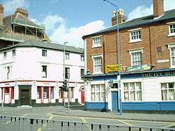
The most likely real-world source for this inn is an Edgbaston pub called the Ivy Bush, near which Tolkien lived for a number of years.[78][79]
A hotel in Carmarthen (Wales) is named the Ivy Bush Royal Hotel.
Khand
Khand is a land which lay on the south-east of Mordor at the end of the Mountains of Shadow. To the south-west of Khand lay Near Harad, and to the east lay the vast region of Rhûn. Tolkien says little about the land or its people. It was the home of the Variags of Khand, warriors who appear tangentially in the text with little description. The index of Volumes VIII and XII of The History of Middle-earth, presumably due to Christopher Tolkien, glosses Variag as "the people of Khand".
Khand existed in the shadow of its powerful neighbour, Mordor. It appears twice in Tolkien's account of the history of Gondor: first in the year 1944 of the Third Age when the Variags together with the Wainriders attacked Gondor, and later during the War of the Ring when they fought and died on the Pelennor Fields.
Kheled-zarâm
- see Mirrormere
Lake Evendim
Lake Evendim (S. Nenuial) was located in Eriador in the Hills of Evendim, which lay north of the Shire. The lake covered an estimated 639 square miles[80] (1,655 km²). It was the source of the river Baranduin (the Brandywine).[81]
In the early part of the Second Age, Galadriel and Celeborn may have dwelled in the area around Lake Evendim with many other Elves in their following before they moved to Eregion around the year S.A. 700.[82] Men also lived around Lake Evendim in the early part of the Second Age.[83] When the North-kingdom of Arnor was established in S.A. 3320, the High King Elendil had his seat at Annúminas on the south-east shore of Lake Evendim near the outflow of the Baranduin.[84] One of the palantíri was kept there.[85]
After Arnor was divided into three kingdoms in 861 of the Third Age, the capital was moved to Fornost (about 100 miles to the east of Annúminas). Annúminas began to fall into ruin and was eventually abandoned.[86] In the Fourth Age, Annúminas was re-established as the northern capital by Aragorn, King Elessar.[87] In the year 15 of the Fourth Age, the King, and Queen Arwen, came north to dwell by the shores of Lake Evendim for a time.[88]
Evendim means "evening twilight."[89] The Sindarin name was Nenuial meaning "lake of twilight" from "nen" meaning "lake" and "uial" meaning "twilight."[90]
Last Bridge
The Last Bridge is the crossing point of the river Mitheithel by the Great East Road. The stone bridge of three arches, the river's lowest crossing below its upper reaches in the Ettenmoors,[91] served as an important landmark on the road from Bree to Rivendell, as it was just over halfway between these two points and at least a week's journey east of Bree.
Bilbo Baggins, the dwarves, and Gandalf crossed this bridge in The Hobbit, though it is not named, and their encounter with the trolls occurred in the Trollshaws nearby. In The Fellowship of the Ring, Aragorn finds a beryl on the bridge that was left by Glorfindel as a warning that the Nazgûl were searching the Great East Road for the One Ring. Glorfindel mentions waging battle with the Nazgûl upon the bridge, as to make it safe for the Hobbits and Aragorn to reach Rivendell.
Last Desert
An arid region in the far east of Rhûn. It was the abode of Wereworms.
Lithlad
Lithlad (S. 'ash-plain') is an arid region of Mordor to the south of Ered Lithui, upon the outskirts of which the Tower of Barad-dûr stood.
Lond Daer Enedh
Lond Daer Enedh was the first permanent settlement of the Númenóreans in Middle-earth. It was located on the coast of Enedwaith, on the southern banks of the estuary of the Gwathló; this river provided access to the great region of Eregion in the hinterland to the north.
The settlement was founded as Vinyalondë ('New Haven') by Númenor's crown prince Aldarion between the years 739 and 800 of the Second Age.[92] From here Aldarion's "Guild of Venturers" began harvesting the local timber for the shipbuilding industry of Númenor.
Within a few centuries, the deforestation of the outlying regions Enedwaith and Minhiriath became cataclysmic, angering the local native population (ancestors of the Dunlendings), and they began to fight back with increasing ferocity, destroying the haven several times, and frequently burning the great wood-stores in hit-and-run attacks.
By the time of the War of the Elves and Sauron in the middle of the Second Age, this 'New Haven' had become very well established, and its name had shifted over the intervening one thousand years to Lond Daer, the Great Haven. As such, it was one of the two beachheads of the Númenórean forces in Eriador that were used to support the Elves around S.A. 1700.
Lond Daer's shipyards were starved of timber following the war, as the forces of Sauron had burnt almost all of what remained in Enedwaith and Minhiriath. Once its shipbuilding yards were no longer practicable, Lond Daer declined in importance, and the Númenórean hunger for ever more wealth shifted focus to the establishment of newer havens to the south, Pelargir and Umbar. Following this, Lond Daer was once again renamed, being now one of several major ports in Middle-earth, and was known as Lond Daer Enedh, or 'Great Middle Haven'. Despite this, Númenor still maintained traffic on the Gwathló as far as the city of Tharbad.
After the Downfall of Númenor, Elendil founded the realm of Arnor in the lands north of Lond Daer, but the haven was now redundant, and fell into ruin. Instead, control over the region was maintained from Tharbad. The ancient ruins of Lond Daer were still visible as late as the end of the Third Age, however, and still featured on maps from that time.
Long Lake
The Long Lake is a lake situated at the confluence of the Forest River and the northern reaches of the Celduin south of the Lonely Mountain. The lake gets its name from being many times longer north-south than it was wide east-west (from the west shore where the Forest River emptied into the lake the east shore could barely be seen, but the north and south not at all). The lake emptied out over waterfalls on the southern edge into the River Running that led all the way to the great Sea of Rhûn. Esgaroth, a town of Men, was built entirely upon the lake itself, which thus formed a natural moat. It was built very near to the Forest River outlet, but protected from the stream by a promontory of rock. The water in the Lake itself was calm.
In The Hobbit, Bilbo Baggins and Thorin's company traversed virtually the whole lake from south to north before heading to the Lonely Mountain. They were rowed by men of Esgaroth.
The lake covered an estimated 93 square miles[80] (272 km²).
Lune
Methedras
Methedras (S. 'end-horn') is the southernmost peak of the Misty Mountains. On its west lay Isengard in the valley of Nan Curunír.
On the eastern side of Methedras lay Fangorn Forest. The Entwash sprang from the mountain's higher eastern slopes. Treebeard's home, Wellinghall, was located at the feet of the mountain near the source of the river. From there the young river ran down the mountain's lowest slopes on its way through the forest.
Treebeard and the Ents, together with Meriadoc Brandybuck and Peregrin Took, traversed the southern spur of Methedras, a high ridge, on their march from Fangorn to Isengard.
Mindolluin
Mindolluin (S. 'towering head blue') was the easternmost peak of the White Mountains. The city of Minas Tirith stood upon the Hill of Guard, the eastern shoulder of the mountain. In The Return of the King, shortly after Aragorn's coronation as King Elessar, Gandalf took him by an ancient path that led up Mindolluin to a high hallow that overlooked the city far below. There he discovered, upon an otherwise barren slope, a sapling of Nimloth, the White Tree of Gondor, which he replanted in the city's Court of the Fountain as a sign of rebirth.
The Mindolluin Montes on Titan, the great moon of Saturn, are named after Tolkien's Mindolluin.
Minhiriath
Minhiriath (Sindarin for 'Between Rivers' and thus an Elvish form of Mesopotamia) was the most southerly region of Eriador. The two rivers referred to are the Brandywine on the north-west and the Greyflood on the south-east. In the south and south-west were Minhiriath's coastlands, washed by Belegaer, 'the Great Sea'. It had no clear border on the north-east.
The original inhabitants of Minhiriath (Minhiriathrim) were descended from the same Atani as the ancestors of the Númenóreans, but because they spoke mutually unintelligible languages, the Númenóreans did not class the Minhiriathrim as Middle Men.
When the large-scale deforestation of their land began under the Númenórean 'Ship Kings' after the 7th century of the Second Age, the minhiriathrim became openly hostile, and were persecuted. Only those who "fled from Minhiriath into the dark woods of the great Cape of Eryn Vorn" survived. Most, if not all, of these forest-dwellers subsequently "welcomed Sauron and hoped for his victory over the Men of the Sea", but they were to be disappointed by Sauron's burning of much of the rest of the surviving forest, and final defeat, in S.A. 1701.
From S.A. 3320, Minhiriath became nominally part of the newly established Kingdom of Arnor, at which time it formed the upper part of
- ..a land that was far and wide on either bank a desert, treeless but untilled.
- ('Of Galadriel & Celeborn' from Unfinished Tales)
From T.A. 861, Minhiriath was inherited by one of Arnor's three successor states, Cardolan, but the "ravaging" of Cardolan by evil forces in T.A. 1409 no doubt caused extensive depopulation of the whole country. Even worse was the advent of the Great Plague in T.A. 1636, after which Minhiriath was "almost entirely deserted". After T.A. 1975, even though "a few secretive hunter-folk lived in the woods" the region was almost entirely desolate.
Although "still in places well-wooded" by the time of the War of the Ring, the once continuously forested Minhiriath bore the permanent scars of over 5000 years of felling, burning and war.
During the Fourth Age the region once more developed under the auspices of the restored Kingdom of Arnor: when talking of Eriador (and particularly the lands south and west of Bree) to an innkeeper at the end of the War of the Ring, for example, Gandalf confidently predicts that,
- ..the waste in time will be waste no longer, and there will be people and fields where once there was wilderness.
- ("The Journey Home", The Lord of the Rings)
Mirrormere
The Mirrormere is the tarn (mountain-lake) located in Dimrill Dale below the doors of Khazad-dûm (Moria), on the eastern side of the central Misty Mountains. It was known as Kheled-zâram by the Dwarves.
According to the Dwarves of Durin's folk, their ultimate forefather Durin the Deathless had awoken in the First Age at Mount Gundabad in the far north Misty Mountains, and then travelled south until he came upon the Mirrormere. He looked down in it, and in the reflection saw a crown of stars above his head; this constellation was thus named Durin's Crown by Dwarves. Having acquired a "crown", he then founded the kingdom of Khazad-dûm nearby. Mirrormere was revered by Dwarves; they erected Durin's Stone on the spot by the edge of the lake where their patriarch had his vision.
When Balin attempted to refound a Dwarf-colony in Moria, he was fatally attracted by the Mirrormere. On 10 'November' T.A. 2994 he went alone to look in the lake, but was shot by an Orc.
The Fellowship of the Ring neared the lake shortly after escaping Moria, early in the afternoon of 15th 'January' T.A. 3019. Despite the urgency of getting further away from Moria, Gimli, a Dwarf, would not pass by without looking in the lake. Frodo Baggins and Sam Gamgee joined him, and they could see the stars of Durin's Crown as if reflected in the lake, even though it was broad daylight and no stars were in the sky.
Morannon
The Morannon, the Black Gate of Mordor (Sindarin mor "black" + annon "gate"), was a great stone rampart built across Cirith Gorgor, the pass into Mordor between the ends of the Ephel Duath (Mountains of Shadow) and the Ered Lithui (Ash Mountains). The battlemented wall separated Dagorlad on the north from the vale of Udûn on the south, and had one iron gate with "three vast doors,"[93] The wall guarded Mordor from attack from the northwest and was flanked by Carchost and Narchost, the two "Towers of the Teeth." The Black Gate stood near the meeting of four roads: one led to the north, another east along the Ered Lithui, another west and then south through Ithilien (and ultimately to Harad), and the last through the gate into Udûn. Udûn held underground armories for the defence of the Morannon, and secret passwords were needed to pass through the gate.[94] The hills on either side contained tunnels and caves where orcs lay in wait, ready to go to war.[95]
The Morannon was built by Sauron[95] sometime during the Second Age and certainly by 3434,[96] when the Battle of Dagorlad in the War of the Last Alliance was "fought for days and months on the plain at the Black Gates."[97][98]
Frodo, Sam and Gollum reached the Black Gate early on 5th 'March' T.A. 3019 to seek a way into Mordor, but were unable to enter and so left. On the 25th of 'March' the Army of the West fought with the armies of Mordor before the Black Gate in the "Battle of the Morannon." The battle was intended to distract Sauron and give Frodo time to destroy the One Ring. When the Ring was unmade, Sauron's army was defeated and the Black Gate destroyed.
Morgul Pass
The Morgul Pass is the main pass from the Morgul Vale into Mordor. The Morgul Pass was at the far eastern end of the Morgul Vale. The Mountains of Shadow were relatively low at that point. The Morgul-road ran through the valley past Minas Morgul and over the Morgul Pass. This road then ran down into Mordor and crossed Gorgoroth to Mount Doom and Barad-dûr. The Morgul Pass was so called because it was located in the Morgul Vale. The word morgul means "black magic". The element mor means "black, dark." The element gûl means "sorcery, magic" from the stem ngol or nólë meaning "long study, lore, knowledge." This pass was also called the Nameless Pass, presumably by those who did not wish to utter the evil name of Morgul.
Far up the northern wall of the Morgul Pass, far above the main roadway, was a steep secondary pass reached by a perilous stairway, and known as Cirith Ungol.
Mount Gram
Mount Gram is a mountain in north Eriador; its exact location is unknown but it probably was located either in the Ettenmoors or the Mountains of Angmar, or somewhere else in the northern Misty Mountains. It was inhabited by Orcs.
In T.A. 2747 the Orc-ruler was king Golfimbul; in that year he fatally led an invasion into the Shire.
Mount Gundabad
Mount Gundabad (S. 'stone[99]-judgement[100]': a translation of a Khuzdul name[101]) is a mountain in the northernmost section of the Misty Mountains, close to the western extremity of the Grey Mountains. It was a stronghold of Dwarves and later, Orcs. According to the Dwarves, Durin the Deathless, oldest of the Fathers of the Dwarves, awoke at Mount Gundabad some time after the awakening of the Elves. Mount Gundabad remained a sacred place to the Dwarves ever after.[101]
In the middle of the Second Age, Orcs (servants of Sauron) invaded Gundabad. The site would not be cleansed until very late in the Second Age, possibly around or after the fall of Sauron and the loss of the One Ring.
In the Third Age, the Orcs of Angmar yet again claimed it as their capital, which was one of the reasons for the Dwarves' special hatred of this people. After the fall of Angmar, Gundabad remained an Orc stronghold, even after it was sacked during the War of the Dwarves and Orcs. The army of goblins that fought in the Battle of Five Armies was said to have mustered at the mountain in The Hobbit.
The maps published in The Hobbit and The Lord of the Rings depict Mount Gundabad as a three-peaked formation, reminiscent of two other Middle-earth mountains: Thangorodrim and Thrihyrne.
Mountains of Angmar
The Mountains of Angmar are the northernmost range of the Misty Mountains;[102] it ran north-west from Mount Gundabad to Carn Dûm. Carn Dûm was the capital of the evil kingdom of Angmar, which straddled the mountains and gave its name to the range. The mountains were inhabited at various times both by Dwarves and Orcs.
Mountains of Ash
- see Ered Lithui
Mountains of Moria
The Mountains of Moria were the three massive peaks at the midpoint of the Misty Mountains: Caradhras, Celebdil and Fanuidhol. The great Mines of Moria were delved by the Dwarves beneath these three mountains; the main body of their realm lay under Celebdil. The Mountains of Moria embayed a great valley, Dimrill Dale, with Celebdil on the west, Caradhras in the north, and Fanuidhol on the east.
The most southerly of the Misty Mountains' few passes was located in the Mountains of Moria: the Redhorn Pass on Caradhras. During the events of The Lord of the Rings, the Company of the Ring attempted to traverse this pass, but they were forced to enter the Mines due to a heavy snowfall.
Mountains of Shadow
- for Beleriand's Mountains of Shadow see Ered Wethrin
- for Mordor's Mountains of Shadow see Ephel Dúath
Nanduhirion
- see: Dimrill Dale
Narchost
Nen Hithoel
Nen Hithoel was a large lake upon the Great River Anduin amid the Emyn Muil to the east of Rohan. The lake was approximately 20 miles (32 km) long from north to south, and 10 miles (16 km) wide. Upon the lake's northern approach from Anduin the Men of Gondor constructed the huge pillars of the Argonath in the reign of Rómendacil II to mark the northern boundary of their realm, although by the time of the War of the Ring that boundary had long since receded. At the southern end of the lake stood three hills. Amon Hen, the Seat of Seeing, stood upon the western shore and Amon Lhaw, the Seat of Hearing upon the east. The third hill formed an island in the lake itself, Tol Brandir. None has ever set foot upon the island due to the intense currents at the lake's south end, for the lake was drained by the falls of Rauros.
The Fellowship of the Ring entered Nen Hithoel in the late afternoon of 25 'February' T.A. 3019, and made camp at Parth Galen, on the shore of Nen Hithoel at the feet of Amon Hen. The fall of Boromir and the breaking of the Fellowship occurred the following day. Frodo and Sam took a boat for the eastern shore, Merry and Pippin were captured by Uruk-Hai, and after sending Boromir's body over the falls in another boat, Aragorn, Legolas and Gimli, calling themselves the Three Hunters, set out to track the Uruk-Hai and find the captive Hobbits.
Nen Hithoel features in an oblique aerial view of the Emyn Muil sketched by Tolkien. The sketch is published in J. R. R. Tolkien: Artist and Illustrator.[3]
Nenuial
- see Lake Evendim
Nindalf
Nindalf (also called Wetwang) is a swamp that lay to the south of the Emyn Muil and east of the Great River Anduin, fed by the great inland delta of the Entwash. The Dead Marshes lay further east and may have been an extension of the Nindalf. The 'f' at the end of Nindalf is pronounced "as in English of".[103]
Old Ford
The Old Ford is the point where the Old Forest Road crossed the River Anduin, about forty miles (sixty-four kilometres) downriver from the Carrock. In older times, the river was crossed by a stone bridge here, but by the end of the Third Age, the bridge had long since disappeared, and the crossing was no more than a simple ford.
Old Guesthouse
The Old Guesthouse was an inn in Minas Tirith. Situated on the Lampwrights' Street in the lowest circle of the city, it was located near the city's Great Gate, and thus convenient for travellers.
It is described as "a large building of grey weathered stone with two wings running back from the street, and between them a narrow greensward, behind which was the many-windowed house, fronted along its whole width by a pillared porch and a flight of steps down on to the grass."[104]
Peregrin Took met Bergil at the Old Guesthouse on 9th 'March' T.A. 3019. Five days later, Sauron's forces besieged the city and set its lowest circle in flames. Many of the buildings in that circle were severely damaged or destroyed, but the fate of the Old Guesthouse is not recorded.
Old Púkel Land
- see Drúwaith Iaur
Osgiliath
Osgiliath is a city of Middle-earth, the old capital city of the kingdom of Gondor. Osgiliath is a Sindarin name that means Citadel of the Host of Stars. Founded by Elendil and his sons Isildur and Anárion at the end of the Second Age, Osgiliath was located on either side of the Great River Anduin. In T.A. 1437, during the Kin-strife, Osgiliath was burned and its palantír was lost in the Anduin. Later Osgiliath was badly affected by the Great Plague which wiped out a substantial part of the city's population. In T.A. 1640 King Tarondor shifted the capital to Minas Anor, and Osgiliath began to fall into ruin. The half-ruined city was completely abandoned in T.A. 2475 when Orcs from Mordor invaded Ithilien and destroyed the city's great bridge. They were driven back by forces led by Boromir, son of Denethor I, a Steward of Gondor.[8]
Osgiliath was the scene of some of the earliest fighting in the War of the Ring, when in 3018, Sauron's forces attacked and captured East Osgiliath. The orcs were driven back from the western shore by forces led by Boromir (son of Steward Denethor II) and the last bridge was thrown down. During the assault on Gondor, the army of Sauron again attacked the western city and after overcoming the defence, surrounded Minas Tirith, beginning the siege of Gondor and leading directly into the Battle of the Pelennor Fields.
In Peter Jackson's film of The Lord of the Rings: The Two Towers, Faramir takes Frodo, Sam and Gollum to Osgiliath, where they witness a battle. However, in the book, the hobbits are not taken to Osgiliath, nor do they witness the battle that occurs there.
Parth Galen
Parth Galen (S: 'Green Sward') is a green lawn above the Falls of Rauros at the feet of Amon Hen. It was on the western shore of Nen Hithoel near the southern end—a fair, green sward, watered by a small spring. Sward means a large open expanse of lawn: parth means "field, enclosed grassland", related to "path", meaning "level space, sward"; galen (or calen) means "green". It was here that the breaking of the Fellowship of the Ring took place.
The Prancing Pony
The Prancing Pony is an inn in the village of Bree. It served locals, and it was also familiar to travellers, for one of Eriador's major cross-roads was located just outside the village: the meeting of the Great East Road and the Greenway.
The inn was located in the centre of the village at the base of the Bree-hill, at the spot where the East Road made a bend. The building is described in The Lord of the Rings:
"Even from the outside the inn looked a pleasant house to familiar eyes. It had a front on the Road, and two wings running back on land partly cut out of the lower slopes of the hill, so that at the rear the second-floor windows were level with the ground. There was a wide arch leading to a courtyard between the two wings, and on the left under the arch there was a large doorway reached by a few broad steps. ... Above the arch there was a lamp, and beneath it swung a large signboard: a fat white pony reared up on its hind legs. Over the door was painted in white letters: THE PRANCING PONY by BARLIMAN BUTTERBUR."[105]
Inside there was a large common room, several private parlours, and a number of bedrooms, including a few rooms in the north wing designed for Hobbits, that were low to the ground and had round windows. The inn also had stables.
The Prancing Pony was a meeting place for both Bree-folk and travellers, and was frequented by Men, Hobbits and Dwarves. Some of the Bucklanders from the Shire are known to have travelled to the inn occasionally. The art of smoking pipe-weed was said to have begun in Bree and from The Prancing Pony it spread among the races of Middle-earth. The inn was also noted for its fine beer, enchanted at an occasion by Gandalf.[106] Tom Bombadil knew the inn well, but presumably by repute only (it lay outside his own little realm which he never left).
At the time of the War of the Ring, the proprietor was Barliman Butterbur, whose family had kept the inn "from time beyond record".[107] Two Hobbits worked for Butterbur: Nob, a servant in the inn, and Bob, who worked in the stables.
Two important events leading up to the War of the Ring took place at The Prancing Pony. The first was "a chance-meeting" of Gandalf and Thorin Oakenshield on 15th 'March' T.A. 2941; this meeting eventually led to the destruction of Smaug and far lighter casualties during the war in the northern theatre.[108] The second event occurred during the journey of Frodo Baggins to Rivendell, when he and his companions stayed at The Prancing Pony for a night (29th 'September' T.A. 3018). After singing The Man in the Moon Stayed Up Too Late, Frodo accidentally put the One Ring on and became invisible, which led to an attack on the inn by the Black Riders. Frodo also met Aragorn at that time, who saved him and led the party away.
Business at The Prancing Pony declined during the war because of an influx of rough Men from the South who terrorized Bree and the surrounding countryside. However, when Gandalf stopped with the Hobbits at the inn on their way home (28th 'October' T.A. 3019), he prophesied that "better days" were coming as the Kingdom was restored and "some fair folk" would be staying at The Prancing Pony.[109]
In Peter Jackson's The Lord of the Rings: The Fellowship of the Ring movie the hobbits only briefly reside in the common room, without Frodo singing, after which Frodo is taken away by Aragorn.
The Inn also features in Lord of the Rings Online and features in the development of the game's storyline for individual adventurers.
Ravenhill
Ravenhill is an outlying hill beneath the height of Erebor, the Lonely Mountain. It stood at the end of a ridge of high ground extending southwards from the mountain itself. The eastern aspect of the hill overlooked the town of Dale and upper valley of the River Running; the main gate of Erebor could be seen further to the north.
The Dwarves of Erebor built a large guard-post at the hill-top; the underground shelter had "room for a hundred". The guard-post could be accessed by paths and stairs that led off the main road between Erebor and Dale.[111]
Carc and his wife (a pair of a large, intelligent and long-lived breed of raven) had lived above the guard-post during the childhood of Balin, a Dwarf of Erebor who supposed that the hill was named after this pair.[112] However it's probable that a raven rookery had existed on the hill for generations, so the name Ravenhill may have been much older than Balin was aware.
During the expedition of Thorin & Company to Erebor in T.A. 2941, they utilized the lookout at Ravenhill and the shelter of the guard-chamber. Two or three weeks later, the allies made a stand on Ravenhill in the Battle of Five Armies.[113]
Sarn Gebir
Sarn Gebir is a stretch of rapids in the river Anduin where it entered the north of the Emyn Muil.[114] An old portage-way existed on the western shore to enable light boat traffic to by-pass the rapids.
In the Fellowship of the Ring's voyage down the river, they came upon the rapids suddenly, just before midnight on 23 'February' T.A. 3019. Simultaneously they were ambushed by Orc-archers positioned on the east bank.
Sea of Nurnen
The Sea of Núrnen is an inland sea in south-east Mordor. It held bitter water not suitable for drinking, but the area around it, Núrn, watered by a river system coming from the Ephel Dúath, was fertile enough to feed the entire armies of Sauron in Mordor.
The sea covered an estimated 5,718 square miles[80] (14,810 km²).
Sea of Rhûn
The Sea of Rhûn is an inland sea near the western edge of Rhûn. The Sea of Rhûn, according to Tolkien's maps, covered an estimated 17,898 square miles[80] (46,355 km²), or a little smaller than the Aral Sea in Tolkien's lifetime. The Celduin (River Running) flowed from the northwest through the land Dorwinion into a northwestern arm of the sea, while several unnamed rivers flowed from the northeastern shore. The sea was also called the Inland Sea.[115]
The Kine of Araw, a wild white cattle, lived in lands around the Sea of Rhûn. Vorondil (Steward to King Eärnil II of Gondor, T.A. 1998-2029) visited these lands to hunt the Kine.[116]
The relationship of the Sea of Rhûn to the Sea of Helcar (an inland sea which had also lain in the East, but only in the First Age) is unclear, except that the Sea of Rhûn was very much smaller than the vast Sea of Helcar. Christopher Tolkien and others have speculated that the Sea of Rhûn might "...be identified with the Sea of Helkar, vastly shrunken" (The War of the Jewels, pg. 174). In The Peoples of Middle-earth there are references to the Sea of Rhûn existing in the First Age, but no indication whether it should be equated with the Sea of Helcar. Karen Wynn Fonstad's Atlas of Middle-earth shows the Sea of Rhûn as a surviving northern fragment of the Sea of Helcar.
Shathûr
- see Fanuidhol
Silvertine
- see Celebdil
Stair Falls
The Stair Falls is a waterfall outside the West-gate of Moria. The falls were formed by the stream Sirannon, which flowed from the valley in front of the West-gate and over a cliff about 30 feet (9.1 m) high and then continued southwestward to join the Glanduin. There was a flight of stone steps carved into the cliff on the northern side of the falls, but the main path wound up the cliffside a bit north of the stairs. The Stair Falls were once strong and full, but by the time of the War of the Ring the waterfall was cut off when the Sirannon was dammed, forming a pool where the Watcher in the Water lurked.[117][118]
When the Fellowship arrived at the Stair Falls on 13 'January' T.A. 3019, they found a mere trickle. Gandalf, Gimli, and Frodo climbed the Stair, discovered that the pool blocked their path, returned and used the main path up the cliff and around the pool. It seems possible that after the War and reoccupation of Moria, the Sirannon may have been unblocked and the Stair Falls may have flowed once more, but this is nowhere stated.
Starkhorn
The Starkhorn is a snow-clad peak that rose in the inner regions of the White Mountains. From its feet sprang the Snowbourn River, whose widening valley ran northwards through the mountains to emerge onto the plains of Rohan. The Rohirrim called that valley Harrowdale, and built their courts of Edoras at its mouth, from where the lonely white peak of the Starkhorn could be seen along the straight length of the valley.
Swanfleet
The Swanfleet (S. Nîn-in-Eilph) is a marshy area in Eriador. Formed where the Glanduin (mistakenly labelled as "Swanfleet river" on some maps) joins the Gwathló (Greyflood), the Swanfleet is effectively an inland delta, with uncertain streams and a very uncertain difference between land and water.
It strongly resembles the Gladden Fields on the other side of the Misty Mountains, and as such many Stoors felt right at home here after their migration into Eriador. These Stoors remained here until the Great Plague nearly wiped them out, and the remainder then went to the South Farthing of the Shire. Near the Swanfleet was a ford over the Glanduin, from where led a road to the ruins of Ost-in-Edhil, the ruined city of Eregion.
Tharbad
Tharbad is a city on the southern edge of Eriador. Tharbad, Sindarin for 'The Crossing Road',[119] was originally the name given to a fort where the old North-South Road crossed the fenlands at the head of the Gwathló. The area around Tharbad was flat and marshy; the road approached the river from either side along miles of causeway and crossed via a great bridge, in ruins by the late Third Age. Gondor's garrison was withdrawn following the Great Plague (T.A. 1636), but the city continued to exist until flooded in the aftermath of the Fell Winter (early 2912).
In the summer of T.A. 3018 Boromir passed through Tharbad on his journey to Rivendell, where he joined the Fellowship. He lost his horse in the fords at Tharbad.[120]
Thrihyrne
The Thrihyrne was a massive triple-peaked mountain in the northernmost White Mountains. The gorge of Helm's Deep wound into the base of the Thrihyrne, where the Glittering Caves of Aglarond were located. The name is from Old English þrí "three" and hyrne "horn, corner, angle"[121].
The three-peaked shape of Thrihyrne is reminiscent of two other Middle-earth mountains: Thangorodrim and Gundabad.
Tol Brandir
Tol Brandir is an island crag set in the lake of Nen Hithoel. It straddled the Falls of Rauros at the southern end of the Emyn Muil. Tol Brandir was the middle peak of a row of three prominent hills; Amon Hen stood nearby on the western shore, while Amon Lhaw stood nearby on the eastern shore. In days past, the hills near Tol Brandir had been important watchtowers for the Kingdom of Gondor. However, no man ever visited Tol Brandir, or so the legends state.
Tol Brandir means "tall island" and was the name used by Elves. Men called the island "Tindrock", derived from the Old English word "tind" meaning sharp point (literally, therefore, 'pointed rock').
Tolkien's aerial view of the Emyn Muil, entitled 'Rauros Falls & the Tindrock', shows Tol Brandir to be much taller than Amon Hen and Amon Lhaw. The sketch is published in J. R. R. Tolkien: Artist and Illustrator.[3]
Tomb of Elendil
The Tomb of Elendil was the tomb of the first King of Arnor and of Gondor. Its location was a secret kept for many centuries, but it was later discovered to be atop the mountain known as the Halifirien, on the borders of Gondor and Rohan.[122] Following the Gift of Calenardhon to Eorl, the remains of Elendil were removed to a new tomb in the Hallows of Minas Tirith.
Torech Ungol
Torech Ungol, or Shelob's Lair, was the subterranean domain of the giant spider Shelob. It was part of Cirith Ungol, a pass over the Mountains of Shadow into Mordor, and was located near the top of the pass. The orcs of Mordor often had to use the pass, and built extensive additional tunnels to try to avoid Shelob. When some of them were unruly or Shelob needed to be appeased, the orcs would throw some of their own kind into the lair without much concern for them.[123]
Frodo Baggins and Sam Gamgee entered Shelob's Lair on 12th 'March' T.A. 3019, unaware of its monster. They were led by Gollum, who had previously visited Shelob's Lair in secret on more than one occasion. Frodo and Sam noticed a strong "foul reek" emanating from the tunnel. Once inside,
"they were in utter and impenetrable dark. Not since the lightless passages of Moria had Frodo or Sam known such darkness, and if possible here it was deeper and denser. ... Here the air was still, stagnant, heavy, and sound fell dead. They walked as it were in a black vapour wrought of veritable darkness itself that, as it was breathed, brought blindness not only to the eyes but to the mind, so that even the memory of colours and of forms and of any light faded out of thought. Night always had been, and always would be, and night was all."[124]
In Peter Jackson's film adaptations of the books, the entire sequence in Shelob's Lair was moved to The Lord of the Rings: The Return of the King. Because The Lord of the Rings: The Two Towers needed a new climax, a new sub-plot was created in which Faramir took Frodo to Osgiliath.[125] This addition was criticized by some purists.[126][127]
Jackson explained that he moved the scene from The Two Towers into his The Return of the King for the sake of the timeline of events as given in the books. Although the episode with Shelob occurred in the Two Towers book, it was chronologically simultaneous with events in other parts of Middle-earth that took place during The Return of the King. For example, even in the books, Frodo's capture at Shelob's Lair happened as Gandalf and Pippin were engaged in battle against Gothmog's orc army at the besieged Minas Tirith, not at Helm's Deep or even Isengard.
Tower Hills
The Tower Hills are a series of steep hills at the west end of Eriador, called in Sindarin Emyn Beraid. They lay about 30 Númenórean miles east of the Grey Havens, and about 50 miles (80 km) west of the White Downs, of old the border of the Shire. High upon the Tower Hills stood three tall Elven towers, the highest of which was called Elostirion and held a palantír.
The Tower Hills formed the ancient border between the Elven realm of Lindon and the Kingdom of Arnor, and the Great East Road which led all the way to Rivendell ran through them. In the early Fourth Age, Elanor Gamgee and her husband Fastred Fairbairn moved to the Tower Hills, founding the town of Undertowers on the eastern slopes of the Hills, and becoming the Wardens of Westmarch, when the Tower Hills became the new western border of the Shire by the issue of King Elessar.
Towers of the Teeth
The Towers of the Teeth, also called the Teeth of Mordor, are the two towers situated on either side of the Black Gate of Mordor. The towers — known individually as Carchost and Narchost — were originally constructed by the men of Gondor after Sauron's defeat in the Second Age to guard the entrance to Mordor, but were taken over by Sauron in the later Third Age, having been abandoned sometime after the defeat of King Ondoher in T.A. 1944 to the Wainriders, as the Towers are stated to have been manned before the Battle.
Tolkien's writings leave it unclear which tower was located on which side of the Morannon. However, Carchost appears to have stood to the eastern side and Narchost on the western side. Carchost is a Sindarin name that means "Tooth Fort", a compound of carch (meaning 'tooth or fang') and ost (meaning 'fortress'). Narchost is a Sindarin name that means "Fire Fort".
Frodo Baggins, Sam Gamgee and Gollum hid near the western tower on 5th 'March' T.A. 3019.
The towers were destroyed in the War of the Ring with the defeat of Sauron following the destruction of the One Ring. Their collapse is shown in Peter Jackson's film interpretation of The Return of the King.
Trollshaws
The Trollshaws are the upland woods consisting at least partly of beech trees, that lay to the west of Rivendell between the rivers Hoarwell and Loudwater. They were the haunt of trolls. Three of these trolls waylaid Bilbo Baggins and his companions during The Hobbit. Years later Frodo Baggins and his companions found them on their way to Rivendell, but they were inert stone.
There is a contradiction regarding the layout of the Trollshaws. In The Hobbit, the company passes over a "stone bridge" and very soon after that spots the trolls' fire, an hour or two away. In The Fellowship of the Ring, however, Aragorn explicitly leads the Hobbits over the Last Bridge and takes six days to reach the site of the troll camp. This discrepancy was not noticed by J. R. R. Tolkien, but was discussed by Christopher Tolkien in The Return of the Shadow.
Tyrn Gorthad
- see Barrow-downs
Udûn
Udûn was pronounced "oo-doon."[128] In the Elvish language of Sindarin, Udûn translates as hell,[129] and possibly as u+dûn = un-west (although this may be a pseudo-etymology, as it most likely is cognate to Quenya "Utumno").[130]
Udûn was the name of a deep valley and region between the ends of the Ephel Duath (Mountains of Shadow) and the Ered Lithui (Ash Mountains) in north-western Mordor. The two ends of the valley were closed by the Black Gate (Morannon) and the Isenmouthe. The Isenmouthe (Carach Angren) was Udûn’s southern entrance, south of which lay Gorgoroth. The Isenmouthe was built across the southern pass between a spur from the Ephel Duath and a spur from the Ered Lithui. There were towers and forts upon the ends of both these spurs.[131] Looking north, the valley opened out but then narrowed again where a spur from each mountain range again came close to the other. Each spur contained caves and there hordes of Orcs could be stationed when needed.[132] The Black Gate was built across the northern pass or gap between the spurs of the two mountain ranges. This pass was called Cirith Gorgor = the Haunted Pass. Udûn contained underground armories and tunnels for the defence of the Morannon.
A road passed through Udûn connecting the Black Gate to the Isenmouthe. The old castle of Durthang (later an orc-hold) was positioned high up on the south-western spur of the Ephel Duath and there were many other orc-holds clustered about the valley.[131] J. R. R. Tolkien developed his concept of north-west Mordor when he had the idea that the valley behind the Morannon was closed at the southern end by the spurs of the two mountain ranges.[133] His original idea was that Gorgoroth would have extended right up to the mouth of the northern pass of Cirith Gorgor. Tolkien’s earlier name for the vale of Udûn was "The Narch" which was described as a "deep dark valley."[134]
The name Udûn recalled the name of Melkor's ancient fortress, Utumno in Quenya or Udûn in Sindarin, located to the north of Beleriand. It was Melkor's fortress that Gandalf referred to when he addressed the Balrog in Moria as "Flame of Udûn."
Undergate
- see: Cirith Ungol
Underharrow
Underharrow is a hamlet in Rohan. It lay near Dunharrow on the banks of the Snowbourn in the upper valley of Harrowdale.
Upbourn
Upbourn is a hamlet in Rohan, located on the banks of the Snowbourn river in the valley of Harrowdale. It lay south of Edoras, the capital of Rohan, and north of Underharrow.
Withered Heath
The Withered Heath is a region at the eastern extreme of the Grey Mountains (Ered Mithrin). There, the Grey Mountains broke into two long spurs, north and south. Between these roughly-parallel spurs lay the Withered Heath.
The burned, blackened valley was known as a breeding ground of the Great Worms: Dragons. The Dragons nurtured around the Withered Heath terrorized the Dwarves of the Grey Mountains, forcing them to leave in T.A. 2589 and relocate to Erebor (roughly 60 miles to the south of the Withered Heath) and the Iron Hills. A young[135] dragon left the Withered Heath in T.A. 2770 to destroy and occupy Erebor; this dragon's name was Smaug.
Zirakzigil
- see: Celebdil
See also
References
- ↑ Tolkien, J. R. R. (1980), Unfinished Tales, George Allen & Unwin, ch.V appendix (i) p.367 & footnote, ISBN 0-04-823179-7. The name Éofor recalls Eofor of the epic Beowulf.
- ↑ Rateliff, John D. (2007), The History of the Hobbit, London: HarperCollins, p. 815, ISBN 978-0-00-723555-1
- 1 2 3 4 Wayne G. Hammond & Christina Scull (1995), J. R. R. Tolkien: Artist and Illustrator, Harper Collins; picture no. 159 (p. 164); ISBN 0-261-10322-9
- ↑ J. R. R. Tolkien (1954), The Fellowship of the Ring, 2nd edition (1966), George Allen & Unwin, book 2 ch. VI p. 361; ISBN 0 04 823045 6
- ↑ J. R. R. Tolkien (1955), The Return of the King, 2nd edition (1966), George Allen & Unwin, appendix A part I(iii) p. 320; ISBN 0 04 823047 2
- ↑ J. R. R. Tolkien (1955), The Return of the King, 2nd edition (1966), George Allen & Unwin, appendix B, Third Age, p. 366; ISBN 0 04 823047 2
- ↑ Tom Shippey (2003), The Road to Middle-earth, revised & expanded edition, Houghton Mifflin, ch. 4 § 'Maps and Names' p. 102; ISBN 0-618-25760-8
- 1 2 Tolkien, J. R. R. "Appendix A: Gondor and the Heirs of Anárion". The Lord of the Rings. ISBN 0-9741468-0-3.
- ↑ Tolkien, J. R. R. "The Great River". The Lord of the Rings (The Fellowship of the Ring). ISBN 0-345-33208-3.
- ↑ Tolkien, Guide to the Names in the Lord of the Rings, in The Tolkien Compass, edited by Jared Lobdell, Open Court, 1975, ISBN 0-87548-303-8.
- 1 2 Tolkien, J. R. R. (1955), The Return of the King, The Lord of the Rings, Boston: Houghton Mifflin (published 1987), Appendix A, iii, first section, ISBN 0-395-08256-0
- ↑ Tolkien, J. R. R. (1996), Christopher Tolkien, ed., The Peoples of Middle-earth, Boston: Houghton Mifflin, ISBN 0-395-82760-4 , See also Araval at the Encyclopedia of Arda
- 1 2 3 Tolkien, J. R. R. (1955), The Return of the King, The Lord of the Rings, Boston: Houghton Mifflin (published 1987), "The Scouring of the Shire", ISBN 0-395-08256-0
- ↑ Tolkien, J. R. R. (1954), The Fellowship of the Ring, The Lord of the Rings, Boston: Houghton Mifflin (published 1987), Book 2, Ch. IX: "The Great River", ISBN 0-395-08254-4
- 1 2 Hammond and Scull, J.R.R. Tolkien: Artist & Illustrator, Figure 158: "Dimrill Dale and Mountains of Moria", p. 163.
- ↑ Carpenter, Humphrey, ed. (1981), The Letters of J. R. R. Tolkien, Boston: Houghton Mifflin, #306, ISBN 0-395-31555-7
- ↑ Robert Foster (1978), Guide to Middle-earth
- ↑ Tolkien's sketch Cirith Ungol as been published in Pictures by J. R. R. Tolkien (no. 28) and J. R. R. Tolkien: Artist and Illustrator (no. 171 p. 175). Two other versions of the sketch appear in Artist and Illustrator: nos. 172 & 173 on p. 176.
- ↑ J. R. R. Tolkien (1937), The Hobbit, 4th edition (1978), George Allen & Unwin, ch. XI p. 175; ISBN 0-04-823147-9
- ↑ J. R. R. Tolkien (1937), The Hobbit, 4th edition (1978), George Allen & Unwin, ch. 1 p. 28; ISBN 0-04-823147-9
- ↑ J. R. R. Tolkien (1954), The Fellowship of the Ring, 2nd edition (1966), George Allen & Unwin, book 2 ch. 8 p. 38; ISBN 0 04 823045 6
- ↑ J. R. R. Tolkien (1954), The Fellowship of the Ring, 2nd edition (1966), George Allen & Unwin, book 1 ch. 1 pp. 35 & 37; ISBN 0 04 823045 6
- ↑ J. R. R. Tolkien (1937), The Hobbit, 4th edition (1978), George Allen & Unwin, ch. XII p. 194 & ch. XIV p. 211; ISBN 0-04-823147-9
- ↑ Tolkien, J. R. R. (1937), The Hobbit, London: George Allen & Unwin, ch. I p. 28; ISBN 0-04-823147-9
- ↑ J. R. R. Tolkien (1937), The Hobbit, 4th edition (1978), George Allen & Unwin, ch. 3 p. 52; ISBN 0-04-823147-9
- ↑ Tolkien, J. R. R. (1937), The Hobbit, London: George Allen & Unwin, ch. XVII p. 238 & ch. XVIII p. 243; ISBN 0-04-823147-9
- ↑ J. R. R. Tolkien (1954), The Fellowship of the Ring, 2nd edition (1966), George Allen & Unwin, book 1, ch. 2 p. 67; ISBN 0 04 823045 6
- ↑ J. R. R. Tolkien (1955), The Return of the King, 2nd edition (1966), George Allen & Unwin, Appendix B, Third Age, between years 2944 & 2951; ISBN 0 04 823047 2
- ↑ Wayne G. Hammond & Christina Scull (1995), J. R. R. Tolkien: Artist and Illustrator, Harper Collins; picture no. 160 (p. 165), text on pp. 165, 167 & particularly 168; ISBN 0-261-10322-9
- ↑ J. R. R. Tolkien (1955), The Return of the King, George Allen & Unwin, 2nd edition (1966), book 6 ch.6 p.257, and Index p.431, ISBN 0 04 823 047 2.
- ↑ J. R. R. Tolkien (1955), The Return of the King, George Allen & Unwin, 2nd edition (1966), Appendix A:II p.348, ISBN 0 04 823 047 2.
- ↑ J. R. R. Tolkien (1967), Nomenclature of The Lord of the Rings, published in Hammond & Scull (2005), p.768.
- ↑ Hammond, Wayne G.; Scull, Christina (2005). The Lord of the Rings: A Reader's Companion. HarperCollins. ISBN 0 00 720308 X. :150
- ↑ J. R. R. Tolkien (1937), The Hobbit, 4th edition (1978), George Allen & Unwin, ch. IX pp. 153 & 155; ISBN 0-04-823147-9
- ↑ Rateliff, John D. (2007), The History of the Hobbit, London: HarperCollins, pp. 418-420, ISBN 978-0-00-723555-1
- ↑ J. R. R. Tolkien (1955), The Return of the King, 2nd edition (1966), George Allen & Unwin, book 6 ch. VI pp. 261 & 263; ISBN 0 04 823047 2
- ↑ J. R. R. Tolkien (1955), The Return of the King, 2nd edition (1966), George Allen & Unwin, appendix A part III p. 354; ISBN 0 04 823047 2
- ↑ Tolkien, J.R.R. (2005). The Fellowship of the Ring (50th Anniversary ed.). Harper Collins. ISBN 0-261-10325-3.
- ↑ J. R. R. Tolkien (1954), The Two Towers, 2nd edition (1966), George Allen & Unwin, book 3 ch. V pp.105-106; ISBN 0 04 823046 4
- ↑ J. R. R. Tolkien (1955), The Return of the Ring, 2nd edition (1966), George Allen & Unwin, appendix A part 2 p. 351; ISBN 0 04 823047 2
- ↑ Tolkien, J. R. R. (1980), Christopher Tolkien, ed., Unfinished Tales, Boston: Houghton Mifflin, History of Galadriel and Celeborn: Amroth and Nimrodel, ISBN 0-395-29917-9
- ↑ Tolkien, J. R. R. (1987), The Lost Road and Other Writings (volume 5 of The History of Middle-earth), Unwin Hyman, part 3 'The Etymologies', p.374 MUY-, ISBN 0-04-823349-8.
- ↑ Wayne G. Hammond & Christina Scull (1995), J. R. R. Tolkien: Artist and Illustrator, Harper Collins; picture no. 159 (p. 164), text on pp. 167-168; ISBN 0-261-10322-9
- ↑ Tolkien, J. R. R. (1954), The Fellowship of the Ring, London: George Allen & Unwin, book 2 ch. IX p.401
- ↑ A Tolkien Compass, ed. Jared Lobdell, Open Court Press, Chicago 1975.
- ↑ J. R. R. Tolkien (1977), The Silmarillion, George Allen & Unwin 1st edition, ch. 10 p. 91; ISBN 0 04 823139 8
- ↑ J.R.R. Tolkien, The Lord of the Rings, Appendix B, "The Second Age"
- ↑ J. R. R. Tolkien (1955), The Return of the King, 2nd edition (1966), George Allen & Unwin, Appendix B p. 369; ISBN 0 04 823047 2
- ↑ Tolkien, J. R. R. (1955), The Return of the King, The Lord of the Rings, Boston: Houghton Mifflin (published 1987), ISBN 0-395-08256-0
- ↑ Tolkien, J. R. R. (1980), Christopher Tolkien, ed., Unfinished Tales, Boston: Houghton Mifflin, Appendix D to "The History of Galadriel and Celeborn", ISBN 0-395-29917-9
- ↑ Tolkien, J. R. R. (1955), The Return of the King, The Lord of the Rings, Boston: Houghton Mifflin (published 1987), Appendix B: The Tale of Years (Chronology of the Westlands), The Third Age, ISBN 0-395-08256-0
- ↑ Tolkien, J. R. R. (1955), The Return of the King, London: George Allen & Unwin, Appendix A section II, under entry for Folca, 13th King of Rohan
- ↑ Tolkien, J. R. R. (1955), The Return of the King, The Lord of the Rings, Boston: Houghton Mifflin (published 1987), Appendix A (II), ISBN 0-395-08256-0
- 1 2 J. R. R. Tolkien (1955), The Return of the King 2nd edition (1966), George Allen & Unwin, book 5 ch. III p.77; ISBN 0 04 823047 2
- ↑ Tolkien, J. R. R. (1980), Unfinished Tales, George Allen & Unwin, part 2 ch.IV appendix C p.260, ISBN 0-04-823179-7.
- ↑ J. R. R. Tolkien (1996), The Peoples of Middle-earth (being volume 12 of The History of Middle-earth), Houghton Mifflin, part 1, ch. IX (iii), p. 273; ISBN 0-395-82760-4
- ↑ Unfinished Tales, "Cirion and Eorl", (iii)
- ↑ J. R. R. Tolkien (1967), Nomenclature of The Lord of the Rings, in Wayne G. Hammond & Christina Scull (2005), The Lord of the Rings: A Reader's Companion, Harper Collins, p. 771; ISBN 0 00 720308 X
- ↑ The word "Folde" is the genitive singular of the Old English word "Foldan", which in turn is a feminine noun. It meaning can be translated to "of the earth", or simply "earth" or "land". and "Archived copy". Archived from the original on 2007-12-27. Retrieved 2007-11-06.
- ↑ J. R. R. Tolkien (1980), Unfinished Tales, George Allen & Unwin, part 3, ch. V. Appendix (i) p. 367; ISBN 0-04-823179-7
- ↑ Tolkien, J. R. R. (1954), The Fellowship of the Ring, The Lord of the Rings, Boston: Houghton Mifflin (published 1987), "A Knife in the Dark", ISBN 0-395-08254-4
- 1 2 Tolkien, J. R. R. (1937), Douglas A. Anderson, ed., The Annotated Hobbit, Boston: Houghton Mifflin (published 2002), "Roast Mutton", ISBN 0-618-13470-0
- ↑ Tolkien, J. R. R. (1937), The Hobbit, 4th edition (1978), George Allen & Unwin, ch. IV p.60; ISBN 978-0-04-823147-5
- ↑ Tolkien, J. R. R. (1937), The Hobbit, 4th edition (1978), George Allen & Unwin, ch. V p.68; ISBN 978-0-04-823147-5
- ↑ Tolkien, J. R. R. (1954) The Fellowship of the Ring, 2nd edition (1966), George Allen & Unwin, ch. III p. 97; ISBN 0 04 823045 6.
- ↑ J. R. R. Tolkien (1967), Nomenclature of The Lord of the Rings, published in Wayne G. Hammond & Christina Scull (2005), The Lord of the Rings: A Reader's Companion, HarperCollins, p.771, ISBN 0 00 720308 X.
- ↑ Tolkien, J. R. R. (1955), The Return of the King, 2nd edition (1966), George Allen & Unwin, ch. II p.200, ISBN 0 04 823047 2
- ↑ Tolkien, J. R. R. (1955), The Return of the King, 2nd edition (1966), George Allen & Unwin, ch. III p.213, ISBN 0 04 823047 2
- ↑ The Fellowship of the Ring, "The Shadow of the Past".
- ↑ The Lord of the Rings: The Return of the King DVD, "Return to Edoras"
- ↑ http://tolkien.cro.net/talesong/merryinn.html
- ↑ Hooker, Mark T. (2014). The Tolkienaeum. Llyfrawr. p. 79.
- ↑ Humphrey Carpenter (1977), J. R. R. Tolkien: A Biography, Unwin Paperbacks, ch. 2 'Birmingham' p. 31; ISBN 0 04 928039 2
- ↑ Tolkien, J. R. R. (1989), Christopher Tolkien, ed., The Treason of Isengard, Boston: Houghton Mifflin, The Council of Elrond - 4th version, pg 124, ISBN 0-395-51562-9
- ↑ J. R. R. Tolkien (1955), The Return of the King, 2nd edition (1966), George Allen & Unwin, book 5 ch. 1 p. 24; ISBN 0 04 823047 2
- ↑ J. R. R. Tolkien (1967), Nomenclature of The Lord of the Rings, in Wayne G. Hammond & Christina Scull (2005), The Lord of the Rings: A Reader's Companion, Harper Collins, p. 772; ISBN 0 00 720308 X
- ↑ The Fellowship of the Ring, "A Long-expected Party".
- ↑ Blackham, Bob, 'Tolkien's Birmingham', in Mallorn, the journal of The Tolkien Society (U.K.) issue 45, Spring 2008, p.27
- ↑ Hooker, Mark T. (2009). The Hobbitonian Anthology. Llyfrawr. p. 81. ISBN 978-1448617012.
- 1 2 3 4 Karen Wynn Fonstad, The Atlas of Middle-earth, revised edition (1994), HarperCollins, p.191; ISBN 0 261 10277 X
- ↑ Tolkien, J. R. R. (1977), Christopher Tolkien, ed., The Silmarillion, Boston: Houghton Mifflin, "Of the Rings of Power and the Third Age," p. 360, ISBN 0-395-25730-1
- ↑ Tolkien, J. R. R. (1980), Christopher Tolkien, ed., Unfinished Tales, Boston: Houghton Mifflin, "The History of Galadriel and Celeborn," p. 234-35, ISBN 0-395-29917-9
- ↑ Tolkien, J. R. R. (1996), Christopher Tolkien, ed., The Peoples of Middle-earth, Boston: Houghton Mifflin, "Of Dwarves and Men," p. 313, ISBN 0-395-82760-4
- ↑ Tolkien, J. R. R. (1955), The Return of the King, The Lord of the Rings, Boston: Houghton Mifflin (published 1987), Appendix A: "The Númenórean Kings: Númenor," p. 317, ISBN 0-395-08256-0
- ↑ Tolkien, J. R. R. (1954), The Two Towers, The Lord of the Rings, Boston: Houghton Mifflin (published 1987), "The Palantír," p. 203, ISBN 0-395-08254-4
- ↑ Tolkien, J. R. R. (1955), The Return of the King, The Lord of the Rings, Boston: Houghton Mifflin (published 1987), Appendix A: "The North-kingdom and the Dúnedain," p. 324, ISBN 0-395-08256-0
- ↑ Tolkien, J. R. R. (1955), The Return of the King, The Lord of the Rings, Boston: Houghton Mifflin (published 1987), "Homeward Bound," p. 272-73, ISBN 0-395-08256-0
- ↑ Tolkien, J. R. R. (1955), The Return of the King, The Lord of the Rings, Boston: Houghton Mifflin (published 1987), Appendix B: "The Tale of Years," p. 378, ISBN 0-395-08256-0
- ↑ Tolkien, J. R. R. (1954), The Fellowship of the Ring, The Lord of the Rings, Boston: Houghton Mifflin (published 1987), "The Council of Elrond", p. 257, ISBN 0-395-08254-4
- ↑ Tolkien, J. R. R. (1977), Christopher Tolkien, ed., The Silmarillion, Boston: Houghton Mifflin, "Appendix: Elements in Quenya and Sindarin Names," entry for uial, ISBN 0-395-25730-1
- ↑ The Fellowship of the Ring, "Flight to the Ford"
- ↑ J. R. R. Tolkien (1980), Unfinished Tales, George Allen & Unwin, part 2, ch. 2 pp. 175-177 & ch. 3 p. 219 (Aldarion born in S.A. 700); ISBN 0-04-823179-7
- ↑ Tolkien, J. R. R., The Return of the King, "The Black Gate Opens", London: George Allen and Unwin Publishers (1978 (Hardback) Impression), p. 163, 0048230464.
- ↑ Tolkien, J. R. R., The Return of the King, "The Land of Shadow", London: George Allen and Unwin Publishers (1978 (Hardback) Impression), p. 205, 0048230464.
- 1 2 Tolkien, J. R. R. (1954). "The Black Gate is Closed". The Two Towers (1978 (Hardback) Impression ed.). London: George Allen and Unwin Publishers. p. 244. ISBN 0048230464.
- ↑ The Return of the King, Appendix B.
- ↑ The Two Towers, "The Passage of the Dead Marches".
- ↑ The Silmarillion, "Of the Rings of Power and the Third Age", p. 293–294.
- ↑ John D. Rateliff (2007), The History of the Hobbit, HarperCollins, part 2 'Return to Bag-End', ch. XVII p. 675 note 20, ISBN 0-00-725066-5.
- ↑ J. R. R. Tolkien (1987), The History of Middle-earth volume 5, Unwin Hyman, part 3 'The Etymologies', root BAD- "judgement", related to entry MBAD- "duress, prison, doom, hell"; ISBN 0-04-823349-8. The names derived from MBAD- are epic underground places of confinement (Angband, Mandos); thus the name Gundabad alludes to Aulë's creation of the Dwarves, Durin's awakening, and the stone-bound fate of his people.
- 1 2 J. R. R. Tolkien (1996), The History of Middle-earth volume 12, part 2 (Late Writings), ch. X p. 301, ISBN 0-395-82760-4.
- ↑ J. R. R. Tolkien (1980), Unfinished Tales, George Allen & Unwin, fold-out map 'The West of Middle-earth at the end of the Third Age', ISBN 0-04-823179-7.
- ↑ J. R. R. Tolkien (1955), The Return of the King, 2nd edition (1966), George Allen & Unwin, appendix E(I) p. 391, entry for 'F'; ISBN 0 04 823047 2
- ↑ J. R. R. Tolkien (1955), The Return of the King, 2nd edition (1966), George Allen & Unwin, book 5 ch. 1 p. 41; ISBN 0 04 823047 2
- ↑ The Fellowship of the Ring, "At the Sign of the Prancing Pony".
- ↑ The Fellowship of the Ring, "The Council of Elrond".
- ↑ The Fellowship of the Ring, Prologue: "Concerning Pipe-weed".
- ↑ Tolkien, J. R. R. (1980), Christopher Tolkien, ed., Unfinished Tales, Boston: Houghton Mifflin, "The Quest of Erebor", ISBN 0-395-29917-9
- ↑ The Return of the King, "Homeward Bound".
- ↑ PDF: "The Prancing Pony by Barliman Butterbur" ADCBooks, accessed 26 September 2014
- ↑ J. R. R. Tolkien (1937), The Hobbit, 4th edition (1978), George Allen & Unwin, ch. XIII pp. 208, 206; ISBN 0-04-823147-9
- ↑ Tolkien, J. R. R. (1937), The Hobbit, London: George Allen & Unwin, ch.XV p.217, ISBN 0-04-823147-9
- ↑ Tolkien, J. R. R. (1937), The Hobbit, London: George Allen & Unwin, ch.XVII p.240, ISBN 0-04-823147-9
- ↑ Tolkien, J. R. R. (1954), The Fellowship of the Ring, London: Allen & Unwin, bk.2 ch IX. pp.401fl.
- ↑ J. R. R. Tolkien (1955), The Return of the King, 2nd edition (1966), George Allen & Unwin, book 5 ch. I p.38; ISBN 0 04 823047 2
- ↑ J. R. R. Tolkien (1955), The Return of the King, 2nd edition (1966), George Allen & Unwin, book 5 ch. 1 p.27 & appendix A part I(iii) p. 319 footnote; ISBN 0 04 823047 2
- ↑ Tolkien, J. R. R. (1954), The Fellowship of the Ring, The Lord of the Rings, Boston: Houghton Mifflin (published 1987), "A Journey in the Dark," p. 314-16, ISBN 0-395-08254-4
- ↑ Tolkien, J. R. R. (1954), The Fellowship of the Ring, The Lord of the Rings, Boston: Houghton Mifflin (published 1987), "The Bridge of Khazad-dûm," p. 336-37, ISBN 0-395-08254-4
- ↑ Tolkien, J. R. R. (1977), Christopher Tolkien, ed., The Silmarillion, Boston: Houghton Mifflin, Appendix, p. 364, ISBN 0-395-25730-1
- ↑ J. R. R. Tolkien (1955), The Fellowship of the Ring, 2nd edition (1966), George Allen & Unwin, book 2 ch. VIII p. 390; ISBN 0 04 823045 6
- ↑ http://www.bosworthtoller.com/
- ↑ Tomb of Elendil - Tolkien Gateway
- ↑ Tolkien, J. R. R. (1954), The Two Towers, The Lord of the Rings, Boston: Houghton Mifflin (published 1987), "The Choices of Master Samwise", ISBN 0-395-08254-4
- ↑ J. R. R. Tolkien (1954), The Two Towers, 2nd edition (1966), George Allen & Unwin, book 4, ch. IX, pp. 326-327; ISBN 0-04-823046-4
- ↑ From Book to Script: Finding the Story [DVD]. New Line.
- ↑ What Happened to Gallant Captain Faramir?
- ↑ The Trouble With Frodo: Fragility in The Two Towers
- ↑ "Udûn". The Encyclopedia of Arda. 14 December 2002. Retrieved 26 January 2015.
- ↑ Tolkien, J. R. R. (1955), "Index: III Places," The Return of the King, London: George Allen and Unwin Publishers (1978 (Hardback) Impression), (p. 436), 0048230464
- ↑ Allan, J. (1978). "Sindarin-English Dictionary". In Allan J. An Introduction to Elvish (reprinted 2002 ed.). Helios: Bran’s Head Books. pp. 76, 90. ISBN 0905220102.
- 1 2 Tolkien, J. R. R. (1955). "The Land of Shadow". The Return of the King (1978 (hardback) Impression ed.). London: George Allen and Unwin Publishers. p. 205. ISBN 0048230464.
- ↑ Tolkien, J. R. R. (1954). "The Black Gate is Closed". The Two Towers (1978 (hardback) Impression ed.). London: George Allen and Unwin Publishers. p. 244. ISBN 0048230464.
- ↑ Tolkien, C. R. (1992). "The Land of Shadow". J.R.R. Tolkien: The End of the Third Age - The History of The Lord of the Rings Part Four (2000 (paperback edition) ed.). New York: Houghton Mifflin. p. 32. ISBN 9780618083565.
- ↑ Tolkien, C. R. (1992). "The Land of Shadow". J.R.R. Tolkien: The End of the Third Age - The History of The Lord of the Rings Part Four (2000 (paperback edition) ed.). New York: Houghton Mifflin. pp. 33–34. ISBN 9780618083565.
- ↑ J. R. R. Tolkien (1937), The Hobbit, 4th edition (1978), George Allen & Unwin, ch. XII p. 193; ISBN 0-04-823147-9