Bang Pla Ma District
| Bang Pla Ma บางปลาม้า | |
|---|---|
| Amphoe | |
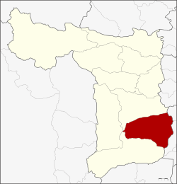 Amphoe location in Suphan Buri Province | |
| Coordinates: 14°24′8″N 100°9′16″E / 14.40222°N 100.15444°ECoordinates: 14°24′8″N 100°9′16″E / 14.40222°N 100.15444°E | |
| Country |
|
| Province | Suphan Buri |
| Area | |
| • Total | 481.3 km2 (185.8 sq mi) |
| Population (2013) | |
| • Total | 79,286 |
| • Density | 180.7/km2 (468/sq mi) |
| Time zone | UTC+7 (THA) |
| Postal code | 72150 |
| Geocode | 7204 |
Bang Pla Ma (Thai: บางปลาม้า, pronounced [bāːŋ plāː máː]) is a district (amphoe) in the southern part of Suphan Buri Province, central Thailand.
History
The district was established in 1897 by the governor Phra Samutkhananurak (พระสมุทรคณานุรักษ์).
The name Pla Ma is the Thai name of the fish species Boesemania microlepis, which is found a lot in the area of the district.
Geography
Neighboring districts are (from the east clockwise) Phak Hai and Bang Sai of Ayutthaya Province, Song Phi Nong, U Thong and Mueang Suphan Buri of Suphan Buri Province.
The main water resource of the district is the Tha Chin river or Suphan river.
Administration
Central administration
The district Bang Pla Ma is subdivided into 14 subdistrict (tambon), which are further subdivided into 127 administrative villages (muban).
| No. | Name | Thai | Villages | Pop.[1] |
|---|---|---|---|---|
| 1. | Khok Khram | โคกคราม | 12 | 7,303 |
| 2. | Bang Pla Ma | บางปลาม้า | 12 | 9,000 |
| 3. | Takha | ตะค่า | 9 | 5,727 |
| 4. | Bang Yai | บางใหญ่ | 8 | 4,549 |
| 5. | Kritsana | กฤษณา | 7 | 3,952 |
| 6. | Sali | สาลี | 8 | 7,152 |
| 7. | Phai Kong Din | ไผ่กองดิน | 8 | 6,754 |
| 8. | Ongkharak | องครักษ์ | 7 | 5,378 |
| 9. | Chorakhe Yai | จรเข้ใหญ่ | 9 | 4,815 |
| 10. | Ban Laem | บ้านแหลม | 5 | 4,473 |
| 11. | Makham Lom | มะขามล้ม | 14 | 5,004 |
| 12. | Wang Nam Yen | วังน้ำเย็น | 7 | 4,109 |
| 13. | Wat Bot | วัดโบสถ์ | 11 | 4,909 |
| 14. | Wat Dao | วัดดาว | 10 | 6,161 |
Local administration
There are 7 subdistrict municipalities (thesaban tambon) in the district:
- Ban Laem Phatthana (Thai: เทศบาลตำบลบ้านแหลมพัฒนา) consisting of parts of the subdistrict Ban Laem.
- Khok Khram (Thai: เทศบาลตำบลโคกคราม) consisting of parts of the subdistrict Khok Khram.
- Bang Pla Ma (Thai: เทศบาลตำบลบางปลาม้า) consisting of parts of the subdistrict Bang Pla Ma.
- Ban Laem (Thai: เทศบาลตำบลบ้านแหลม) consisting of parts of the subdistrict Ban Laem.
- Phai Kong Din (Thai: เทศบาลตำบลไผ่กองดิน) consisting of parts of the subdistrict Phai Kong Din.
- Ton Kram (Thai: เทศบาลตำบลต้นคราม) consisting of parts of the subdistrict Khok Khram.
- Takha (Thai: เทศบาลตำบลตะค่า) consisting of the complete subdistrict Takha.
There are 11 subdistrict administrative organizations (SAO) in the district:
- Bang Pla Ma (Thai: องค์การบริหารส่วนตำบลบางปลาม้า) consisting of parts of the subdistrict Bang Pla Ma.
- Bang Yai (Thai: องค์การบริหารส่วนตำบลบางใหญ่) consisting of the complete subdistrict Bang Yai.
- Kritsana (Thai: องค์การบริหารส่วนตำบลกฤษณา) consisting of the complete subdistrict Kritsana.
- Sali (Thai: องค์การบริหารส่วนตำบลสาลี) consisting of the complete subdistrict Sali.
- Phai Kong Din (Thai: องค์การบริหารส่วนตำบลไผ่กองดิน) consisting of parts of the subdistrict Phai Kong Din.
- Ongkharak (Thai: องค์การบริหารส่วนตำบลองครักษ์) consisting of the complete subdistrict Ongkharak.
- Chorakhe Yai (Thai: องค์การบริหารส่วนตำบลจรเข้ใหญ่) consisting of the complete subdistrict Chorakhe Yai.
- Makham Lom (Thai: องค์การบริหารส่วนตำบลมะขามล้ม) consisting of the complete subdistrict Makham Lom.
- Wang Nam Yen (Thai: องค์การบริหารส่วนตำบลวังน้ำเย็น) consisting of the complete subdistrict Wang Nam Yen.
- Wat Bot (Thai: องค์การบริหารส่วนตำบลวัดโบสถ์) consisting of the complete subdistrict Wat Bot.
- Wat Dao (Thai: องค์การบริหารส่วนตำบลวัดดาว) consisting of the complete subdistrict Wat Dao.
References
- ↑ "Population statistics 2013" (in Thai). Department of Provincial Administration. Retrieved 2014-10-04.