Baneshwor, Kathmandu
| Baneshwor बानेश्वर | |
|---|---|
| neighbourhood | |
 PsYLand | |
| Nickname(s): Residential Hub of Kathmandu, Heart of KTM City, PsYLand | |
| Country |
|
| District | Kathmandu District |
| Time zone | UTC+5:45 (Nepal Time) |
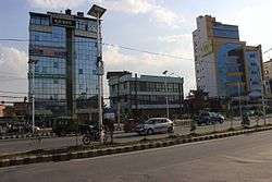
Baneshwor (Nepali: बानेश्वर) is the largest residential area of Kathmandu, Nepal. The area is composed of New-, Mid-, and Old-Baneshwor, Baneshwor Height, Minbhawan, Shankhamul, Bhimsengola and Thapa Gaun.. Major landmarks of Baneshwor include the current meeting place of the Federal Parliament of Nepal, the International Convention Centre. Maitighar Mandala is located at the southern border of the neighborhood.
Baneshwor a is a local financial and educational hub hosting several national banks and institutions. The following organisations have their headquarters in Baneshwor:
| Name | Sector | Notes |
|---|---|---|
| Association of Youth Organizations Nepal | Non-Governmental | |
| College of Applied Food and Dairy Technology | Education | [1] |
| Derivative and Commodity Exchange Nepal Ltd. | Finance | [2] |
| Global College of Management | Education | [3] |
| Hits FM | Broadcasting | [4] |
| Janata Bank Nepal Limited | Finance | [5] |
| Liverpool International College | Education | [6] |
| Manang Air | Aviation | [7] |
| N. K. Singh Memorial English Preparatory School | Education | [8] |
| Nepal Tribune Media | News | |
| Sadbhavana Party | Political Party | |
| Standard Chartered Nepal | Finance | [9] |
| Thames International College | Education | [10] |
Transportation
Busses of Sajha Yatayat serve Baneshwor.[11] Other private Bus companies also stop at several points in the neighborhood.
References
- ↑ "Contact Us". College of Applied Food and Dairy Technology. Retrieved 15 August 2018.
- ↑ "Contact". DCXNepal. Retrieved 15 August 2018.
- ↑ "Contact Us". Global College of Management. Retrieved 15 August 2018.
- ↑ "HITS FM". Hits FM. Retrieved 15 August 2018.
- ↑ "Contact Us". Sunrise Bank Ltd. Retrieved 30 October 2017.
- ↑ "Contacs Us". LIC. Retrieved 15 August 2018.
- ↑ "Contacs". Manang Air Pvt. Ltd. Retrieved 1 September 2018.
- ↑ "HITS FM". Hits FM. Retrieved 15 August 2018.
- ↑ "ATMs and Branches". Standard Chartered Nepal. Retrieved 15 August 2018.
- ↑ "Contact". Thames College. Retrieved 15 August 2018.
- ↑ "Route". Sajha Yatayat. Retrieved 20 April 2018.
External links
Coordinates: 27°42′52″N 85°19′12″E / 27.71453°N 85.31991°E