Baldwin, Ontario
| Baldwin | |
|---|---|
| Township (single-tier) | |
| Township of Baldwin | |
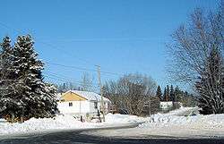 Residential side street in McKerrow | |
 Baldwin | |
| Coordinates: 46°19′N 81°45′W / 46.317°N 81.750°WCoordinates: 46°19′N 81°45′W / 46.317°N 81.750°W | |
| Country |
|
| Province |
|
| District | Sudbury |
| Incorporated | 1927 |
| Government | |
| • Reeve | Vern Gorham |
| • Federal riding | Algoma—Manitoulin—Kapuskasing |
| • Prov. riding | Algoma—Manitoulin |
| Area[1] | |
| • Land | 83.20 km2 (32.12 sq mi) |
| Population (2016)[1] | |
| • Total | 620 |
| • Density | 7.5/km2 (19/sq mi) |
| Time zone | UTC-5 (EST) |
| • Summer (DST) | UTC-4 (EDT) |
| Postal Code | P0P 1M0 |
| Area code(s) | 705 and 249 |
| Website | www.townshipofbaldwin.ca |
Baldwin (2016 population 620) is a township in the Canadian province of Ontario. Located in Sudbury District north of Espanola, the township's two main communities and population centres are McKerrow and Lorne.
The junction of Ontario Highway 17 and Ontario Highway 6 is in Baldwin, just west of McKerrow.
An old abandoned fire tower still stands north of McKerrow on Agnew Lake.
The township is part of the federal riding of Algoma—Manitoulin—Kapuskasing (MP Carol Hughes) and the provincial riding of Algoma—Manitoulin (MPP Michael Mantha).
Demographics
Population trend:[2]
- Population in 2011: 551 (2006 to 2011 population change: -0.5 %)
- Population in 2006: 554
- Population in 2001: 624
- Population in 1996: 694
- Population in 1991: 692
See also
References
- "Baldwin". Geographical Names Data Base. Natural Resources Canada. Retrieved 2010-06-30.
- "Toporama - Topographic Map Sheet 41I5". Atlas of Canada. Natural Resources Canada. Archived from the original on 2010-02-10. Retrieved 2010-06-30.
External links
Places adjacent to Baldwin, Ontario | |
|---|---|
| Towns | 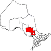 | |
|---|---|---|
| Townships | ||
| First Nations | ||
| Indian reserves | ||
| Unorganized area | ||
| Local services boards | ||
| ||
This article is issued from
Wikipedia.
The text is licensed under Creative Commons - Attribution - Sharealike.
Additional terms may apply for the media files.