Bahawalnagar
| Bahawalnagar بہاولنگر | ||
|---|---|---|
| City | ||
 | ||
| ||
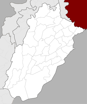 Bahawalnagar Location of Bahawalnagar  Bahawalnagar Bahawalnagar (Pakistan) | ||
| Coordinates: 29°59′34″N 73°15′13″E / 29.99278°N 73.25361°ECoordinates: 29°59′34″N 73°15′13″E / 29.99278°N 73.25361°E | ||
| Country |
| |
| Province |
| |
| District | Bahawalnagar | |
| Tehsil | Bahawalnagar | |
| Union councils | 118 | |
| Government[1] | ||
| • Type | Municipal Committee | |
| • Chairman | Rana Atif Rauf | |
| • Vice Chairman | Haji Abdul Majeed Qureshi | |
| • Chief Officer | Rashid Aziz Ghaznawi | |
| Elevation | 163 m (535 ft) | |
| Population (2017)[2] | ||
| • Total | 161,033 | |
| Time zone | UTC+5 (PST) | |
| • Summer (DST) | +6 | |
| Website | Municipal Committee Bahawalnagar | |
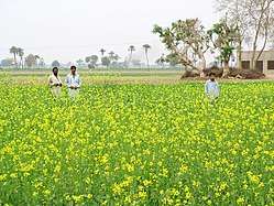
Bahawalnagar (Punjabi, Urdu: بہاولنگر), is the capital city of Bahawalnagar District situated in the south east region in the Punjab province of Pakistan. The town of Bahawalnagar is the headquarter of the district and tehsil as well.[3] Old name of Bahawalnagar was Rojanwali/Ubbha. It was named Bahawalnagar in 1904 after Bahawal Khan V, the ruler of the Bahawalpur state comprising the present districts of Bahawalpur, Bahawalnagar and Rahim Yar Khan.[4] It is 192 miles south of Lahore and about 120 miles east of Bahwalpur. River Sutlej passes on the northern side at a distance of about 6 miles.[5]
History
Bahawalnagar originally known as Rojhanwali[6] was a small settlement consisting of few huts and shacks. This village Rojhanwali is still in existence at a distance of about 1.5 miles north of the Railway Station. In the year 1895, a railway station was established and was named as Rojhanwali Railway Station. It was a junction between Bahawalnagar and Bhatinda at distance of 113 miles, now linking branch lines Amrooka and Fort Abbas. Before partition it was very busy junction. Trains used to run from Karachi to Delhi and vice versa via Bahawalnagar. Passenger trains also used to run from Bahawalnagar to Fazilka, Ferozpur. There was a loco shed and two institutes meant for recreation.[5]
In 1904 when Nawab Mohammad Bahawal Khan Abbasi IV,[7] who originally ruled over Bahawalpur State visited Rojhanwali the people asked that with His permission they want to rename the city on the name of Nawab, The Nawab allowed them with pleasure and since then the city is named as Bahawalnagar. With the advent of railways, 40–50 shops with a population of 100 dwelling units developed at existing railway bazar. Though this site was not fit for flourishing as the topographical features were not favorable and drinking water was unfit for health. With the introduction of canal system, it has become fertile area. The real achievement was Fordwah Canal which brought almost the entire district under the command of irrigation system. The town developed as colony town south of railway station.[5]
In the year 1900–1901, first police station post was established and in 1902–1903 the first primary school was established. In the year 1906 a panchayat committee consisting of nominated members was composed. 1914 Bahawalnagar was recommended as Tehsil and the police post Jweka was shifted to Bahawalnagar. A regular municipal committee was constituted in year 1922 along with many members. The Assistant Commissioner and Tehsildar were then appointed as Mir Majlis and Naib Mir Majlis.[5]
Railways station

The Bahawalnagar railway station played a key role in development of former Bahawalpur state, especially of Bahawalnagar district which was established in 1952–53, while the rail section set up in 1894 was named as Rojhanwali Railway Station. Later, the station was renamed by Nawab Muhammad Bahawal Khan as Bahawalnagar Railway Junction in 1901. But now, it wears a deserted look as no train is running now-a-days. The only train which had been running through these tracks for years from Samasata to Amrooka was suspended on July 26, 2011. Moreover, railway assets are being stolen and land being grabbed. Beside, most of the Railways quarters and officers accommodation have been occupied by influential persons. The rail service was originally introduced by the Southern Punjab Railway Company among Delhi on 257 kilometres track. The west part of the rail track was laid between Samasata and Amrooka section at the Pakistan-India border. It linked Baghdad-ul-Jadeed, Khairpur, Tamewali, Qaimpur, Hasilpur, Chishtian, Bahawalnagar and Mandi Sadiq Ganj railway stations to Ferozpur and Amrooka stations through various lines. Likewise, the second railway track was laid down between Bhatinda and Hindumalkote railway station of Indian state. Before partition of the subcontinent, the rail line was of great importance for connecting Dehli and Karachi. It was utilized for transportation of staff and their belongings in 1947 from India to Karachi. State railway lines were named as Darbar Lines and all their expenditures were borne by the respective states. It was running under the control of the Northern Western Railways. The 112 km Darbar line of the then Bahawalpur state was laid down between Bahawalnagar and Fort Abbas in 1928. On the track, new grain markets of Khichiwala, Faqirwali, Haroonabad and Donga Bonga were established. But unfortunately, the rail service on the track had been suspended since long, while a renowned Mandi Dhab Sanateka railway station has been submerged with filthy water. The Bahawalnagar Railways Junction was at its climax in 1935. Then, dozens of rails among Karachi, Delhi and Lahore by Ferozepur, Amrooka, Bahawalnagar to Samma Satta, particularly freight trains from Quetta to Delhi used to run regularly. Hustle and bustle of passengers on the station round-the-clock was a permanent feature and it was considered one of the important railways junctions of the subcontinent at that time. In 1938, a power substation was set up which generated DC power with the help of diesel engine, while today, the railway section has been deprived of electricity supply due to non-payment. After the partition, the well-equipped junction continued its reputation as business centre till 1980. It was more important than the town. It was given final shape in 1935 and 1938, when five hundred quarters for staff were constructed including the railway officers accommodations, railway hospital, DC electricity power station, dak bungalow, playgrounds, graveyard, dance club, workshop, Railway police. With the completion of the all railway requirements, it turned into a beautiful location. At its climax, hundreds of workers discharge their duties. A beautiful overhead bridge of the junction was unique for its visitors. Unfortunately, such a glorious railway junction had fallen prey to corruption.[8]
Education
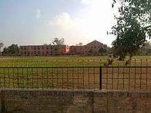
The literacy rate of Bahawalnagar is less than 25% and unemployment rate is much higher than 25%.[9] As the literacy rate of this city is not quite enough but the government owned institutions are offering their services to increase the literacy rate. The sub-Campus of Islamia University[10] is also located in Bahawalnagar from which the students are getting the higher education with up to date syllabus.Bahawalnagar is not very popular but the quality of education in the city is up to the mark. There is an Army public school which is on the main bahawalnagar to Minchinabad road in bahawalnagar cantt.
Sports ground
Haider Stadium is the biggest stadium of Bahawalnagar City as well as Bahawalnagar District.[11]
Demographics
The population of the Bahawalnagar MC, according to the 1998 Census of Pakistan, was 111,300.[12]
Administration
Bahawalnagar is the administrative center of Bahawalnagar District, one of the five tehsils or subdivisions of the district, the tehsil is subdivided into 31 Union Councils.
Climate
Bahawalnagar has a hot desert climate (Köppen climate classification BWh) with hot summers and mild winters. Precipitation mostly falls in the monsoon season from June to August, although some rain also falls from February to April. Over the years, global climate change has affected Bahawalnagar as well as any other place on Earth and below comparison charts from Weatherbase and NOAA show the difference in rainfall and low temperatures between 1990 and 2015:
| Climate data for Bahawalnagar, Pakistan | |||||||||||||
|---|---|---|---|---|---|---|---|---|---|---|---|---|---|
| Month | Jan | Feb | Mar | Apr | May | Jun | Jul | Aug | Sep | Oct | Nov | Dec | Year |
| Average high °C (°F) | 20 (68) |
23 (73) |
29 (84) |
36 (96) |
40 (104) |
41 (105) |
38 (100) |
37 (98) |
36 (96) |
34 (93) |
28 (82) |
22 (71) |
32 (89) |
| Average low °C (°F) | 4 (39) |
7 (44) |
13 (55) |
19 (66) |
23 (73) |
28 (82) |
27 (80) |
27 (80) |
24 (75) |
17 (62) |
11 (51) |
6 (42) |
17 (62) |
| Average precipitation mm (inches) | 18 (0.7) |
8 (0.3) |
21 (0.8) |
3 (0.1) |
8 (0.3) |
19 (0.8) |
92 (3.6) |
75 (2.9) |
35 (1.4) |
--- (---) |
5 (0.2) |
1 (---) |
28.5 (11.1) |
| Source: Weatherbase 2015[13] | |||||||||||||
| Climate data for Bahawalnagar | |||||||||||||
|---|---|---|---|---|---|---|---|---|---|---|---|---|---|
| Month | Jan | Feb | Mar | Apr | May | Jun | Jul | Aug | Sep | Oct | Nov | Dec | Year |
| Record high °C (°F) | 29.3 (84.7) |
35.6 (96.1) |
39.4 (102.9) |
45.6 (114.1) |
48.0 (118.4) |
50.1 (122.2) |
46.0 (114.8) |
42.4 (108.3) |
42.0 (107.6) |
40.0 (104) |
37.0 (98.6) |
29.6 (85.3) |
50.1 (122.2) |
| Average high °C (°F) | 20.6 (69.1) |
22.76 (72.97) |
28.3 (82.9) |
35.9 (96.6) |
40.8 (105.4) |
42.0 (107.6) |
38.3 (100.9) |
37.4 (99.3) |
36.5 (97.7) |
34.2 (93.6) |
28.6 (83.5) |
22.5 (72.5) |
32.32 (90.17) |
| Daily mean °C (°F) | 13.3 (55.9) |
15.7 (60.3) |
21.0 (69.8) |
28.0 (82.4) |
32.8 (91) |
35.1 (95.2) |
33.1 (91.6) |
32.4 (90.3) |
30.6 (87.1) |
26.4 (79.5) |
20.6 (69.1) |
15.0 (59) |
25.3 (77.6) |
| Average low °C (°F) | 5.8 (42.4) |
8.4 (47.1) |
13.8 (56.8) |
20.0 (68) |
24.7 (76.5) |
28.2 (82.8) |
27.8 (82) |
27.4 (81.3) |
24.7 (76.5) |
18.6 (65.5) |
12.6 (54.7) |
7.6 (45.7) |
18.3 (64.9) |
| Record low °C (°F) | 0.0 (32) |
−1.0 (30.2) |
3.9 (39) |
12.6 (54.7) |
14.4 (57.9) |
18.3 (64.9) |
16.1 (61) |
21.4 (70.5) |
13.1 (55.6) |
11.0 (51.8) |
4.0 (39.2) |
1.7 (35.1) |
−1 (30.2) |
| Average precipitation mm (inches) | 4.5 (0.177) |
16.5 (0.65) |
15.2 (0.598) |
10.2 (0.402) |
4.8 (0.189) |
15.3 (0.602) |
77.2 (3.039) |
39.9 (1.571) |
9.5 (0.374) |
1.0 (0.039) |
4.3 (0.169) |
5.0 (0.197) |
203.4 (8.007) |
| Mean monthly sunshine hours | 222.4 | 218.9 | 250.8 | 274.3 | 269.1 | 213.9 | 218.3 | 256.6 | 279.3 | 284.0 | 260.8 | 223.5 | 2,971.9 |
| Source: NOAA (1971–1990)[14] | |||||||||||||
See also
References
- ↑ "Municipal Committee Bahawalnagar: Administrative Setup". Local Government Punjab. Retrieved 2018-04-24.
- ↑ "POPULATION AND HOUSEHOLD DETAIL FROM BLOCK TO DISTRICT LEVEL: PUNJAB (BAHAWALNAGAR DISTRICT)" (PDF). Pakistan Bureau of Statistics. 2018-01-03. Retrieved 2018-04-24.
- ↑ Tehsils & Unions in the District of Bahawalnagar – Government of Pakistan Archived 2012-02-09 at the Wayback Machine.
- ↑ "Archived copy". Archived from the original on 2017-04-21. Retrieved 2017-04-20.
- 1 2 3 4 Bahawalnagar – Outline Development Plan, Govt of Punjab, 1978. Accessed 2017-02-24.
- ↑ Nadīm, Fārūq (2005). Chaos: Research Articles on History and Socio Economic Situation of Pakistani Punjab. World Institute of Literature & Culture. Archived from the original on 22 April 2017. Retrieved 21 April 2017.
- ↑ Bahawalpur (princely state)
- ↑ "Bahawalnagar rail junction a relic from 1901". The Nation. 14 November 2011. Archived from the original on 1 October 2016. Retrieved 23 March 2016.
- ↑ "Archived copy". Archived from the original on 2016-02-08. Retrieved 2015-06-07.
- ↑ "The Islamia University of Bahawalpur Pakistan – Department". iub.edu.pk. Archived from the original on 28 July 2016. Retrieved 23 March 2016.
- ↑ "Pakistan Cricket – 'our cricket' website". pcboard.com.pk. Archived from the original on 5 April 2016. Retrieved 23 March 2016.
- ↑ "Archived copy". Archived from the original on 2016-12-04. Retrieved 2017-01-14.
- ↑ "Weatherbase: Historical Weather for Bahawalnagar, Pakistan". Weatherbase. 2015. Archived from the original on 2015-09-22.
- ↑ "Bahawalnagar Climate Normals 1971–1990". National Oceanic and Atmospheric Administration. Retrieved January 16, 2013.
Bibliography
- Economic & Industrial Publications (1990), Economic Review, Volume 21, The University of Michigan
- Pattan Development Organization (2006), Working paper understanding the role of political dynasties: Local Government Election 2005, The University of Michigan
External links
| Wikivoyage has a travel guide for Punjab (Pakistan). |