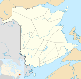
Back Bay, New Brunswick
| Back Bay | |
|---|---|
| Unincorporated community | |
 Back Bay Location within New Brunswick. | |
| Coordinates: 45°03′22″N 66°52′11″W / 45.05611°N 66.86972°WCoordinates: 45°03′22″N 66°52′11″W / 45.05611°N 66.86972°W | |
| Country |
|
| Province |
|
| County | Charlotte |
| Parish | Saint George |
| Electoral Districts Federal |
New Brunswick Southwest |
| Provincial | Charlotte-The Isles |
| Government | |
| • Type | Local service district |
| Time zone | UTC-4 (AST) |
| • Summer (DST) | UTC-3 (ADT) |
| Postal code(s) | E5C |
| Area code(s) | 506 |
| Highways |
|
Back Bay is an unincorporated settlement in New Brunswick, Canada on the shore of a bay of the same name in the Bay of Fundy.
Integrated multi-trophic aquaculture at the site includes Atlantic cod,[1] saccharina latissima (sugar kelp), alaria esculenta (winged kelp), blue mussels, and Atlantic salmon, produced in a collaborative project by the University of New Brunswick and Fisheries and Oceans Canada, and Cooke Aquaculture.[2]
In 1866 Back Bay was a fishing and farming community, with a population of about 30 resident families. The population had grown by 1871 to approximately 200 people. And in 1898 Back Bay was a port of entry with one post office, two stores, two churches and a population of 300.[3]
It is the site of the Back Bay Elementary School.[4]
References
- ↑ "Existing aquaculture sites in Bay Management". Canadian Environmental Assessment Agency. Retrieved 7 December 2016.
- ↑ "Organic kelp almost ready for market". Aquaculture North America. 2014-09-04. Retrieved 2016-12-07.
- ↑ "Back Bay". Provincial Archives of New Brunswick. Retrieved 7 December 2016.
- ↑ "Back Bay Elementary School". Retrieved 7 December 2016.