BR-369
| BR-369 | |
|---|---|
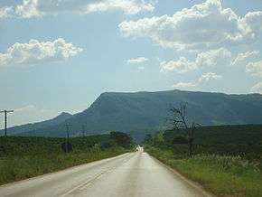 BR-369 near Boa Esperança, Minas Gerais | |
| Route information | |
| Length | 1,232 km[1] (766 mi) |
| Major junctions | |
| northeast end | Oliveira, Minas Gerais |
| southwest end | Cascavel, Paraná |
| Highway system | |
|
Highways in Brazil | |
BR-369 is a Brazilian federal highway that begins in Oliveira, Minas Gerais and ends in Cascavel in the state of Paraná.[2][3] The highway also serves the municipalities of Campo Belo, Boa Esperança, and Campos Gerais in Minas Gerais; Pirassununga, Jaú, Bauru, and Ourinhos in the state of São Paulo; and Londrina and Campo Mourão in Paraná.[1]
References
- 1 2 "Rodovias Diagonais" (PDF). dnit.gov.br (in Portuguese). Departamento Nacional de Infraestrutura de Transportes (DNIT) — Sistema Nacional de Viação. Retrieved 29 February 2016.
- ↑ "Infra-estrutura de transportes" (map). ibge.gov.br (in Portuguese). Brazilian Institute of Geography and Statistics (IBGE). 2005. Retrieved 28 February 2016.
- ↑ "SNV 2015 Completo". dnit.gov.br (in Portuguese). Departamento Nacional de Infraestrutura de Transportes (DNIT) — Sistema Nacional de Viação. 2015-12-15. Archived from the original on 4 March 2016. Retrieved 28 February 2016.
| Rodovias radiais | |
|---|---|
| Rodovias longitudinais | |
| Rodovias transversais |
|
| Rodovias diagonais | |
| Rodovias de ligação |
|
This article is issued from
Wikipedia.
The text is licensed under Creative Commons - Attribution - Sharealike.
Additional terms may apply for the media files.