Ayala Center
|
Logo since 2010, after a major rebranding scheme | |
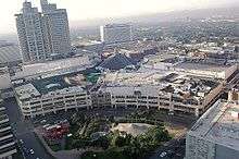 Aerial view of Glorietta in Ayala Center | |
| Location | San Lorenzo Village, Makati CBD, Metro Manila, Philippines |
|---|---|
| Opening Date | 1991 |
| Developer | Ayala Land |
| Owner | Ayala Land |
| Website | Ayala Malls |
The Ayala Center is a major commercial development operated by Ayala Land located in the Makati Central Business District in Metro Manila, Philippines.[1]
About the Center
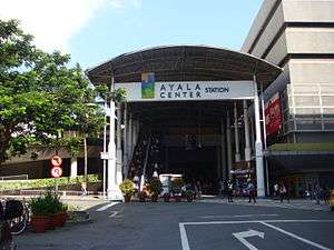
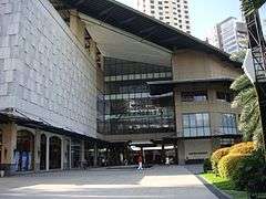
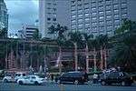
The Ayala Center is a recreational, shopping, dining, and entertainment development located in the heart of Makati. It is bounded by Ayala Avenue on the east, Epifanio de los Santos Avenue (EDSA) on the south, Arnaiz Avenue on the west, and to north by Legazpi Street and Paseo de Roxas. The Ayala MRT Station of the MRT Line 3 serves the area.[2] The development originally started In 1988 and 1991 with a number of separate shopping arcades and Greenbelt Park before expanding to cover over 50 hectares of facilities.[1] Today the complex now includes several malls, each with its own shopping and restaurant arcades and cinemas; three department stores, a number of hotels; and the Ayala Museum, showcasing exhibits on Philippine history and art.
Shopping malls
Department stores
- Rustan's
- SM Makati
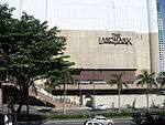
- The Landmark
- Adora
- Marks & Spencer
- Debenhams
- The Ramp Crossings

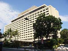
Hotels
- InterContinental Manila (closed in 2016)
- Dusit Thani
- Holiday Inn & Suites Makati
- Makati Fairmont Hotel and Raffles Suites and Residences
- New World Renaissance Hotel
- Makati Shangri-La
- Ascott Hotel (formerly the Oakwood Premier)
- Seda Hotel (2020)
Incidents
2000 bombing
On May 17, 2000 at 5:02 p.m., Glorietta was bombed injuring 12 persons, mostly teenagers. According to local authorities, the homemade bomb was placed in front of a toilet beside a video arcade.
The 2000 Glorietta bombing was said to be the precursor of the May 21, 2000 SM Megamall bombing and the December 30, 2000 Rizal Day bombings.
2007 explosion
The 2007 Glorietta explosion ripped through the Glorietta 2 section of the Glorietta shopping complex at Ayala Center in Makati on 19 October 2007.
The death toll in the explosion was 11, while 120 were injured. Although there were conflicting reports as to the cause, it was concluded that the explosion was caused by a faulty liquefied petroleum gas tank located in a Chinese restaurant.
See also
References
- 1 2 "Archived copy". Archived from the original on 2013-06-24. Retrieved 2014-04-01.
- ↑ Route Map, Metro Rail Transit Corporation Passenger Information, retrieved July 7, 2006 Archived June 26, 2006, at the Wayback Machine.
External links
| Wikinews has related news: Blasts kills 8, injures 126 at a mall in Manila, The Philippines |
- Ayala Malls, Official Website
- Inquirer.net, List of dead and injured in Glorietta blast
- Inquirer.net, View interactive map and photos of Glorietta blast
- GMA NEWS.TV, Partial list of casualties in Glorietta blast
| Towers |  | ||||
|---|---|---|---|---|---|
| Ayala Center | |||||
| Other landmarks | |||||
| Education | |||||
| Transportation |
| ||||
Italics denote buildings under construction or planned. | |||||
| Topics |  | |
|---|---|---|
| Areas |
| |
| Divisions |
| |
Italics indicate disputed areas (part of Fort Bonifacio). | ||
| Historical sites |  | |
|---|---|---|
| Religious buildings | ||
| Monuments and memorials | ||
| Integrated resorts | ||
| Amusement parks |
| |
| Parks and recreation | ||
| Museums and galleries | ||
| Events and traditions | ||
| Events venues | ||
| Shopping | ||