Arzobispo River
| Juan Amarillo River | |
|---|---|
 | |
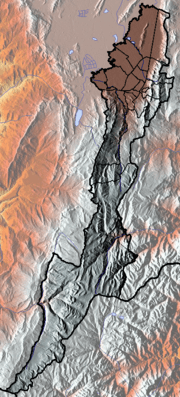
 Location of the Juan Amarillo River in Colombia | |
| Native name | Río Juan Amarillo |
| Other name(s) |
Salitre River Arzobispo River |
| Country |
|
| Department | Cundinamarca |
| Municipalities | Bogotá |
| Localities | Usaquén, Chapinero, Santa Fe, Suba, Barrios Unidos, Teusaquillo, Engativá |
| Physical characteristics | |
| Main source |
Eastern Hills 3,300 m (10,800 ft) 4°38′09.1″N 74°02′00.2″W / 4.635861°N 74.033389°WCoordinates: 4°38′09.1″N 74°02′00.2″W / 4.635861°N 74.033389°W |
| River mouth |
Bogotá River Tibabuyes 2,539 m (8,330 ft) 4°44′15.2″N 74°07′38.7″W / 4.737556°N 74.127417°W |
| Basin features | |
| River system |
Bogotá River Magdalena Basin Caribbean Sea |
| Basin size | 12,892 ha (31,860 acres) |
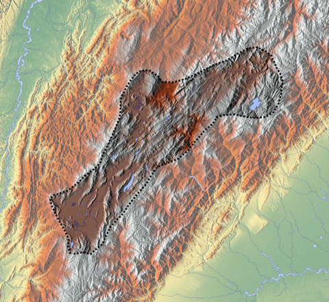
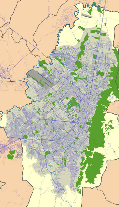
The Juan Amarillo, Arzobispo, or Salitre River is a river on the Bogotá savanna and a left tributary of the Bogotá River in Colombia. The river originates from various quebradas in the Eastern Hills and flows into the Bogotá River at the largest of the wetlands of Bogotá, Tibabuyes, also called Juan Amarillo Wetland. The total surface area of the Juan Amarillo basin, covering the localities Usaquén, Chapinero, Santa Fe, Suba, Barrios Unidos, Teusaquillo, and Engativá, is 12,892 hectares (31,860 acres). Together with the Fucha and Tunjuelo Rivers, the Juan Amarillo River forms part of the left tributaries of the Bogotá River in the Colombian capital.
Description
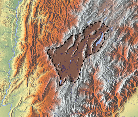
The Juan Amarillo, Arzobispo, or Salitre River,[1] is formed by various quebradas ("creeks") sourced at an altitude of 3,300 metres (10,800 ft) in the Eastern Hills of Bogotá. Main feeder creeks are Las Delicias, La Vieja, El Chicó, Los Molinos, Santa Bárbara, Delicias del Carmen, El Cóndor, El Cedro, San Cristóbal, La Cita and La Floresta.[2][3][4] The Juan Amarillo Basin covers the localities Usaquén, Chapinero and Santa Fe in its upper course and Suba, Barrios Unidos, Teusaquillo and Engativá in its lower drainage area. The Suba Hills (cerros de Suba) are located in the Juan Amarillo River basin. The total surface area of the Juan Amarillo basin is 12,892 hectares (31,860 acres).[5]
The river transports 3,400 milligrams per litre (0.0020 oz/cu in) of solid sediments, of which 1,320 milligrams per litre (0.00076 oz/cu in) reach the mouth of the river near the Tibabuyes wetland.[6]
Wetlands
Six of the fifteen protected wetlands of Bogotá are located in the Juan Amarillo River basin.
| Wetland | Location | Altitude (m) |
Area (ha) |
Notes | Image |
|---|---|---|---|---|---|
| La Conejera | Suba | 2544 | 58.9 | [7] | |
| Tibabuyes Juan Amarillo |
Suba Engativá |
2539 | 222.58 | [8] | 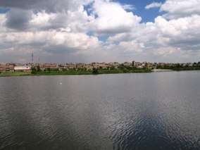 |
| Jaboque | Engativá | 2539 | 148 | [9] | 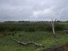 |
| Córdoba | Suba | 2548 | 40.51 | [10] | 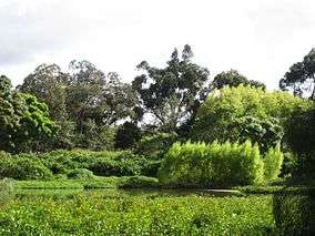 |
| Santa María del Lago |
Engativá | 2549 | 12 | [11] | 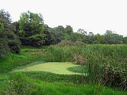 |
| El Salitre | Barrios Unidos |
2558 | 6.4 | [12] | |
Gallery
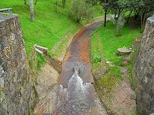
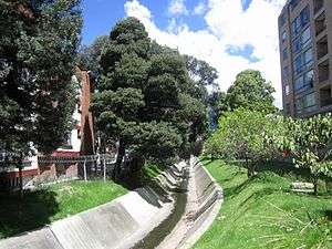
- Channelised part near the Carrera Séptima
 Channel near Carrera 30
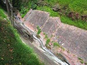 Quebrada El Virrey
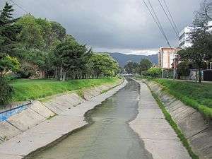 Channelised Río Molinos, near Carrera 25
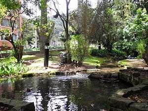 Quebrada El Chicó
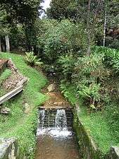 Quebrada La Vieja
See also
References
- ↑ (in Spanish) Entre ríos y quebradas Bogotá tiene 198 cuerpos de agua ¿Los conoce?
- ↑ Isaza Londoño et al., 1999, p.28
- ↑ Isaza Londoño et al., 1999, p.29
- ↑ Cerros, s.a., p.27
- ↑ Acueducto, 2010, p.23
- ↑ (in Spanish) Humedal Juan Amarillo
- ↑ Humedal La Conejera
- ↑ Humedal Tibabuyes
- ↑ Humedal Jaboque
- ↑ Humedal Córdoba
- ↑ Humedal Santa María del Lago
- ↑ Humedal El Salitre
Bibliography
- Isaza Londoño, Juan Luis; Diana Wiesner Ceballos; Camilo Salazar Ferro; Juan Pablo Ortiz Suárez, and Catalina Useche Mariño. 1999. Los cerros: paisaje e identidad cultural – Identificación y valoración del patrimonio ambiental y cultural de los cerros orientales en Santa Fe de Bogotá, 1–124. CIFA, Universidad de los Andes. Accessed 2017-03-06.
- Various, authors. 2010. Plan de manejo ambiental - humedal Juan Amarillo, 1-383. Acueducto. Accessed 2017-03-06.
- N., N. s.a. Los cerros, una reserva natural, 22–27. Accessed 2017-03-06.
External links
- (in Spanish) Sistema Hídrico, Bogotá
 | Administrative subdivision in 20 localities | 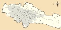 | |
|---|---|---|---|
| Metropolitan Area | |||
| Geography | |||
| |||
| |||