Arran–Elderslie
| Arran–Elderslie | |
|---|---|
| Municipality (lower-tier) | |
| Municipality of Arran–Elderslie | |
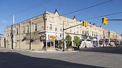 1st Avenue, Chesley | |
 Arran–Elderslie Location in southern Ontario | |
| Coordinates: 44°24′N 81°12′W / 44.400°N 81.200°WCoordinates: 44°24′N 81°12′W / 44.400°N 81.200°W | |
| Country |
|
| Province |
|
| County | Bruce |
| Government | |
| • Mayor | Paul Eagleson |
| • Federal riding | Bruce—Grey—Owen Sound |
| • Prov. riding | Bruce—Grey—Owen Sound |
| Area[1] | |
| • Land | 460.13 km2 (177.66 sq mi) |
| Elevation | 254 m (833 ft) |
| Population (2011)[2] | |
| • Total | 6,810 |
| • Density | 14.8/km2 (38/sq mi) |
| Time zone | UTC-5 (EST) |
| • Summer (DST) | UTC-4 (EDT) |
| Postal Code | N0G |
| Area code(s) | 519 and 226 |
| Website |
www |
The Municipality of Arran–Elderslie is a township in Bruce County in Western Ontario, Canada. The township is located at the headwaters of the Sauble River, and the Saugeen River forms the northwestern boundary.
Communities
.jpg)
Allenford
The township comprises the communities of Allenford, Arkwright, Arranvale, Burgoyne, Chesley, Dobbinton, Dreamland, Dunblane, Ellengowan, Elsinore, Gillies Hill, Invermay, Kelly's Corners, Lockerby, Mount Hope, Paisley, Salem, Salisbury, Tara, Vesta and Williscroft.
Demographics
| Canada census – Arran–Elderslie community profile | |||
|---|---|---|---|
| 2011 | 2006 | ||
| Population: | 6810 (0.9% from 2006) | 6,747 (2.6% from 2001) | |
| Land area: | 460.13 km2 (177.66 sq mi) | 460.13 km2 (177.66 sq mi) | |
| Population density: | 14.8/km2 (38/sq mi) | 14.7/km2 (38/sq mi) | |
| Median age: | 40.7 (M: 39.7, F: 41.5) | 41.2 (M: 40.6, F: 41.7) | |
| Total private dwellings: | 2941 | 2,791 | |
| Median household income: | $43,803 | ||
| References: 2011[1] 2006[3] earlier[4] | |||
Population trend:[5]
- Population in 2006: 6747
- Population in 2001: 6577
- Population total in 1996: 6851
- Arran (township): 1707
- Chesley (town): 1904
- Elderslie (township): 1231
- Paisley (village): 1106
- Tara (village): 903
- Population in 1991:
- Arran (township): 1690
- Chesley (town): 1852
- Elderslie (township): 1219
- Paisley (village): 1102
- Tara (village): 848
See also
References
- 1 2 "2011 Community Profiles". Canada 2011 Census. Statistics Canada. July 5, 2013. Retrieved 2012-08-09.
- ↑ "Arran-Elderslie census profile". 2011 Census of Population. Statistics Canada. Retrieved 2012-08-09.
- ↑ "2006 Community Profiles". Canada 2006 Census. Statistics Canada. March 30, 2011. Retrieved 2009-02-24.
- ↑ "2001 Community Profiles". Canada 2001 Census. Statistics Canada. February 17, 2012.
- ↑ Statistics Canada: 1996, 2001, 2006 census
- "Arran-Elderslie". Geographical Names Data Base. Natural Resources Canada. Retrieved 2010-06-24.
- "Toporama - Topographic Map Sheet3 41A6, 41A11". Atlas of Canada. Natural Resources Canada. Archived from the original on 2010-08-31. Retrieved 2010-06-24.
External links
| Wikimedia Commons has media related to Arran–Elderslie. |
Places adjacent to Arran–Elderslie | ||||||||||
|---|---|---|---|---|---|---|---|---|---|---|
| ||||||||||
This article is issued from
Wikipedia.
The text is licensed under Creative Commons - Attribution - Sharealike.
Additional terms may apply for the media files.