Arlesey railway station
| Arlesey | |
|---|---|
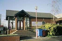 The small station building | |
| Location | |
| Place | Arlesey |
| Local authority | District of Central Bedfordshire |
| Grid reference | TL190378 |
| Operations | |
| Station code | ARL |
| Managed by | Great Northern |
| Number of platforms | 2 |
| DfT category | E |
|
Live arrivals/departures, station information and onward connections from National Rail Enquiries | |
| Annual rail passenger usage* | |
| 2012/13 |
|
| 2013/14 |
|
| 2014/15 |
|
| 2015/16 |
|
| 2016/17 |
|
| History | |
| 7 August 1850 | Station opens as Arlsey and Shefford Road |
| March 1860 | Station renamed Arlesey and Shefford Road |
| July 1893 | Station renamed Arlesey |
| July 1895 | Station renamed Arlesey and Shefford Road |
| 1 March 1933 | Station renamed Arlesey and Henlow |
| 5 January 1959 | Station closes |
| 3 October 1988 | Rebuilt station opens |
| National Rail – UK railway stations | |
| * Annual estimated passenger usage based on sales of tickets in stated financial year(s) which end or originate at Arlesey from Office of Rail and Road statistics. Methodology may vary year on year. | |
|
| |
Arlesey railway station serves the town of Arlesey in Bedfordshire, England. It is 37 miles 3 chains (59.61 km) from London King's Cross on the East Coast Main Line.[1] Arlesey is managed and served by Great Northern.
Arlesey is the nearest station to the towns of Stotfold and Shefford and to the villages of Langford, Clifton and Henlow.
History
Original station
The first section of the Great Northern Railway (GNR) (from Louth to a junction with the Manchester, Sheffield and Lincolnshire Railway at Grimsby) opened on 1 March 1848; but the southern section of the main line (from Maiden Lane to Peterborough) was not opened until 7 August 1850. One of the 1850 stations was Arlsey and Shefford Road.[2][3][4] It was renamed Arlesey and Shefford Road in March 1860, but the shorter name of Arlesey was used between July 1893 and July 1895.[4]
The GNR became part of the London and North Eastern Railway (LNER) during the grouping of 1923. On 1 March 1933 the LNER renamed the station Arlesey and Henlow.[4] The station passed to the Eastern Region of British Railways on nationalisation in 1948.
The station and the adjacent Three Counties railway station were closed to passengers on 5 January 1959[4] and to goods on 28 November 1960, and demolished soon after due to declining receipts.[4][5]
Present station
The line, however, remained open; and the present station built by Network SouthEast opened on 3 October 1988 on the site of the original station in the Church End area of Arlesey. The rebuilt station was designed to be fully accessible to wheelchairs but was initially unusable by those who couldn't leave their chair as there were no facilities for 'loading and unloading'. First Capital Connect provided the station with ramps in 2006, and users now simply have to ring 24 hours in advance for assistance.
In 2006 Her Majesty The Queen visited the station.
The station's platforms are currently being lengthened to accommodate 12 car trains scheduled to serve the station upon completion of the Thameslink Programme.[6]
_station_geograph-3247257-by-Ben-Brooksbank.jpg)
Facilities
The station is fully accessible to wheelchair users but is not accessible platform to platform. There is no access to ticket machines or help point on the down (Peterborough) platform. FCC installed modern LED lights on both platforms in 2009.[7]
The station now has two small shelters on both platforms. The station is currently (as of 2010) served by a small portable cafe in the mornings.
There is a ticket office on the southbound platform with a Permit to Travel Machine and a modern Touch Screen ticket machine located in front of the booking office. Cycle storage is provided on both sides of the station; although only the southbound side has secure storage. First Capital Connect installed a help point on Platform 1. Arlesey station does not currently have automatic ticket gates. Train running information is provided via digital CIS displays, automated announcements and a customer help point on platform 1.[8]
Services
Arlesey station is served by a half-hourly service southbound to London King's Cross and northbound to Peterborough. There is an hourly service in each direction on Sundays.[9]
Timetables for Arlesey can be seen and downloaded here.
Ticket Office Opening Times & Station Staffing Hours
Below are the current opening and staffing times for Arlesey, as of 2017.[8]
| Ticket Office Hours | ||
|---|---|---|
| Day | Opens | Closes |
| Monday to Friday | 06:45 | 12:10 |
| Saturday | 07:45 | 13:10 |
| Sunday | - | - |
| Station Staffing Hours | ||
|---|---|---|
| Day | From | Until |
| Monday to Friday | 06:30 | 12:30 |
| Saturday | 07:30 | 13:30 |
| Sunday | - | - |
Route
| Preceding station | Following station | |||
|---|---|---|---|---|
| Great Northern | ||||
| Thameslink Peterborough to Horsham | ||||
| Historical railways | ||||
Line open; Station closed | Great Northern Railway | Line and station open |
||
Notes
- ↑ Padgett, David (October 2016) [1988]. Brailsford, Martyn, ed. Railway Track Diagrams 2: Eastern (4th ed.). Frome: Trackmaps. map 15B. ISBN 978-0-9549866-8-1.
- ↑ Gordon 1989, volume II, p. 44
- ↑ Awdry 1990, p. 135
- 1 2 3 4 5 Butt 1995, p. 18
- ↑ source: Bedfordshire Libraries
- ↑ "Archived copy". Archived from the original on 2014-02-27. Retrieved 2012-03-30.
- ↑ "Archived copy". Archived from the original on 2009-08-18. Retrieved 2010-05-08.
- 1 2 Arlesey station facilities National Rail Enquiries
- ↑ Table 25 National Rail timetable, May 2017
References
- Awdry, Christopher (1990). Encyclopaedia of British Railway Companies. London: Guild Publishing. CN 8983.
- Butt, R. V. J. (1995). The Directory of Railway Stations: details every public and private passenger station, halt, platform and stopping place, past and present (1st ed.). Sparkford: Patrick Stephens Ltd. ISBN 978-1-85260-508-7. OCLC 60251199.
- Gordon, W.J. (1989) [1910]. Our Home Railways. London: Bracken Books. ISBN 1-85170-314-4.
- Jowett, Alan (2000). Jowett's Nationalised Railway Atlas (1st ed.). Penryn, Cornwall: Atlantic Transport Publishers. ISBN 978-0-906899-99-1. OCLC 228266687.
External links
| Wikimedia Commons has media related to Arlesey railway station. |
- Train times and station information for Arlesey railway station from National Rail