Arawale National Reserve
| Arawale National Reserve | |
|---|---|
|
IUCN category VI (protected area with sustainable use of natural resources) | |
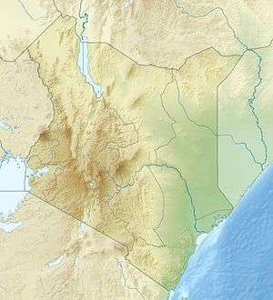 Location of Arawale National Reserve | |
| Location | North Eastern Province, Kenya |
| Nearest city | Garissa |
| Coordinates | 01°26′16″S 40°09′35″E / 1.43778°S 40.15972°ECoordinates: 01°26′16″S 40°09′35″E / 1.43778°S 40.15972°E |
| Area | 533 km2 |
| Established | 1974 |
| Governing body | Kenya Wildlife Service |
The Arawale National Reserve is a designated conservation area managed by the Garissa County in assistance with the Kenya Wildlife Service. It lies in North Eastern Province of Kenya, 77 km south of the town of Garissa. The reserve covers an area of 53,324 hectares (533 km2; 206 sq mi).[1] To the west, it is bordered by the Tana River and, to the east, by the Garissa-Lamu road. In 1974, the reserve was gazetted as the only in-situ conservation site for the critically endangered Hirola population endemic to north-eastern Kenya and south-west Somalia.
Wildlife
The reserve is a critical refuge for a range of wildlife species including four globally threatened species: hirola, Grevy's zebra, East African wild dog and East African cheetah. A study commissioned by Terra Nuova in 2006 also showed signs of presence of the African bush elephant.[2]
Since 2005, the protected area is considered a Lion Conservation Unit together with Lag Badana National Park.[3]
References
- ↑ World Database on Protected Areas – Arawale
- ↑ Njoroge, P. et al. (2007) Densities, biomass and habitat preference of large mammals in Arawale National Reserve, Kenya. National Environmental Management Authority of Kenya.
- ↑ IUCN Cat Specialist Group (2006). Conservation Strategy for the Lion Panthera leo in Eastern and Southern Africa. Pretoria, South Africa: IUCN.
- Andaje, S. A. (2002) Factors limiting the Abundance and Distribution of Hirola in Tsavo and Tana River Districts. Kenya Wildlife Service: Biodiversity Conservation Unit.
- Antipa, R. S, Ali, M. H. and Hussein, A. A. (2007) Assessment of the Potential of Eco/Cultural Tourism as Viable Enterprises in Southern Garissa, Ijara and Lamu Districts: A Community Conservation and Enterprise Support Initiative. National Environmental Management Authority of Kenya.
- Muchai, M. et al. (2007) The Distribution, Abundance and Habitat Use of the Hunter's Hartebeest (Hirola); Beatragus hunteri; Sclater, 1889 in Ishaqibini Community Wildlife Conservancy and Arawale National Reserve, Kenya. National Museums of Kenya.
External links
- National Environmental Management Authority of Kenya
- Kenya Wildlife Service
- National Museums of Kenya
- EDGE of Existence – Top 100 Mammals
- IUCN Red List
- African Conservation Foundation
- Terra Nuova webpage (Italian)