Apacheta-Aguilucho volcanic complex
| Apacheta-Aguilucho volcanic complex | |
|---|---|
 | |
| Highest point | |
| Elevation | 5,557 m (18,232 ft) [1] |
| Coordinates | Coordinates: 21°50′S 68°10′W / 21.833°S 68.167°W [1] |
| Geography | |
 Apacheta-Aguilucho volcanic complex | |
Apacheta-Aguilucho volcanic complex is a volcanic complex in Chile. It consists of two volcanoes Cerro Apacheta and Cerro Aguilucho, which are constructed mainly by lava flows and surrounded by outcrops of lava. A sector collapse and its landslide deposit are located on Apacheta's eastern flank. Two lava domes are associated with the volcanic complex, Chac-Inca and Pabellón.
The volcanic complex was active from the Miocene to the Pleistocene, but ongoing fumarolic activity has been observed and a geothermal system is present. A geothermal power plant was being built in 2015 and became active in late 2017.
Geomorphology and geography
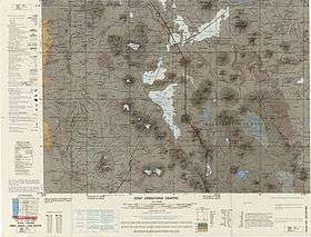
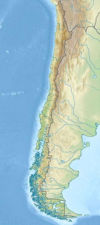
Apacheta-Aguilucho lies in northern Chile, close to the border with Bolivia.[2] The city of Calama lies 105 kilometres (65 mi) southwest of Apacheta-Aguilucho,[3] but with the exception of mining-associated infrastructure the area is remote and uninhabited.[2]
The volcano is part of the Central Volcanic Zone of the Andes. The Central Volcanic Zone further includes the Altiplano-Puna volcanic complex, which between 10 and 1 million years ago was the source of large ignimbrite eruptions; after that it produced lava flows and lava domes like Cerro Chao and geothermal fields such as El Tatio and Sol de Mañana.[3] Volcanic activity is the consequence of the subduction of the Nazca Plate beneath the South America Plate.[4]
Apacheta-Aguilucho is a volcanic complex formed by two volcanoes,[1] Cerro Apacheta and Cerro Aguilucho, both composite volcanoes;[5] with the highest summit of the complex reaching a height of 5,557 metres (18,232 ft).[1] The northern Aguilucho volcano and the southern Apacheta volcano are in their central portions formed by rhyolitic lava flows, with the surrounding edifice formed by andesitic-dacitic lavas. An andesitic lahar and pyroclastic flow crops out south and east of Apacheta,[6] which as the oldest part of the edifice is heavily eroded.[2] North and east of the complex, the two lava domes Chac-Inca and Cerro Pabellón[6] form the youngest part of the volcano.[2]
Moraines are encountered both west-southwest of Apacheta and east of the Chac-Inca dome,[6] and traces of glacial erosion are observed on the Aguilucho crater region.[7] The moraines developed during the last glacial maximum.[8]
Geothermal manifestations
The volcano is fumarolically active on Apacheta's northern[9] and eastern slopes[10] as well as on the summit.[11] Two fumaroles on the northern flank of Apacheta produce superheated steam at a high output; the gas has a composition typical of geothermal system fumaroles, with some differences.[9]
Apacheta-Aguilucho has a geothermal system and the chemistry of fumarole gases suggests that Apacheta-Aguilucho features an active magma system at depth. Drilling has found temperatures of over 200 °C (392 °F) at 500 metres (1,600 ft) depth.[3] This fumarolic activity has resulted in hydrothermal alteration of many parts of the volcano;[1] this activity has generated a sulfur deposit on the west flank of Aguilucho.[5] The mine Mina Aguilucho is located on Aguilucho's western flank.[9] The geothermal activity was discovered in 1999.[4]
The discovery of steam during the drilling of a freshwater well in the 1990s led to investigations by ENAP and UNOCAL in the area and the discovery of the fumaroles. In 2002, a joint enterprise by ENAP and CODELCO obtained the permission to explore the area, but while a geothermal system was discovered political questions about ENAP's involvement derailed the project.[2]
Another joint enterprise this time including the Italian ENEL performed further research in the area between 2006-2007, and obtained a permit to exploit the system in 2009.[2] The joint enterprise started the geothermal power project Cerro Pabellón, and in 2015 the construction of two power plants with a projected output of 24 MW each started, to be completed in 2017-2018.[12] The plant was inaugurated by the Chilean president Michelle Bachelet on 12 September 2017, becoming either the first[13] or the second (after Copahue) geothermal power station in South America.[4]
Sector collapse
A landslide deposit extends 4.5 kilometres (2.8 mi) away from the volcanic complex on its eastern flank. The landslide deposit covers a surface of about 3 square kilometres (1.2 sq mi),[1] and a large collapse scar with signs of hydrothermal alteration faces the western end of the landslide.[7] In its upper part, the deposit is bordered to the north and south by levees.[14] Downslope, the deposit consists at first of a lobate structure that east of the Pabellón dome grades into a more hummocky deposit. The deposit is increasingly dominated by hydrothermally altered material farther east, while the hummocks consist of lava blocks.[15] The material of the landslide deposit itself features both solid blocks and a finer matrix.[16] Rocks involved in the landslide include both andesitic and dacitic lavas and hydrothermally altered material. The landslide deposit is confined between two older lava flows.[1]
Sector collapses like the one at Apacheta-Aguilucho have been observed on other volcanoes (such as Mount St Helens during its 1980 eruption), and they result in characteristic landslide deposits known as debris avalanche deposits; these feature hummock-like hills and often levees. Such collapses occur for different reasons for each event and are fairly common; in the Central Andes alone 14 volcanoes feature deposits of such collapses.[17] Such deposits commonly feature a stratigraphy that resembles that of the source edifice, as well as jigsaw-like cracks in rocks that form when rocks disintegrate during the collapse and sliding.[18]
In the case of Apacheta-Aguilucho, it is likely that the sector collapse was triggered by hydrothermal alteration of the edifice that weakened its structure until it failed, and its path was likely influenced by regional tectonics.[19] After the edifice had failed, the landslide moved eastward until it was deflected by older topography; the material became increasingly fragmented.[20]
Geology
Off the west coast of South America, the Nazca Plate subducts beneath the South America Plate in the Peru-Chile Trench. This subduction process is responsible for volcanism in the Central Andes, which occurs at distances of 250–300 kilometres (160–190 mi) from the trench.[1]
Two major fault systems are found close to Apacheta-Aguilucho. The first is the major regional Calama-Olacapato-El Toro fault, the second fault system runs from neighbouring Inacaliri volcano northwest of Apacheta-Aguilucho towards the southeast, where it forms the Pabellóncito graben;[1] the volcanic complex is built within that graben.[3] The Pabellóncito fault system was active during the Pleistocene; the activity of these regional fault systems appears to be a consequence of tectonic regime changes during the early Pleistocene, which drove extensional tectonics in the area.[8] Northwest of Apacheta-Aguilucho, the axis of the graben is buried beneath other volcanoes starting with Cerro del Azufre.[21]
The basement beneath Apacheta-Aguilucho is of Eocene to Miocene age. It consists of various volcanic and sedimentary formations[21][1] including eroded volcanoes,[3] and it is in part covered by 7.5 million years old ignimbrites.[1]
Composition
Apacheta-Aguilucho has principally erupted andesite, dacite and rhyolite.[1]
Eruption history
The volcanic complex is of Pliocene to Pleistocene age[5] and developed over several different stages. In the first stage, the so-called Aguilucho ignimbrite consisting of moderately welded, white-to-pink pyroclastic flows was emplaced 7.5 ± 0.6 million years ago and andesitic lava flows 6.7 ± 0.3 million years ago. Subsequently, more lava flows were emplaced, consisting of blocky dacite.[10]
The Apacheta and Aguilucho volcanoes were constructed consecutively. Apacheta consists of lava flows and pyroclastic material made out of andesite, and its crater is covered by pyroclastic flows and a 2.5 kilometres (1.6 mi) long rhyolitic lava flow. Aguilucho is constructed by lava flows. Finally, several lava flow fields were emplaced together with the lava domes Pabellón and Chac-Inca.[10]
Lava flows on Apacheta-Aguilucho have been dated to 910,000 ± 140,000 and 700,000 ± 200,000 years before present.[1] The date of the sector collapse is not known with certainty but was probably after the last lava flow was emplaced on Apacheta-Aguilucho.[19]
Dating of Chac-Inca has produced an age of 140,000 ± 80,000 years before present. Different dates have been obtained on Cerro Pabellón: Potassium-argon dating yields an age of 130,000 - 80,000 years before present, while argon-argon dating has yielded an age of 50,000 ± 10,000 years before present.[10]
See also
References
- 1 2 3 4 5 6 7 8 9 10 11 12 13 Godoy et al. 2017, p. 137.
- 1 2 3 4 5 6 Bona & Coviello 2016, p. 51.
- 1 2 3 4 5 Mercado et al. 2009, p. 1.
- 1 2 3 Maza et al. 2018, p. 4.
- 1 2 3 Urzua et al. 2002, p. 1.
- 1 2 3 Godoy et al. 2017, p. 138.
- 1 2 Godoy et al. 2017, p. 141.
- 1 2 Mercado et al. 2009, p. 3.
- 1 2 3 Urzua et al. 2002, p. 4.
- 1 2 3 4 Mercado et al. 2009, p. 2.
- ↑ Maza et al. 2018, p. 6.
- ↑ Bona & Coviello 2016, p. 52.
- ↑ "Cerro Pabellón, la planta geotérmica chilena pionera en Sudamérica y a mayor altura del mundo" (in Spanish). Santiago: Emol. 17 September 2017. Retrieved 13 December 2017.
- ↑ Godoy et al. 2017, p. 140.
- ↑ Godoy et al. 2017, p. 139.
- ↑ Godoy et al. 2017, p. 138,139.
- ↑ Godoy et al. 2017, p. 136.
- ↑ Godoy et al. 2017, p. 142.
- 1 2 Godoy et al. 2017, p. 144.
- ↑ Godoy et al. 2017, p. 145.
- 1 2 Urzua et al. 2002, p. 3.
Sources
- Bona, Paolo; Coviello, Manlio (April 2016). "Valoración y gobernanza de los proyectos geotérmicos en América del Sur: una propuesta metodológica" (PDF). repositorio.cepal.org (in Spanish). Economic Commission for Latin America and the Caribbean. pp. 1–178. Retrieved 12 December 2017.
- Godoy, Benigno; Rodríguez, Inés; Pizarro, Marcela; Rivera, Germain (November 2017). "Geomorphology, lithofacies, and block characteristics to determine the origin, and mobility, of a debris avalanche deposit at Apacheta-Aguilucho Volcanic Complex (AAVC), northern Chile". Journal of Volcanology and Geothermal Research. 347: 136–148. doi:10.1016/j.jvolgeores.2017.09.008. ISSN 0377-0273.
- Maza, S. N.; Collo, G.; Morata, D.; Lizana, C.; Camus, E.; Taussi, M.; Renzulli, A.; Mattioli, M.; Godoy, B.; Alvear, B.; Pizarro, M.; Ramírez, C.; Rivera, G. (2018). "Clay mineral associations in the clay cap from the Cerro Pabellón blind geothermal system, Andean Cordillera, Northern Chile". Clay Minerals: 1–50. doi:10.1180/clm.2018.9. ISSN 0009-8558.
- Mercado, J.L.; Ahumada, S.; Aguilera, F.; Medina, E.; Renzulli, A.; Piscaglia, F. (November 2009). "Geological and Structural Evolution of Apacheta-Aguilucho Volcanic Complex (AAV C), Northern Chile" (PDF). SERNAGEOMIN. Santiago: 12th Chilean Geological Congress. pp. 1–4. Retrieved 12 December 2017.
- Urzua, Luis; Powell, Tom; Cumming, William B.; Dobson, Patrick (2002). "Apacheta, a new geothermal prospect in Northern Chile" (PDF). eScholarship. Lawrence Berkeley National Laboratory. Retrieved 13 December 2017.