Anzac Peak
| Anzac Peak | |
|---|---|
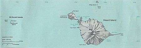 Map of Heard Island and McDonald Islands in the Southern Ocean | |
| Highest point | |
| Elevation | 715 m (2,346 ft) |
| Prominence | 715 m (2,346 ft) |
| Coordinates | 52°59′32″S 73°17′58″E / 52.99222°S 73.29944°ECoordinates: 52°59′32″S 73°17′58″E / 52.99222°S 73.29944°E |
| Geography | |
| Location | Heard Island, Southern Ocean |
Anzac Peak is a 715-metre-high (2,346 ft) volcano on the Laurens Peninsula of Heard Island in the Southern Ocean. It lies to the northwest of Mawson Peak. Despite its low elevation of just over 700 metres high, the peak and several neighbouring peaks have permanent snow and ice, like the Jacka Glacier with several icefalls.[1][2]
See also
References
- ↑ "Heard Island: V5 1997". Archived from the original on 28 September 2007. Retrieved 2007-09-23.
- ↑ Google Earth images.
External links
- Click here to see a map of Heard Island and McDonald Islands, including all major topographical features
This article is issued from
Wikipedia.
The text is licensed under Creative Commons - Attribution - Sharealike.
Additional terms may apply for the media files.