Antsambalahy
| Antsambalahy | |
|---|---|
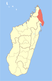
 Antsambalahy Location in Madagascar | |
| Coordinates: 14°43′S 49°55′E / 14.717°S 49.917°E | |
| Country |
|
| Region | Sava |
| District | Antalaha |
| Elevation[1] | 236 m (774 ft) |
| Population (2001)[2] | |
| • Total | 11,284 |
| Time zone | UTC3 (EAT) |
Antsambalahy is a commune (Malagasy: kaominina) in northern Madagascar. It belongs to the district of Antalaha, which is a part of Sava Region. According to 2001 census the population of Antsambalahy was 11,284.[2]
Only primary schooling is available in town. The majority 99.9% of the population are farmers. The most important crop is vanilla, while other important products are coffee and rice. Services provide employment for 0.1% of the population.[2]
References and notes
- ↑ Estimated based on DEM data from Shuttle Radar Topography Mission
- 1 2 3 "ILO census data". Cornell University. 2002. Retrieved 2008-02-15.
Coordinates: 14°43′S 49°55′E / 14.717°S 49.917°E
This article is issued from
Wikipedia.
The text is licensed under Creative Commons - Attribution - Sharealike.
Additional terms may apply for the media files.