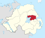
Antrim and Newtownabbey
| Antrim and Newtownabbey Irish: Aontroim agus Baile Nua na Mainistreach Ulster Scots: Anthrim an Newtownabbey | |
|---|---|
| District | |
 | |
| Sovereign state | United Kingdom |
| Constituent country | Northern Ireland |
| Status | District |
| Incorporated | 1 April 2015 |
| Government | |
| • Type | District council |
| • Body | Antrim and Newtownabbey Borough Council |
| Area | |
| • Total | 220.9 sq mi (572.0 km2) |
| Population (mid-2017 est.) | |
| • Total | 141,700 |
| • Density | 640/sq mi (250/km2) |
| Time zone | UTC0 (GMT) |
| • Summer (DST) | UTC+1 (BST) |
| Website | http://www.antrimandnewtownabbey.gov.uk/ |
Antrim and Newtownabbey is a local government district in Northern Ireland. The district was created on 1 April 2015 by merging the Borough of Antrim with the Borough of Newtownabbey. The local authority is Antrim and Newtownabbey Borough Council.
Geography
The district stretches 274 square miles (710 km2) from the lower River Bann and Lough Neagh to the shores of Belfast Lough. It has a population of 141,700.[1] The name of the new district was recommended on 17 September 2008.[2]
Antrim and Newtownabbey Borough Council
Antrim and Newtownabbey Borough Council replaced Antrim Borough Council and Newtownabbey Borough Council. The first election for the new district council was originally due to take place in May 2009, but on April 25, 2008, Shaun Woodward, Secretary of State for Northern Ireland announced that the scheduled 2009 district council elections were to be postponed until 2011.[3] The first elections took place on 22 May 2014 and the council acted as a shadow authority until 1 April 2015.[4]
See also
References
- ↑ "Population Estimates for UK, England and Wales, Scotland and Northern Ireland, Mid-2017". Office for National Statistics. 28 June 2018. Retrieved 28 June 2018.
- ↑ "Provisional Recommendations of the Local Government Boundaries Commissioner for Northern Ireland". LGBC. Archived from the original on 2008-09-20. Retrieved 2008-09-26.
- ↑ Northern Ireland elections are postponed, BBC News, April 25, 2008, accessed April 27, 2008
- ↑ "Antrim and Newtownabbey Borough Councils are merging in 2015" (PDF).