Anju, South Pyongan
| Anju 안주시 | |
|---|---|
| Municipal City | |
| Korean transcription(s) | |
| • Chosŏn'gŭl | 안주시 |
| • Hancha | 安州市 |
| • McCune-Reischauer | Anju-si |
| • Revised Romanization | Anju-si |
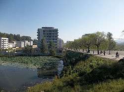 View of Anju | |
 Map of South Pyongan showing the location of Anju | |
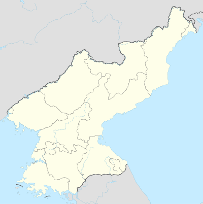 Anju Location in North Korea | |
| Coordinates: 39°37′12″N 125°39′36″E / 39.62000°N 125.66000°ECoordinates: 39°37′12″N 125°39′36″E / 39.62000°N 125.66000°E | |
| Country | North Korea |
| Province | South P'yongan |
| Administrative divisions | 20 tong, 22 ri |
| Population (2008[1]) | |
| • Total | 240,117 |
Anju-si (Korean pronunciation: [an.dzu]) is a city in the South P'yŏngan province of North Korea. Its population was 240,117 in 2008.[1] The Ch'ongch'on River passes through Anju.
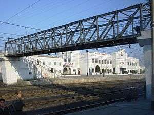
Sinanju railway station in the western part of Anju
Administrative divisions
Anju-si is divided into 20 tong (neighbourhoods) and 22 ri (villages):
|
|
Economy
Anju lies near large deposits of anthracite coal, and contains one of the largest coal production facilities in the country.[2] The deposits contain more than 130 million metric tons of coal.[3] Namhŭng-dong is the location of the Namhŭng Youth Chemical Complex, one of North Korea's most important chemical combines.[4]
Transportation
Anju-si is served by several stations on the P'yŏngŭi and Kaech'ŏn lines of the Korean State Railway.
See also
References
- 1 2 North Korean Central Statistic Bureau, 2008 Census.
- ↑ North Korea Handbook. M.E. Sharpe. 2003. ISBN 0765610043. Retrieved 2012-07-18.
- ↑ Kuo, Chin S. (1994). "The mineral industry of North Korea" (PDF). Retrieved 2012-07-18.
- ↑ Joseph S. Bermudez Jr. (10 April 2014). "North Korea's Namhung Youth Chemical Complex: Seven Years of Construction Pays Off". US-Korea Institute at SAIS.
Further reading
- Dormels, Rainer. North Korea's Cities: Industrial facilities, internal structures and typification. Jimoondang, 2014. ISBN 978-89-6297-167-5
External links

This article is issued from
Wikipedia.
The text is licensed under Creative Commons - Attribution - Sharealike.
Additional terms may apply for the media files.