Aner Dam
| Aner Dam | |
|---|---|
 Location of Aner Dam in Maharashtra | |
| Official name | Aner Dam |
| Location | Shirpur |
| Coordinates | 21°19′30″N 75°08′39″E / 21.3250174°N 75.1442957°ECoordinates: 21°19′30″N 75°08′39″E / 21.3250174°N 75.1442957°E |
| Opening date | 1978 |
| Owner(s) | Government of Maharashtra, India |
| Dam and spillways | |
| Type of dam | Earthfill |
| Impounds | Aner river |
| Height | 47 m (154 ft) |
| Length | 2,275 m (7,464 ft) |
| Dam volume | 3,162 km3 (759 cu mi) |
| Reservoir | |
| Total capacity | 58,914 km3 (14,134 cu mi) |
| Surface area | 0 km2 (0 sq mi) |
Aner Dam, is an earthfill dam on Aner river in Shirpur taluka, Dhule district in state of Maharashtra in India. Aner Dam is 8 km away from Hisale village. Which is situated near Shirpur-Chopda state highway in Shirpur Tehsil. Fishes of this dam are very famous for their taste. Fishes of this dam are very tasty.
Specifications
The height of the dam above lowest foundation is 47 m (154 ft) while the length is 2,275 m (7,464 ft). The volume content is 3,162 km3 (759 cu mi) and gross storage capacity is 103,270.00 km3 (24,775.79 cu mi).[1]
Purpose
- Irrigation
See also
References
- ↑ Specifications of large dams in India Archived July 21, 2011, at the Wayback Machine.
Dhule district topics | ||
|---|---|---|
| History | 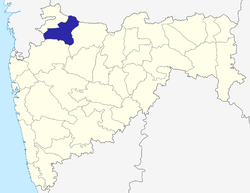 | |
| Rivers and lakes | ||
| Cities and towns | ||
| Culture | ||
| Transport | ||
| Lok Sabha constituencies | ||
| Vidhan Sabha constituencies |
| |
This article is issued from
Wikipedia.
The text is licensed under Creative Commons - Attribution - Sharealike.
Additional terms may apply for the media files.