Wapi Pathum District
| Wapi Pathum วาปีปทุม | |
|---|---|
| Amphoe | |
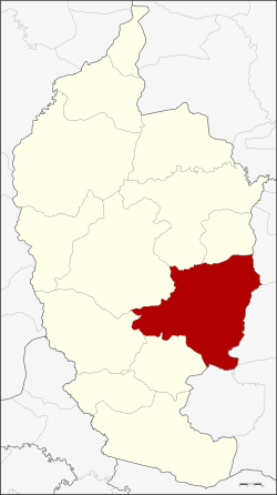 Amphoe location in Maha Sarakham Province | |
| Coordinates: 15°50′48″N 103°22′48″E / 15.84667°N 103.38000°ECoordinates: 15°50′48″N 103°22′48″E / 15.84667°N 103.38000°E | |
| Country | Thailand |
| Province | Maha Sarakham |
| Seat | Nong Saeng |
| Area | |
| • Total | 605.77 km2 (233.89 sq mi) |
| Population (2008) | |
| • Total | 114,020 |
| • Density | 188.1/km2 (487/sq mi) |
| Time zone | UTC+7 (ICT) |
| Postal code | 44120 |
| Geocode | 4409 |
Wapi Pathum (Thai: วาปีปทุม, pronounced [wāː.pīː pā.tʰūm]) is a district (amphoe) of Maha Sarakham Province, northeastern Thailand.
Geography
Neighboring districts are (from the south clockwise) Na Dun, Na Chueak, Borabue, Mueang Maha Sarakham, and Kae Dam of Maha Sarakham Province, Si Somdet, Chaturaphak Phiman, Kaset Wisai, and Pathum Rat of Roi Et Province.
History
The district goes back to the Mueang Wapi Pathum, which was converted into a district around 1900.
Administration
The district is divided into 15 sub-districts (tambon), which are further subdivided into 240 villages (muban). Nong Saeng is a sub-district municipality (thesaban tambon) which covers parts of the tambon Nong Saeng. There are a further 15 tambon administrative organizations (TAO).
| No. | Name | Thai | Villages | Pop.[1] |
|---|---|---|---|---|
| 1. | Nong Saeng | หนองแสง | 28 | 21,063 |
| 2. | Kham Pom | ขามป้อม | 16 | 6,589 |
| 3. | Suea Kok | เสือโก้ก | 19 | 10,319 |
| 4. | Dong Yai | ดงใหญ่ | 16 | 5,013 |
| 5. | Pho Chai | โพธิ์ชัย | 12 | 4,500 |
| 6. | Hua Ruea | หัวเรือ | 21 | 10,486 |
| 7. | Khaen | แคน | 17 | 6,727 |
| 8. | Ngua Ba | งัวบา | 19 | 8,069 |
| 9. | Na Kha | นาข่า | 16 | 8,823 |
| 10. | Ban Wai | บ้านหวาย | 17 | 7,410 |
| 11. | Nong Hai | หนองไฮ | 17 | 7,855 |
| 12. | Pracha Phatthana | ประชาพัฒนา | 11 | 4,487 |
| 13. | Nong Thum | หนองทุ่ม | 10 | 3,987 |
| 14. | Nong Saen | หนองแสน | 10 | 4,319 |
| 15. | Khok Si Thonglang | โคกสีทองหลาง | 11 | 4,373 |
References
- ↑ "Population statistics 2008". Department of Provincial Administration.
External links
- amphoe.com (Thai)
This article is issued from
Wikipedia.
The text is licensed under Creative Commons - Attribution - Sharealike.
Additional terms may apply for the media files.