Chuen Chom District
| Chuen Chom ชื่นชม | |
|---|---|
| Amphoe | |
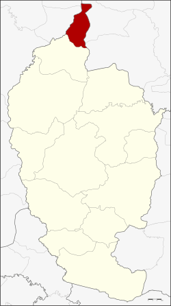 Amphoe location in Maha Sarakham Province | |
| Coordinates: 16°31′53″N 103°10′18″E / 16.53139°N 103.17167°ECoordinates: 16°31′53″N 103°10′18″E / 16.53139°N 103.17167°E | |
| Country | Thailand |
| Province | Maha Sarakham |
| Seat | Chuen Chom |
| Area | |
| • Total | 113.0 km2 (43.6 sq mi) |
| Population (2005) | |
| • Total | 24,586 |
| • Density | 217.6/km2 (564/sq mi) |
| Time zone | UTC+7 (ICT) |
| Postal code | 44160 |
| Geocode | 4413 |
Chuen Chom (Thai: ชื่นชม, pronounced [t͡ɕʰɯ̂ːn t͡ɕʰōm]) is a district (amphoe) in the north of Maha Sarakham Province, northeastern Thailand.
Geography
Neighboring districts are (from the south clockwise) Chiang Yuen of Maha Sarakham Province, Sam Sung and Kranuan of Khon Kaen Province, Huai Mek and Yang Talat of Kalasin Province.
History
The minor district (king amphoe) was split off from Chiang Yuen district on 1 July 1997.[1]
The Thai government on 15 May 2007 upgraded 81 minor districts to full districts.[2] With publication in the Royal Gazette on 24 August the upgrade became official.[3]
Administration
The district is divided into four sub-districts (tambon), which are further subdivided into 47 villages (muban). There are no municipal (thesaban) areas, and four tambon administrative organizations (TAO).
| No. | Name | Thai name | Villages | Pop. | |
|---|---|---|---|---|---|
| 1. | Chuen Chom | ชื่นชม | 11 | 5,886 | |
| 2. | Kut Pla Duk | กุดปลาดุก | 15 | 8,264 | |
| 3. | Lao Dok Mai | เหล่าดอกไม้ | 11 | 6,329 | |
| 4. | Nong Kung | หนองกุง | 10 | 4,107 |
References
- ↑ ประกาศกระทรวงมหาดไทย เรื่อง แบ่งเขตท้องที่อำเภอเชียงยืน จังหวัดมหาสารคาม ตั้งเป็นกิ่งอำเภอชื่นชม (PDF). Royal Gazette (in Thai). 114 (Special 51 ง): 15. June 25, 1997.
- ↑ แถลงผลการประชุม ครม. ประจำวันที่ 15 พ.ค. 2550 (in Thai). Manager Online.
- ↑ พระราชกฤษฎีกาตั้งอำเภอฆ้องชัย...และอำเภอเหล่าเสือโก้ก พ.ศ. ๒๕๕๐ (PDF). Royal Gazette (in Thai). 124 (46 ก): 14–21. August 24, 2007.