Phayakkhaphum Phisai District
| Phayakkhaphum Phisai พยัคฆภูมิพิสัย | |
|---|---|
| Amphoe | |
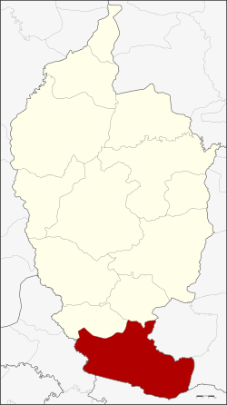 Amphoe location in Maha Sarakham Province | |
| Coordinates: 15°30′59″N 103°11′37″E / 15.51639°N 103.19361°ECoordinates: 15°30′59″N 103°11′37″E / 15.51639°N 103.19361°E | |
| Country | Thailand |
| Province | Maha Sarakham |
| Area | |
| • Total | 409.783 km2 (158.218 sq mi) |
| Population (2008) | |
| • Total | 88,124 |
| • Density | 214.5/km2 (556/sq mi) |
| Time zone | UTC+7 (ICT) |
| Postal code | 44110 |
| Geocode | 4408 |
Phayakkhaphum Phisai (Thai: พยัคฆภูมิพิสัย, pronounced [pʰā.ják.kʰā.pʰūːm pʰí.sǎj]) is a district (amphoe) of Maha Sarakham Province, northeastern Thailand.
Geography
Neighboring districts are (from the north clockwise) Yang Sisurat and Na Dun of Maha Sarakham Province, Pathum Rat, and Kaset Wisai of Roi Et Province, Chumphon Buri of Surin Province, and Phutthaisong of Buriram Province.
Administration
The district is divided into 14 sub-districts (tambon), which are further subdivided into 227 villages (muban). Phayakkhaphum Phisai is a sub-district municipality (thesaban tambon) which covers parts of the tambon Palan and Lan Sakae. There are a further 14 tambon administrative organizations (TAO).
| No. | Name | Thai | Villages | Pop.[1] |
|---|---|---|---|---|
| 1. | Palan | ปะหลาน | 16 | 11,323 |
| 2. | Kam Pu | ก้ามปู | 17 | 6,772 |
| 3. | Wiang Sa-at | เวียงสะอาด | 21 | 6,030 |
| 4. | Mek Dam | เม็กดำ | 22 | 9,690 |
| 5. | Na Si Nuan | นาสีนวล | 14 | 5,939 |
| 9. | Rat Charoen | ราษฎร์เจริญ | 14 | 5,125 |
| 10. | Nong Bua Kaeo | หนองบัวแก้ว | 16 | 6,145 |
| 12. | Mueang Tao | เมืองเตา | 26 | 7,922 |
| 15. | Lan Sakae | ลานสะแก | 19 | 6,881 |
| 16. | Wiang Chai | เวียงชัย | 14 | 3,934 |
| 17. | Nong Bua | หนองบัว | 13 | 5,852 |
| 18. | Rat Phatthana | ราษฎร์พัฒนา | 14 | 3,852 |
| 19. | Mueang Suea | เมืองเสือ | 11 | 4,507 |
| 20. | Phan Aen | ภารแอ่น | 10 | 4,152 |
Missing numbers are tambon which now form Yang Sisurat District.
References
- ↑ "Population statistics 2008". Department of Provincial Administration. Archived from the original on 2009-08-20.
External links
- amphoe.com (Thai)
This article is issued from
Wikipedia.
The text is licensed under Creative Commons - Attribution - Sharealike.
Additional terms may apply for the media files.