Bang Ban District
| Bang Ban บางบาล | |
|---|---|
| District | |
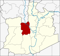 District location in Ayutthaya Province | |
| Coordinates: 14°22′25″N 100°29′8″E / 14.37361°N 100.48556°ECoordinates: 14°22′25″N 100°29′8″E / 14.37361°N 100.48556°E | |
| Country | Thailand |
| Province | Ayutthaya |
| Seat | Maha Phram |
| Tambon | 16 |
| Muban | 111 |
| Area | |
| • Total | 135.3 km2 (52.2 sq mi) |
| Population (2014) | |
| • Total | 34,579 |
| • Density | 254.3/km2 (659/sq mi) |
| Time zone | UTC+7 (ICT) |
| Postal code | 13250 |
| Geocode | 1405 |
Bang Ban (Thai: บางบาล, pronounced [bāːŋ bāːn]) is a district (amphoe) of Ayutthaya Province, in central Thailand.
History
The district was originally created in 1894 as Sena Nai District, with its district office in Sai Noi Sub-district. Later Mr Khiao Bangban (นายเขียว บางบาล) donated a piece of land for the building of the new district office in Bang Ban Sub-district. So the government agreed to change the district name to the donor's family name, which became effective in 1917.[1]
Geography
Neighbouring districts are (from the north clockwise) Pa Mok of Ang Thong Province, Bang Pahan, Phra Nakhon Si Ayutthaya, Bang Sai, Sena and Phak Hai of Ayutthaya Province.
Administration
Central administration
The district Bang Ban is divided into 16 sub-districts (tambon), which are further subdivided into 111 administrative villages (Muban).
| No. | Name | Thai | Villages | Pop.[2] |
|---|---|---|---|---|
| 1. | Bang Ban | บางบาล | 5 | 1,080 |
| 2. | Wat Yom | วัดยม | 4 | 1,551 |
| 3. | Sai Noi | ไทรน้อย | 10 | 2,528 |
| 4. | Saphan Thai | สะพานไทย | 5 | 2,159 |
| 5. | Maha Phram | มหาพราหมณ์ | 10 | 4,809 |
| 6. | Kop Chao | กบเจา | 9 | 2,625 |
| 7. | Ban Khlang | บ้านคลัง | 7 | 2,134 |
| 8. | Phra Khao | พระขาว | 7 | 3,778 |
| 9. | Nam Tao | น้ำเต้า | 8 | 2,471 |
| 10. | Thang Chang | ทางช้าง | 6 | 1,036 |
| 11. | Wat Taku | วัดตะกู | 9 | 1,591 |
| 12. | Bang Luang | บางหลวง | 5 | 919 |
| 13. | Bang Luang Dot | บางหลวงโดด | 4 | 719 |
| 14. | Bang Hak | บางหัก | 8 | 1,486 |
| 15. | Bang Chani | บางชะนี | 5 | 1,901 |
| 16. | Ban Kum | บ้านกุ่ม | 9 | 3,792 |
Local administration
There are two sub-district municipalities (thesaban tambon) in the district:
- Bang Ban (Thai: เทศบาลตำบลบางบาล) consisting of the sub-districts Bang Ban, Sai Noi, Bang Luang Dot, Bang Hak, Bang Chani, Ban Kum.
- Maha Phram (Thai: เทศบาลตำบลมหาพราหมณ์) consisting of the sub-districts Wat Yom, Saphan Thai, Maha Phram.
There are four sub-district administrative organizations (SAO) in the district:
- Kop Chao (Thai: องค์การบริหารส่วนตำบลกบเจา) consisting of the sub-district Kop Chao.
- Ban Khlang (Thai: องค์การบริหารส่วนตำบลบ้านคลัง) consisting of the sub-district Ban Khlang.
- Phra Khao (Thai: องค์การบริหารส่วนตำบลพระขาว) consisting of the sub-district Phra Khao.
- Nam Tao (Thai: องค์การบริหารส่วนตำบลน้ำเต้า) consisting of the sub-districts Nam Tao, Thang Chang, Wat Taku, Bang Luang.
References
- ↑ "ประกาศกระทรวงมหาดไทย เรื่อง เปลี่ยนชื่ออำเภอ" (PDF). Royal Gazette (in Thai). 34 (0 ก): 40–68. 1917-04-29.
- ↑ "Population statistics 2014" (in Thai). Department of Provincial Administration. Retrieved 2015-05-15.