Amel-sur-l'Étang
| Amel-sur-l'Étang | |
|---|---|
| Commune | |
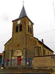 The church in Amel-sur-l'Étang | |
 Amel-sur-l'Étang Location within Grand Est region  Amel-sur-l'Étang | |
| Coordinates: 49°16′02″N 5°38′57″E / 49.2672°N 5.6492°ECoordinates: 49°16′02″N 5°38′57″E / 49.2672°N 5.6492°E | |
| Country | France |
| Region | Grand Est |
| Department | Meuse |
| Arrondissement | Verdun |
| Canton | Bouligny |
| Intercommunality | Pays de Spincourt |
| Government | |
| • Mayor (2014-2020) | Nicole Heintzmann |
| Area1 | 14.74 km2 (5.69 sq mi) |
| Population (2014)2 | 175 |
| • Density | 12/km2 (31/sq mi) |
| Time zone | UTC+1 (CET) |
| • Summer (DST) | UTC+2 (CEST) |
| INSEE/Postal code | 55008 /55230 |
| Elevation |
205–256 m (673–840 ft) (avg. 252 m or 827 ft) |
|
1 French Land Register data, which excludes lakes, ponds, glaciers > 1 km2 (0.386 sq mi or 247 acres) and river estuaries. 2 Population without double counting: residents of multiple communes (e.g., students and military personnel) only counted once. | |
Amel-sur-l'Étang is a commune in the Meuse department in the Grand Est region in northeastern France.
Population
| Historical population | ||
|---|---|---|
| Year | Pop. | ±% |
| 1962 | 299 | — |
| 1968 | 227 | −24.1% |
| 1975 | 192 | −15.4% |
| 1982 | 168 | −12.5% |
| 1990 | 132 | −21.4% |
| 1999 | 150 | +13.6% |
| 2007 | 166 | +10.7% |
| 2009 | 174 | +4.8% |
See also
References
| Wikimedia Commons has media related to Amel-sur-l'Étang. |
This article is issued from
Wikipedia.
The text is licensed under Creative Commons - Attribution - Sharealike.
Additional terms may apply for the media files.