Amasa, Michigan
| Amasa, Michigan | |
|---|---|
| Census-designated place | |
 Amasa  Amasa | |
| Coordinates: 46°13′58″N 88°27′1″W / 46.23278°N 88.45028°W | |
| Country | United States |
| State | Michigan |
| County | Iron |
| Township | Hematite |
| Area[1] | |
| • Total | 4.04 sq mi (10.47 km2) |
| • Land | 4.03 sq mi (10.45 km2) |
| • Water | 0.008 sq mi (0.02 km2) |
| Elevation | 1,441 ft (439 m) |
| Population (2010)[1] | |
| • Total | 283 |
| • Density | 70/sq mi (27.1/km2) |
| Time zone | UTC-6 (Central (CST)) |
| • Summer (DST) | UTC-5 (CDT) |
| ZIP code | 49903 |
| Area code(s) | 906 |
| FIPS code | 26-01960[1] |
| GNIS feature ID | 0620044[2] |
Amasa is an unincorporated community and census-designated place (CDP) in southern Hematite Township, Iron County, Michigan, in the United States. As of the 2010 census it had a population of 283.[1]
The community was named for Amasa Stone of Cleveland, Ohio.[3]
Geography
U.S. Highway 141 passes through Amasa, leading north 23 miles (37 km) to Covington and south 12 miles (19 km) to Crystal Falls, the Iron County seat.
According to the U.S. Census Bureau, the CDP has a total area of 4.1 square miles (10.5 km2), of which 0.01 square miles (0.02 km2), or 0.15%, are water.[1] The Hemlock River, a tributary of the Paint River and part of the Menominee River watershed flowing to Lake Michigan, flows from northeast to southwest through Amasa.
References
- 1 2 3 4 5 "Geographic Identifiers: 2010 Census Summary File 1 (G001): Amasa CDP, Michigan". American Factfinder. U.S. Census Bureau. Retrieved April 5, 2018.
- ↑ U.S. Geological Survey Geographic Names Information System: Amasa
- ↑ Chicago and North Western Railway Company (1908). A History of the Origin of the Place Names Connected with the Chicago & North Western and Chicago, St. Paul, Minneapolis & Omaha Railways. p. 37.
Municipalities and communities of Iron County, Michigan, United States | ||
|---|---|---|
| Cities | 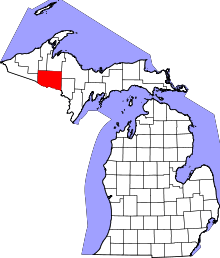 | |
| Village | ||
| Townships | ||
| CDP | ||
| Unincorporated communities | ||
This article is issued from
Wikipedia.
The text is licensed under Creative Commons - Attribution - Sharealike.
Additional terms may apply for the media files.