Alz
| Alz | |
|---|---|
 | |
| Country | Germany |
| Physical characteristics | |
| Main source |
Chiemsee 518 m (1,699 ft) |
| River mouth |
Inn 48°16′12″N 12°49′3″E / 48.27000°N 12.81750°ECoordinates: 48°16′12″N 12°49′3″E / 48.27000°N 12.81750°E |
| Length | 67.3 km (41.8 mi) [1] |
| Discharge |
|
| Basin features | |
| Progression | Inn→ Danube→ Black Sea |
| Basin size | 2,239 km2 (864 sq mi) [1] |
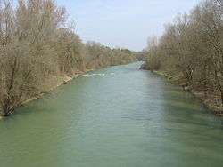
The Alz is a river in Bavaria, southern Germany, the only discharge of the Chiemsee. Its origin is on the northern shore near Seebruck. It is a right tributary of the Inn, into which it flows in Marktl. Other towns on the Alz are Altenmarkt an der Alz, Trostberg, Garching an der Alz and Burgkirchen an der Alz.
The Alz is divided into the Obere Alz (upper Alz) and the Untere Alz (lower Alz). The section from the Chiemsee down to Altenmarkt is called the Obere Alz. The section from Altenmarkt to the mouth in Marktl is called the Untere Alz.
The Traun, a 29 km river flowing past the regional administrative center of Traunstein, is a tributary of the Alz.
Etymology
From pre-indoeuropean *alz "swamp, alder".
References
- 1 2 Complete table of the Bavarian Waterbody Register by the Bavarian State Office for the Environment (xls, 10.3 MB)
External links
- Wasserwirtschaftsamt Traunstein, Die Alz (in German)
This article is issued from
Wikipedia.
The text is licensed under Creative Commons - Attribution - Sharealike.
Additional terms may apply for the media files.