Almond, New York
| Almond | |
|---|---|
| Town | |
 Almond Location within the state of New York | |
| Coordinates: 42°19′14″N 77°44′15″W / 42.32056°N 77.73750°WCoordinates: 42°19′14″N 77°44′15″W / 42.32056°N 77.73750°W | |
| Country | United States |
| State | New York |
| County | Allegany County |
| Incorporated | 1821 |
| Government | |
| • Mayor | |
| Area[1] | |
| • Total | 45.78 sq mi (118.58 km2) |
| • Land | 45.72 sq mi (118.41 km2) |
| • Water | 0.07 sq mi (0.17 km2) |
| Elevation | 2,051 ft (625 m) |
| Population (2010) | |
| • Total | 1,633 |
| • Estimate (2016)[2] | 1,556 |
| • Density | 34.04/sq mi (13.14/km2) |
| Time zone | UTC-5 (EST) |
| • Summer (DST) | UTC-4 (EDT) |
| ZIP code | 14804 |
| Area code(s) | 607 |
| FIPS code | 36-003-01451 |
| Website |
www |
Almond is a town in Allegany County, New York, United States. The population was 1,633 at the 2010 census.
The Town of Almond is on the eastern edge of the county. The town has a village also called Almond. The town is west of Hornell, New York.
History
The first part of the town to be settled was near Karrdale in 1796. When Allegany County was established in 1806, the region now in the Town of Almond was part of the Town of Alfred. The Town of Almond was formed in 1821. After Almond was established, parts were removed to form the towns of West Almond and Birdsall.
Geography
According to the United States Census Bureau, the town has a total area of 45.8 square miles (118.7 km²), of which, 45.8 square miles (118.6 km²) of it is land and 0.02% is water.
The east town line is the border of Steuben County, New York.
The Southern Tier Expressway (Interstate 86 and New York State Route 17) and New York State Route 21 pass through the town. Canacadea Creek flows out the eastern town line.
Demographics
| Historical population | |||
|---|---|---|---|
| Census | Pop. | %± | |
| 1830 | 1,804 | — | |
| 1840 | 1,434 | −20.5% | |
| 1850 | 1,914 | 33.5% | |
| 1860 | 1,739 | −9.1% | |
| 1870 | 1,686 | −3.0% | |
| 1880 | 1,567 | −7.1% | |
| 1890 | 1,419 | −9.4% | |
| 1900 | 1,436 | 1.2% | |
| 1910 | 1,297 | −9.7% | |
| 1920 | 1,121 | −13.6% | |
| 1930 | 1,101 | −1.8% | |
| 1940 | 1,234 | 12.1% | |
| 1950 | 1,331 | 7.9% | |
| 1960 | 1,373 | 3.2% | |
| 1970 | 1,524 | 11.0% | |
| 1980 | 1,671 | 9.6% | |
| 1990 | 1,640 | −1.9% | |
| 2000 | 1,604 | −2.2% | |
| 2010 | 1,633 | 1.8% | |
| Est. 2016 | 1,556 | [2] | −4.7% |
| U.S. Decennial Census[3] | |||
As of the census[4] of 2000, there were 1,604 people, 632 households, and 439 families residing in the town. The population density was 35.0 people per square mile (13.5/km²). There were 789 housing units at an average density of 17.2 per square mile (6.7/km²). The racial makeup of the town was 96.95% White, 0.06% Black or African American, 2.12% Asian, 0.56% from other races, and 0.31% from two or more races. Hispanic or Latino of any race were 0.50% of the population.
There were 632 households out of which 32.6% had children under the age of 18 living with them, 56.6% were married couples living together, 8.4% had a female householder with no husband present, and 30.5% were non-families. 25.2% of all households were made up of individuals and 8.9% had someone living alone who was 65 years of age or older. The average household size was 2.54 and the average family size was 3.05.
In the town, the population was spread out with 26.4% under the age of 18, 8.4% from 18 to 24, 26.0% from 25 to 44, 27.3% from 45 to 64, and 11.8% who were 65 years of age or older. The median age was 39 years. For every 100 females, there were 99.5 males. For every 100 females age 18 and over, there were 99.3 males.
The median income for a household in the town was $38,472, and the median income for a family was $48,839. Males had a median income of $32,026 versus $25,000 for females. The per capita income for the town was $18,805. About 6.1% of families and 11.0% of the population were below the poverty line, including 13.8% of those under age 18 and 8.9% of those age 65 or over.
Communities and locations in the Town of Almond
- Almond – The Village of Almond is at the eastern edge of the town and is partly in Steuben County.
- Bishopville – A hamlet on County Route 32 (Bishopville Road) near the eastern town line.
- Canacadea Creek – A stream in the eastern part of the town.
- Karrdale – A hamlet near the western town line on County Route 2(Karr Valley Road).
- Karr Valley Creek – A stream that parallels the Southern Tier Expressway.
- McHenry Valley - A valley extending southwest from the Village along County Road 11(McHenry Valley Road) toward Five Corners in the Town of Alfred.
- North Almond – A hamlet near the north town line.
- Sand Hill – A location west of Almond village.
- Turnpike Road - part of the original Turnpike Road that extended from Bath, NY westward in the early 19th century (now essentially a one lane road through State Forests).
References
- ↑ "2016 U.S. Gazetteer Files". United States Census Bureau. Retrieved Jul 4, 2017.
- 1 2 "Population and Housing Unit Estimates". Retrieved June 9, 2017.
- ↑ "Census of Population and Housing". Census.gov. Archived from the original on May 12, 2015. Retrieved June 4, 2015.
- ↑ "American FactFinder". United States Census Bureau. Archived from the original on 2013-09-11. Retrieved 2008-01-31.
External links
Municipalities and communities of Allegany County, New York, United States | ||
|---|---|---|
| Towns | 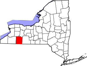 | |
| Villages | ||
| CDPs | ||
| Hamlets | ||
| Indian reservation | ||
| Footnotes | ‡This populated place also has portions in an adjacent county or counties | |